


- Total
- General
- Arts
- Book
- Culture
- Economy
- Essay
- Fun/Joke
- History
- Hobbies
- Info
- Life
- Medical
- Movie
- Music
- Nature
- News
- Notice
- Opinion
- Philosophy
- Photo
- Poem
- Politics
- Science
- Sports
- Travel
Nature [Colorado의 가을] Upper Mohawk Lake
2012.09.30 08:59
Upper Mohawk Lake September 15, 2012 Trailhead: Drive south out of Breckenridge on U.S. 9. At about 2.4 miles from the last light as you leave Breckenridge you turn right on Spruce Creek Rd. and proceed for about 1.2 miles to a well marked parking area and trailhead. If you have 4-wheel drive, you can continue up the road for another approximate 2 miles to cut the walk down. Round-Trip Length: 7 miles - includes both lakes Start-End Elevation: 10,390' - 12,110' (12,250' max elevation) Elevation Change: +1,720' net elevation gain (+2,010' total roundtrip elevation gain). - From the Internet 8월 11에 Lower and Upper Mohawk Lakes을 둘다 올라가려했는데, 다른 사정으로 Upper Mohawk Lake에는 못올라갔고, 9월 15일에 다시 찾아와서 두 호수를 다 올라갔지요. Upper Mohawk Lake에서는 Pacific Peak (13,950 ft / 4,252 m)이 서쪽으로 보이는데, 옛날에 (1979년 3월) 본인이 동기등반했던 산으로, Mount McKinley 등반 (1979년 7월) 전에 연습, 훈련삼아 등반했던 산입니다. 멀리서 지나가면서 가끔 보았지만, 여기에 온 이유는, 33년만에 다시 가까이 찾아와 보고 싶었기 때문이지요. 그때는 여기 산맥 (Ten Mile Ridge)의 서쪽 건너편의 Mayflower Gulch 를 통해서 일주일간에 걸쳐서 동기등반 훈련하면서 North Ridge 를 타고 올라갔었지요. 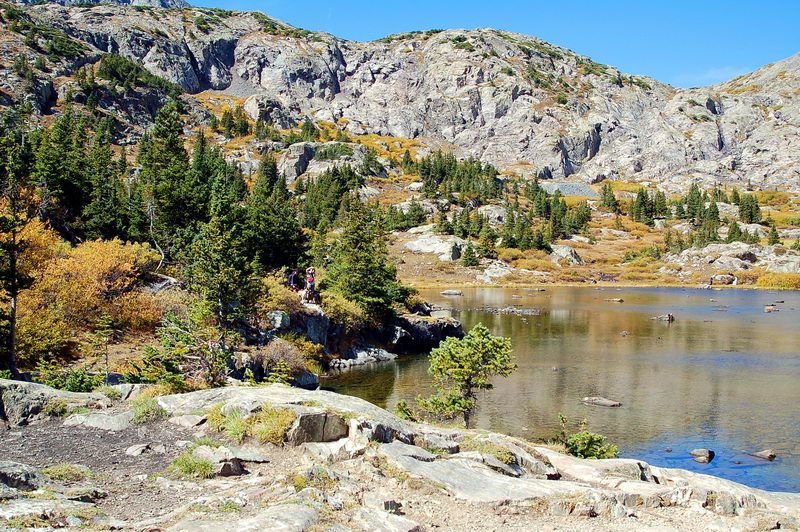 Lower Mohawk Lake (11,861'). Compared to one month ago, now, it is in full autumn colors. What a difference one month's of time makes! 한달전에 왔을때는 초록색으로 쌓였던 호수가 이제는 완연한 가을 색갈로 장식하고 있지요. 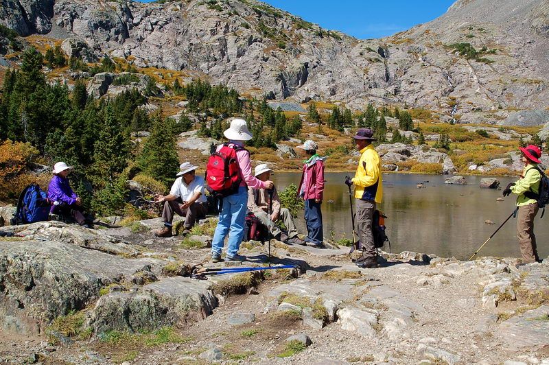 We are resting at the Lower Mohawk Lake for a snack before pushing up towards Upper Lake. Lower Mohawk Lake에서. 오늘의 목표는 머지 않은 윗모학 호수입니다. 급경사를 힘들게 오른후, 여기에서 잠간 쉬고갑니다. 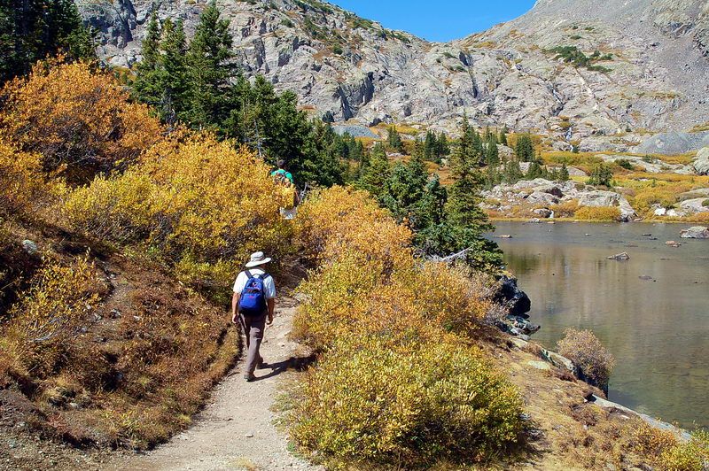 On the way to the Upper Mohawk Lake along the shore of the Lower Lake. 사진 오른쪽으로 실날같은 개울이 흐르는것이 보이지요. 상류호수에서 내려오는 물. 그 턱우리위에 호수가 또 있지요. 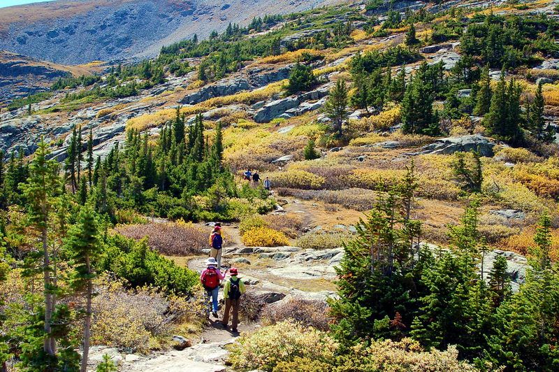 A beautiful autumn scenes on the way to the Upper Lake. I was glad that I came back here again. Lower Mohawk 호수를 빠져나와 커다란 산등성로 올라와서 올라가기 시작. 여기는 모두 노란색 가을단풍입니다. 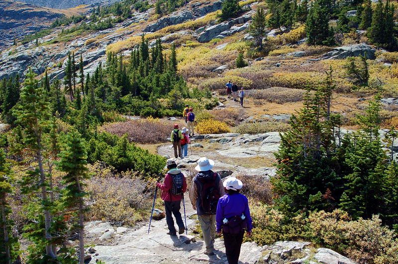 Another scene in a close up. 오늘 여기를 온것이 참 다행이였다고 생각하지요. 좋은 가을날씨에, 않왔더라면 후회했겠지요. 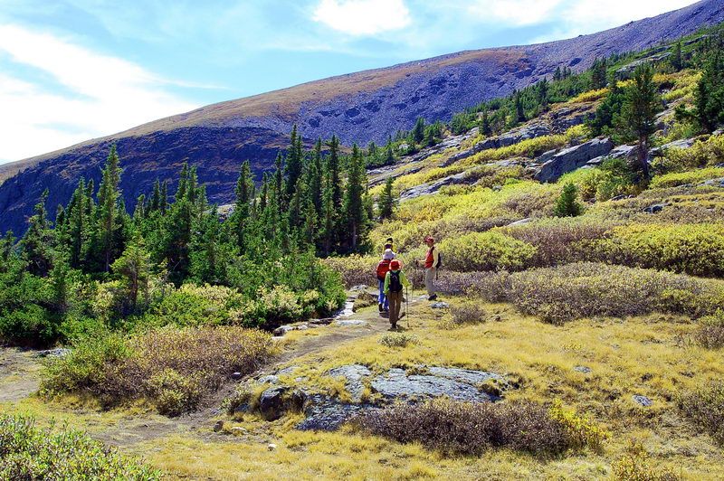 To the south, there's a long east ridge of Pacific Peak. Even though not visible, beyond is the Quandary Peak (14,265 ft / 4,348 m), the only one fourteener in the Ten Mile Range. 남쪽으로 바라본 경치. 건너편에 Pacific Peak의 동쪽 능선이 올라가고, 그 건너편에는 Quandary Peak의 더 큰 능선이 있읍니다. 나무들이 점점 키가 작아지다가 12,000 feet을 넘으면 없어집니다. 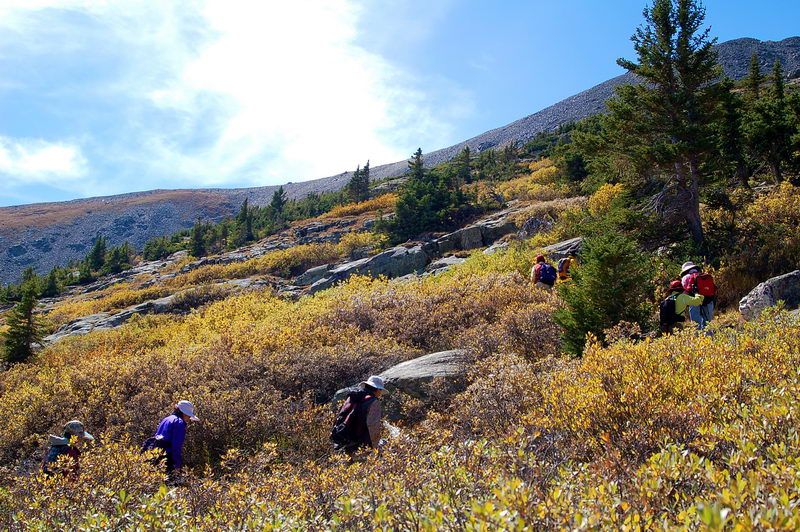 Walking through the bush of Scrub Oak. Again you can see the east ridge of Pacific Peak in the background. 야생 도토리 나무 사이로 올라가며. 금년에는 유난히 야생도토리 나무에 가을단풍이 잘 들었읍니다. 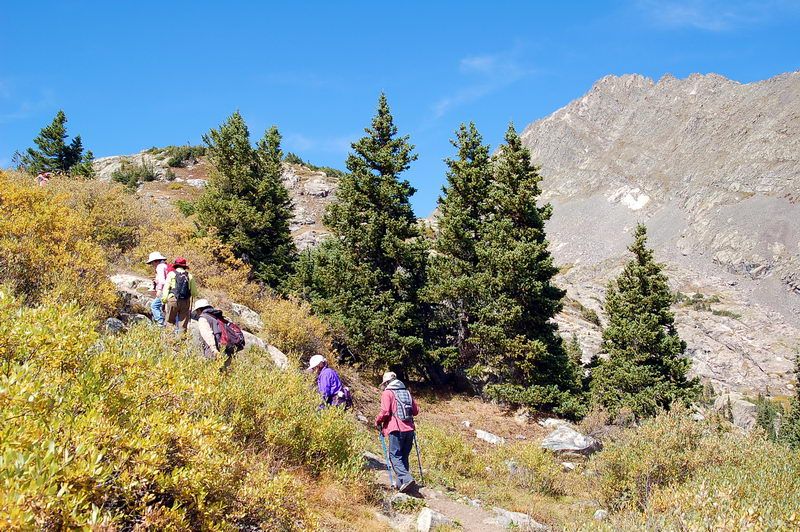 The slope gets steeper. The rocky summit of Mount Helen (13,164 ft / 4,012 m) at the right upper corner. 경사가 급해지며, 오른쪽 위에 Mount Helen이 보인다. 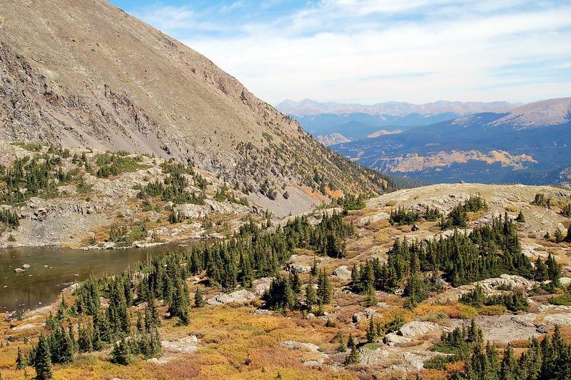 Looking down the Lower Mohawk Lake (at left) and lower valley. In the farthest background, there are Front Range mountains including Grays and Torreys Peaks. 뒤 돌아본 경치. 아주 멀리보이는 산맥이 롴키산맥이 시작되는 Front Range, 그 넘어 아래에 오늘 아침에 떠난 Denver 가 있지요. 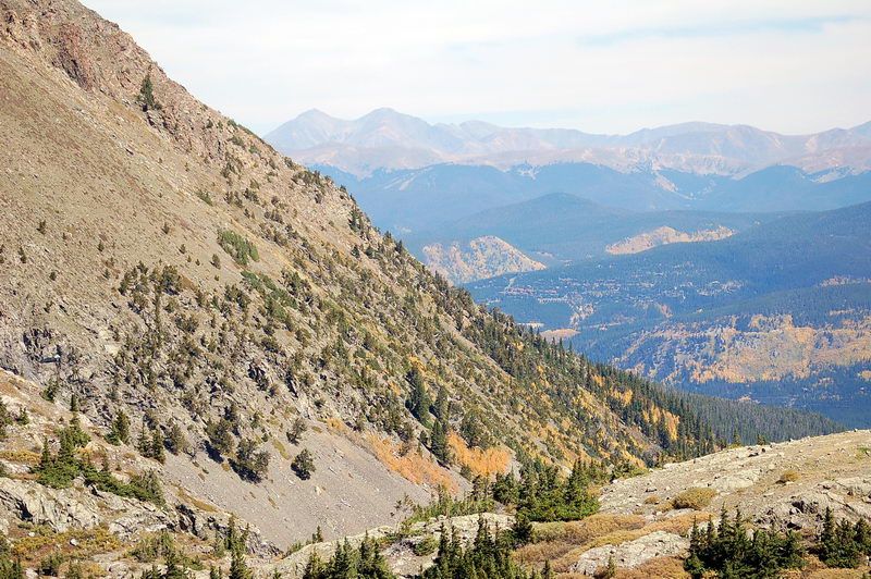 Mount Helen (13,619 at very close left), Torreys and Grays Peaks (two big breast-like summits at center far away), Mounts Bierstadt and Evans (even farther behind the Grays and Torreys, right next to them). These are the mountains in the Front Range of the Rocky Mountains. 멀리 배경의 산줄기가 Rocky 산맥에서 가장 높은 Front Range. 왼쪽의 젓가슴처럼보이는 두 봉우리가 Grays and Torreys Peaks. 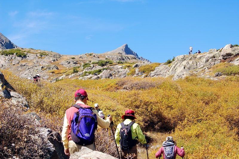 First sighting of the Pacific Peak (sharp triangular peak at center), once we climbed over a steep slope. 보고 싶었던 Pacific Peak가 송곳끝처럼 처음으로 한중간에 나타납니다. 느끼기에는 엊그제 같지만, 무려 33년전에 올랐던 산으로 오늘 여기를 찾아온 목적의 하나입니다. 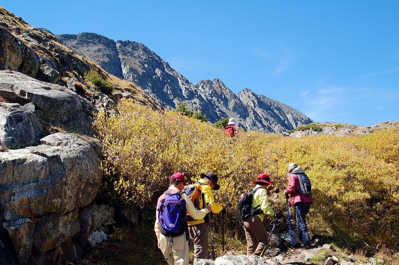 Rocky peaks in the background is the east ridge of Pacific Peak. Though not visible, beyond is the Fletcher Mountain (13,951 ft / 4,252 m). 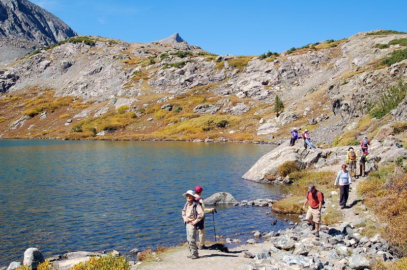 Finally, we are at the shore of the Upper Mohawk Lake (12,110'). The water is much deeper and bluish. 드디어 Upper Mohawk Lake에 도착. 한없이 맑은 깊은 물에, 아름다운 주변에, 푸른 가을 하늘.... 먼길이였지만 후회없지요. 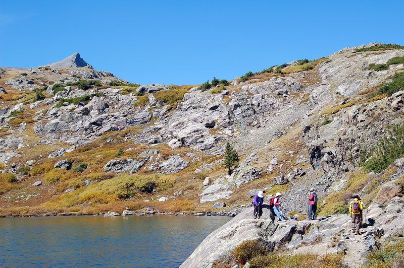 Finding a place for lunch while the Pacific Peak was looking down on us. 점심 먹을 자리 찾으며... 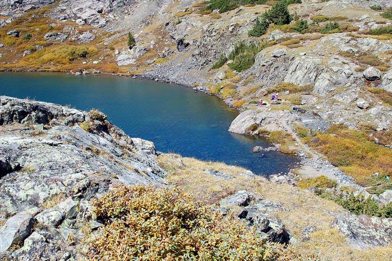 Looking down the Upper Lake. Clear blue water. A touch of turquois color at the lake bottom due to it's glacial origin. 우리 부대가 호숫가에 (오른쪽) 자리잡고 쉽니다. 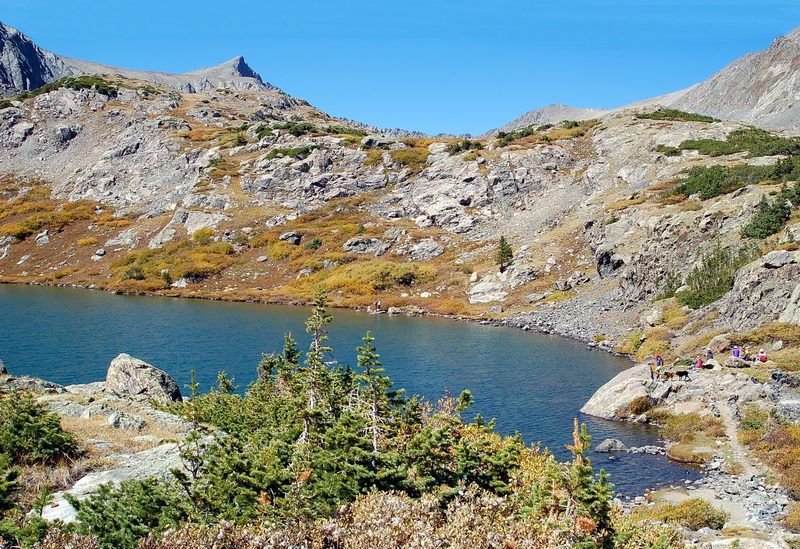 The Upper Lake and the Pacific Peak. There are four more lakes above. 여기서 더 올라가면 호수가 4개 더있읍니다. 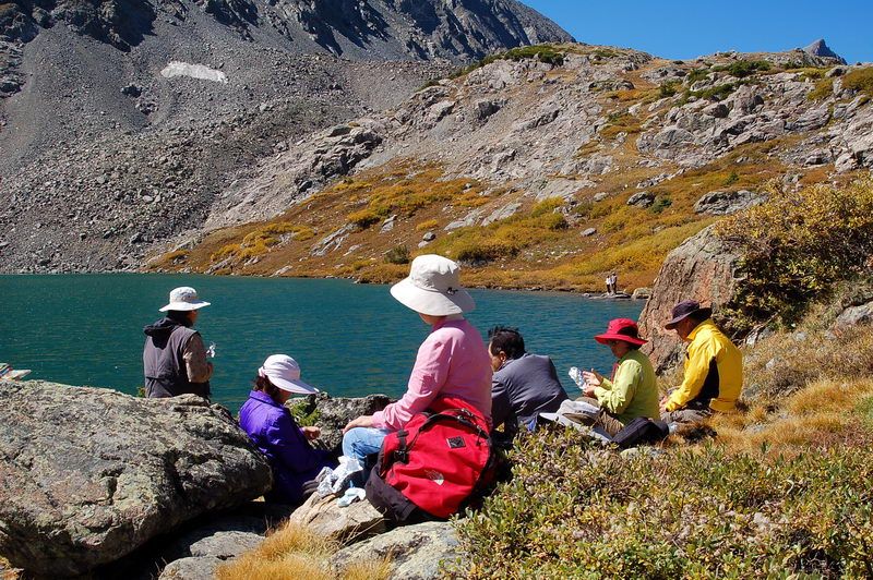 Lunch time on a beautiful sunny day. 빛나는 햇빛 아래 바람도 잔잔한 정오쯤 됩니다. 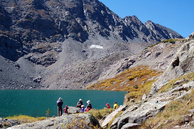 A small patch of snow at the souther slope of the east ridge. A quiet mountain lake in the background. 건너편 산언덕에 마지막 남은 작년의 눈이 보입니다. 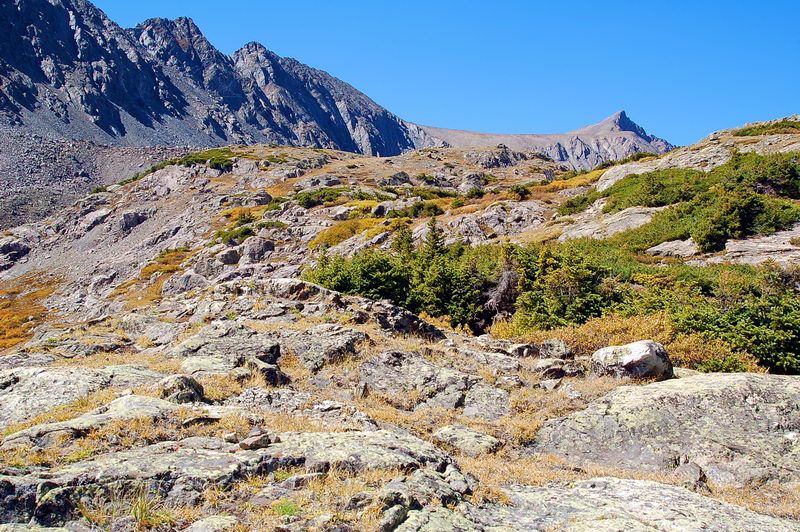 I and Myoungho Kim started to climb to another lake above us for a better view of the Pacific Peak. 지친 사람들을 뒤로 남겨두고, 김명호와 둘이 저 윗층의 다른 호수로 올라갑니다. 이 위로 호수가 네개가 더있지요. 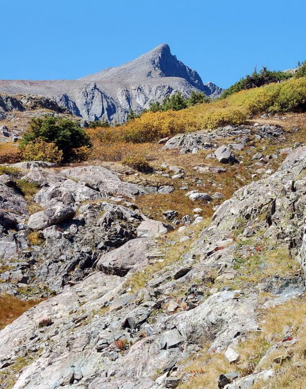 Pacific Peak lies on the crest of the Tenmile Range along a high stretch of peaks spanning between Breckenridge and Hoosier Pass in the Breckenridge quadrangle. Standing at 13,950', it is just short of 50 feet to be a fourteener. It has a notched pyramidal summit. Pacific Peak는 13,950 feet로 50 feet가 모자라서 14,000 feet가 못되는 산이지요. 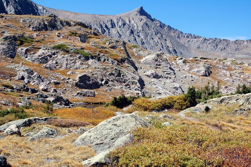 A small un-named lake in front of us. There are a larger lake over the hill in front of us. You can see the long North Ridge of the Pacific Peak here (right uper), the route I climbed the peak in 1979. 사진의 오른쪽 위에 보이는 긴 능선이 Pacific Peak으로 이어지는데, 1979년에 이 능선을 타고 정상 등반했었지요. 이름이 없는 작은 호수가 중간에 보이지요. 다시 한층 더 올라가면 조금 더 큰 호수가 있는데, 우리는 여기서 끝냅니다. 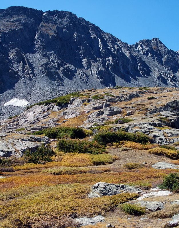 Rugged rocky northern slope of the east ridge. 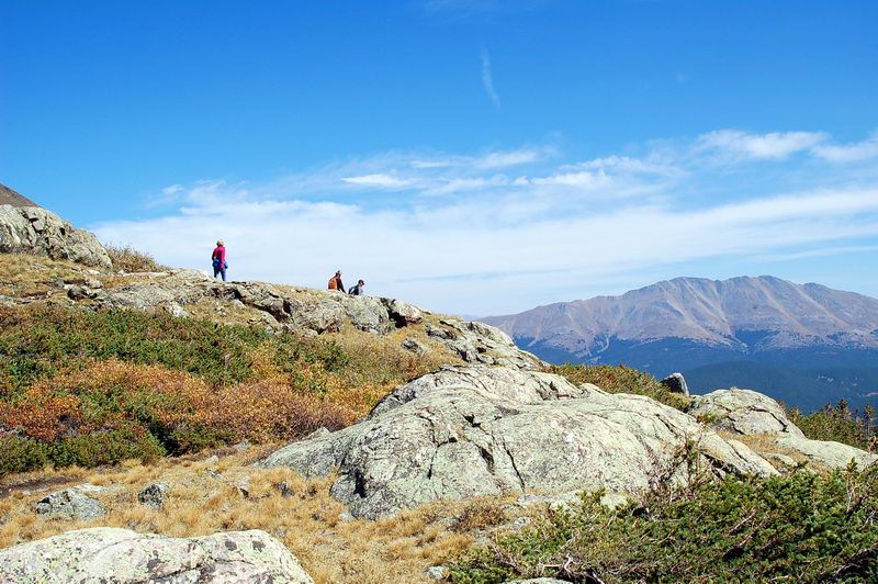 Three hikers are descending against the sky. 내려가는 사람들. 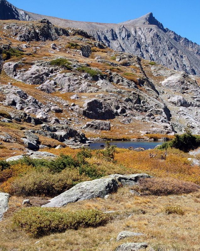 The south ridge of the Pacific Peak and the un-named small lake. 이름이 없는 조그만 호수. 이 위로 3개의 호수가 더 있지요. 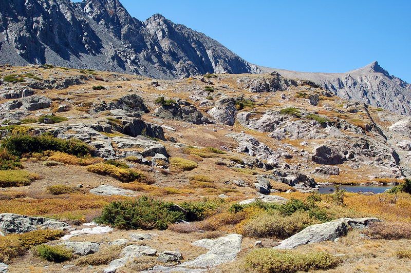 Autumn colors in a high alpine range. 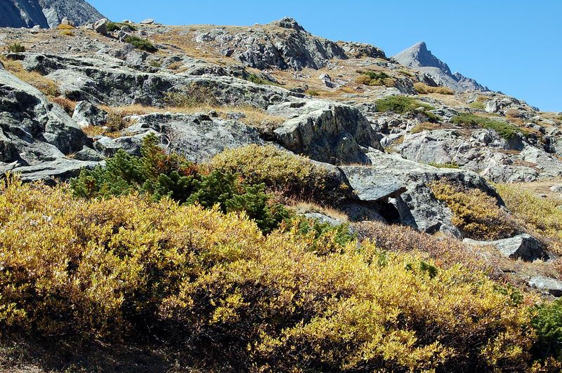 고산 능선의 가을 모습. 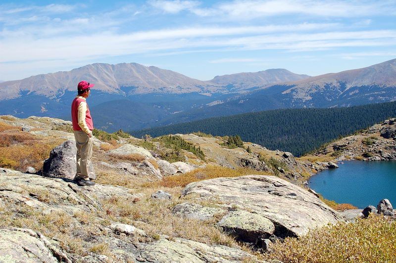 Myoungho looking down toward east. Beyond the Breckenridge Valley are: Bald Mountain (13,684 ft at left background), Mt. Guyot (13,370 ft at right background), Boreas Mountain (13,082 ft, partialy hidden at right edge). When viewed from I-70 or Breckenridge, however, Bald Mountain appears as a single pointy peak (and not a long ridgeline). To the east, the 12,046 ft French Pass separates Bald Mountain from Mt. Guyot (13,370 ft) and to the west, the 11,481 ft Boreas Pass separates Bald and Boreas Mountains from Hoosier Ridge. 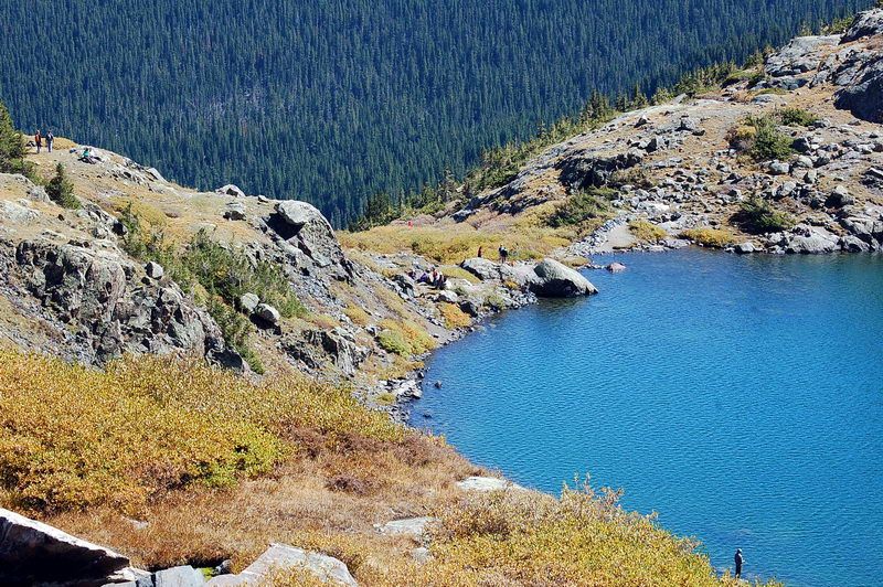 Looking down the Upper Mohawk Lake. Brilliant blue-turquois color of the lake. Our group at the lakes' edge. Upper Mohawk Lake을 내려다 보며. 우리 구릅이 호숫가 물내려가는 부근에 보입니다. 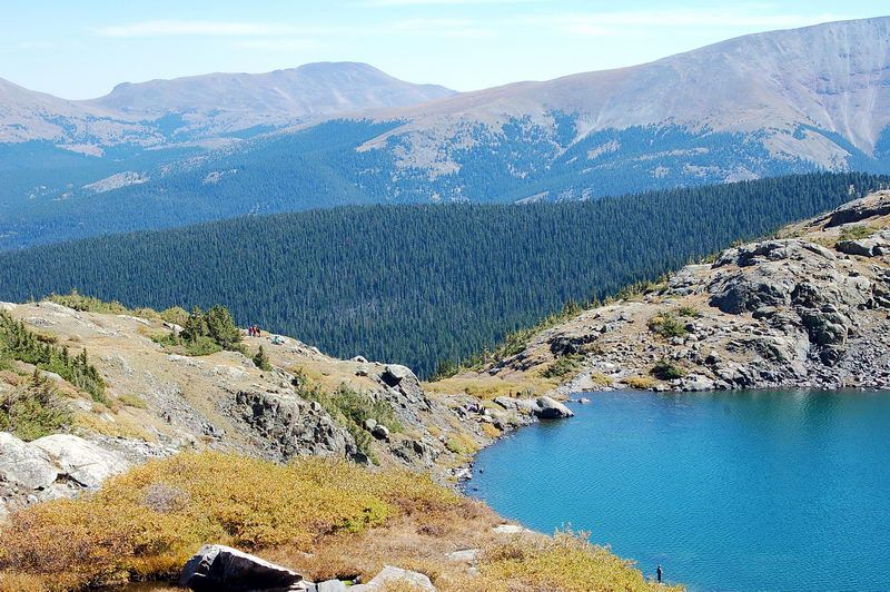 Mt. Guyot (13,370 ft at left center), Boreas Mountain (13,082 ft at right edge) 깊은 산속 꼭대기에 이렇게 찰랑찰랑 물을 담어 놓은 대 자연의 솜씨에 놀랩니다. 살랑대는 미풍에 잔잔한 파도를 이르키며 외롭게 있다가, 우리같은 방문객을 기쁘게 반겨주는 산속의 호수입니다. 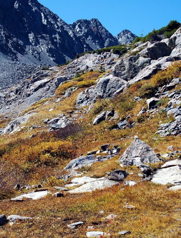 In the very front edge of the picture, you can see a few red-colored plants. They are King's Crown that turned red in autumn. 태고적에 빙하가 밀고 내려오다가 남겨놓은 바위 덩어리들이 층계를 이루고 있지요. 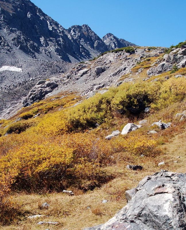 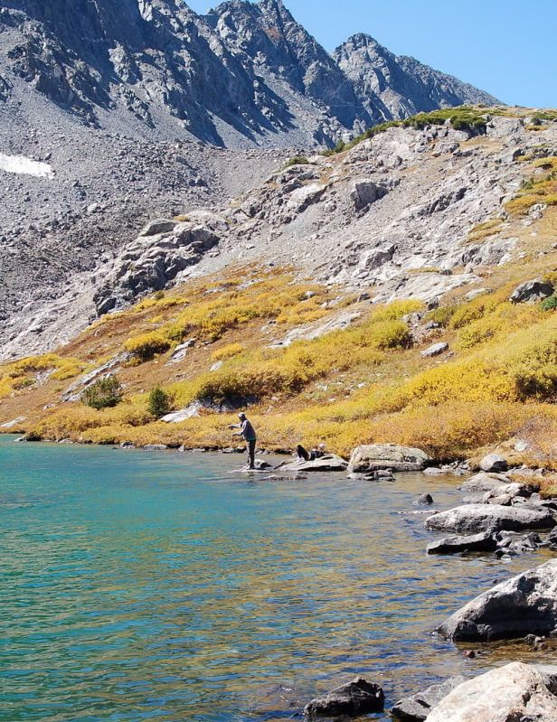 A fisherman throwing his fly fishing lure into the lake. Fly 낚시꾼이 송어를 잡을려합니다. 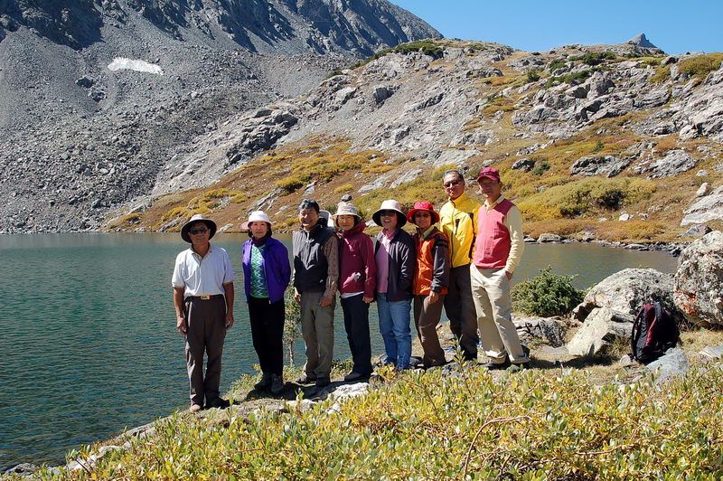 증명 사진 ! From left to right: 본인 부부, 유세만 (서울공대*63), Mrs. 유세만 (서울약대*66, both from Huston), Mrs. 김명호 (간호대*75), Mrs. 김 홍 (연세의대*68 소아과), 김 홍 (연세의대*68 산부인과), 김명호 (서울의대*75 내과) 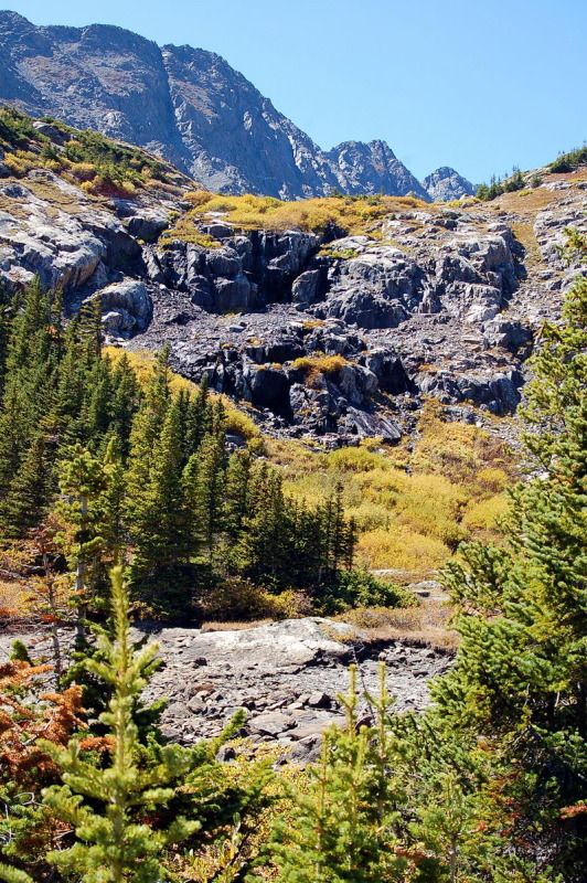 가을 단풍 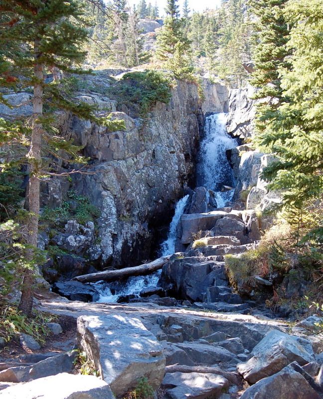 Continental Falls, just below the Lower Mohawk Lake. 컨티넨탈 폭포로 Lower Mohawk Lake에서 내려오는 폭포. 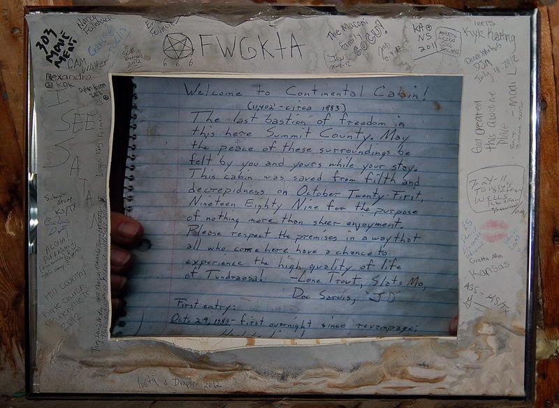
"Welcome to Continental Cabin, 11,402 feet, circa 1883, the last bastion of freedom in this here Summit County. May the peace of these surroundings be felt by you and yours while you stay. The cabin was saved from filth and decrepitness on October 21, 1989 for the purpose of nothing more than sheer enjoyment. Please respect the prmises in a way that all who come here have a chance to experience the high quality of life of Tundraosa! 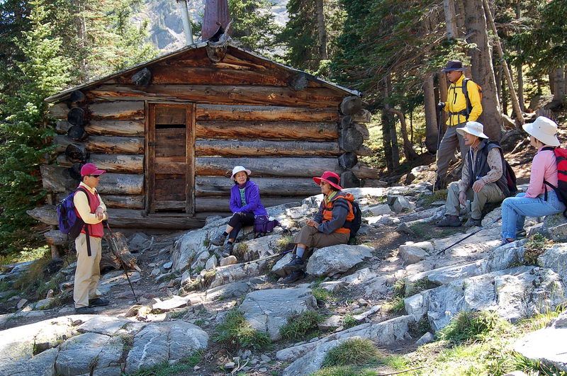 Resting for a while on the way down at the Continental Cabin. 1980년대에 이곳에 금이 발견되고 금광이 한참 번성했을때의 통나무 집 (120년전). 오랫동안 빈집으로 있었는데 1989년에 어떤 등산 구릅이 쓰레기를 치우고 내부를 다시 수선해서 등산객들이 비나 추위를 피해 머무르도록 해놨지요. 안에는 쇠로된 장작 때는 난로가있고 Bunk bed가 몇개 있읍니다. 윗 사진에는 방안에 붙어있는 사진틀에 있는 글. 물론 아무나 들어가서 쉬거나 잘수있고 비용은 무료입니다. Colorado에는 이런 광산자리에 옛 통나무집들이 군데군데 많이있어서 겨울에는 이렇게 통나무집에서 자면서 여러날 동안 스키 여행을 할수있읍니다. 추운 겨울에는 Tent 속 보다는 훨씬 편하고 따듯합니다. Photo and Text by SNUMA WM - September 15, 2012 |
Comment 3
-
운영자
2012.09.30 09:48
-
김창현#70
2012.09.30 21:16
콜로라도의 달 밝은 밤에.....로 나가는 노래가 있었지요.
딸아이가 거기 대학 교수로 있을 때, 달 보러 한번 갈까 하다가
못가본 곳 입니다. 공기가 참 맑을 것 같이 보입니다. -
황규정*65
2012.10.01 01:08
Upper Lake의 옥색빛 맑은 물이 퍽 인상적이네요.
그렇개 높은 산에 이런 아름다운 호수가 있다는것이 놀랍습니다.저도 콜라도의 산들과 그높이와 산세는 비교되지 않지만 Acadia NP의
조그만 산정에 올라가서 내려다 보이는 New England 특유의 가을 풍경과
대서양의 검푸른 바닷 풍경을 만끾하고 돌아 왔습니다.Campsite 에서 먹었던 Lobster 그리고 매일있던 hiking들 이제는 다 좋은
추억으로 남을것입니다. 규정
이때가 2주일전인데, 지금 여기는 눈에 덮혔지요.
어제 계획했었던 Mount Bierstadt (14,060 feet, 4,285 m) 등반은 취소됐지요.