


- Total
- General
- Arts
- Book
- Culture
- Economy
- Essay
- Fun/Joke
- History
- Hobbies
- Info
- Life
- Medical
- Movie
- Music
- Nature
- News
- Notice
- Opinion
- Philosophy
- Photo
- Poem
- Politics
- Science
- Sports
- Travel
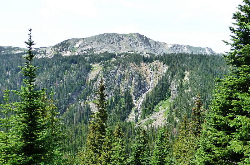
Nature [Hiking] Diamond Lake, Eldora, CO
2013.07.24 05:23
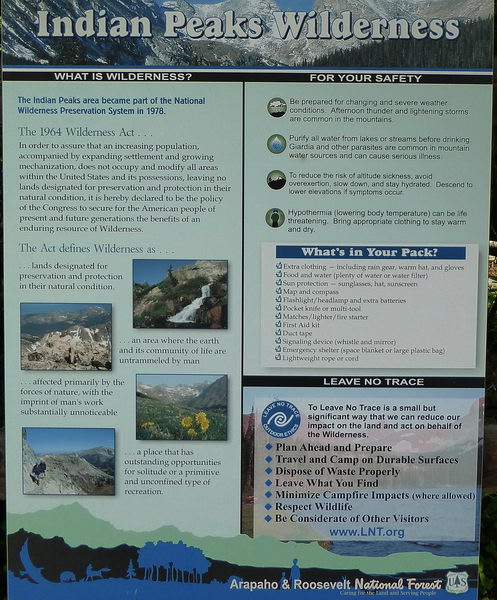
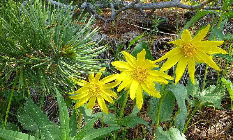
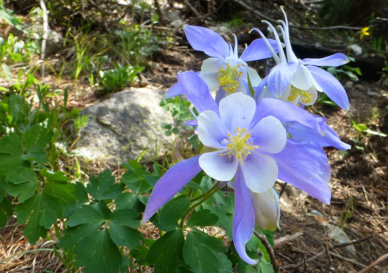
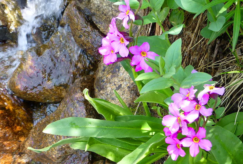
Arapahoe-Roosevelt National Forest Eldora, CO - July 6, 2013 I wrote an webpage about Diamond Lake hike in 2009. I couldn't believe it was four years ago. Directions to Trailhead: Diamond Lake is accessed from the Fourth of July Trailhead in the Indian Peaks Wilderness near Nederland, Colorado. From downtown Nederland, go north on Highway 72 for .5 miles to County Road 130 and make a right. You will see a sign for Eldora Ski Resort at this junction. Continue on Highway 130 through the town of Eldora, just past which it becomes a dirt road (4 miles). Continue on the dirt road (past the Hessie Trailhead) another 4.8 miles and take the right fork at the Buckingham Campground up into the designated parking area. Though suitable for most 2WD cars in good condition, the road between the Hessie turnoff and Fourth of July Trailhead can be rough. High clearance vehicles are recommended.The lake is in the Indian Peaks Wilderness Area of the Arapahoe-Roosevelt National Forest. The trailhead: "Fourth of July Trailhead" at 10, 172 feet 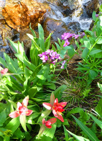 ┗▶ At the streamside, Parry's Primrose (above) and Indian Paintbrush (below) 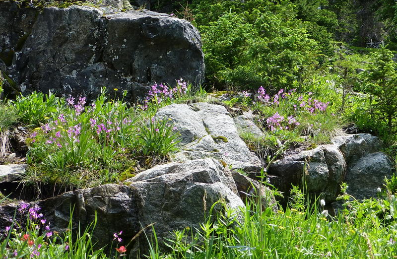 ┗▶ A group of Jeffrey Shooting Star (small pink), Indian Paintbrush (orange at left lower), American Bistort (white at right lower) 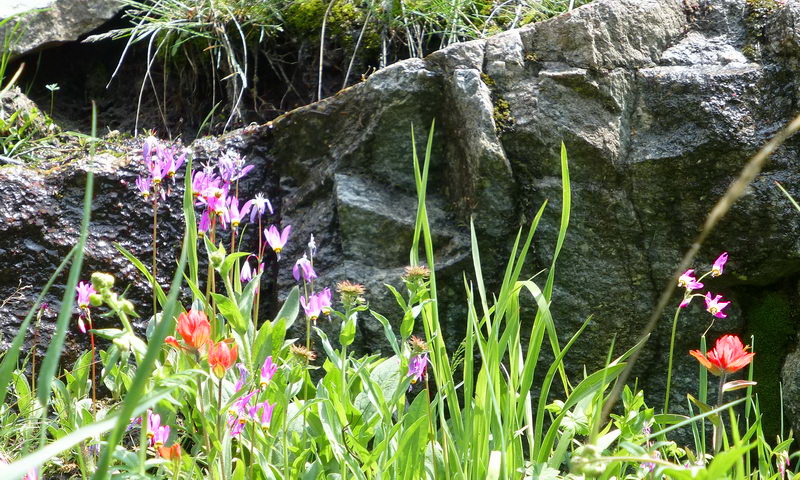 ┗▶ Shooting Star and Indian Paintbrush 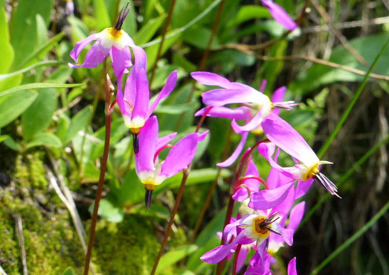 ┗▶ Close up of Jeffrey Shooting Star 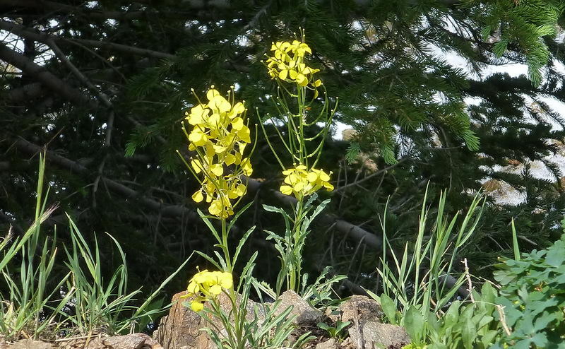 ┗▶ Western Wall Flower (Erysimum Asperum) 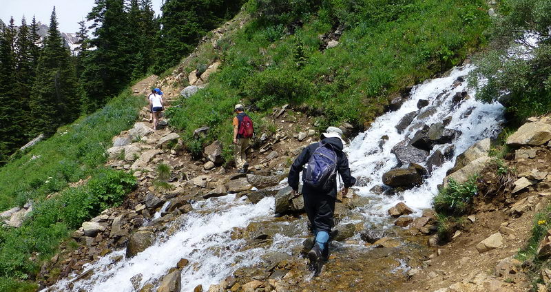 ┗▶ Crossing of a stream. We crossed many streams like this. It's an exciting and fun trail !! 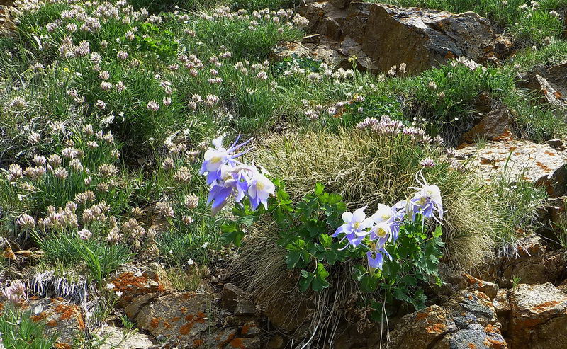 ┗▶ Colorado Blue Columbine (center and right), A large group of Alpine Clover at left  ┗▶ Unusually large group of Columbine at a hillside 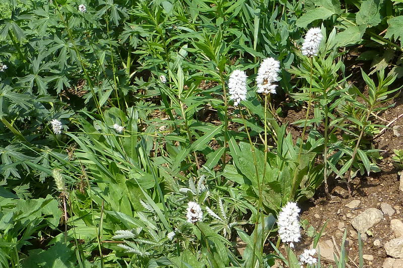 ┗▶ American Bistort 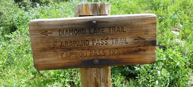 ┗▶ An old trail marker. The Arapahoe Pass trail will lead to Mount Jasper and Mount Neva toward northwest. 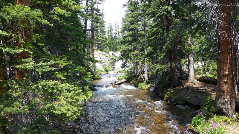 ┗▶ Crossing a swollen stream in the valley, the North Fork of S. Boulder Creek. This water comes from a few more alpine lakes below the Mounts Neva and Jasper at much higher altitude. 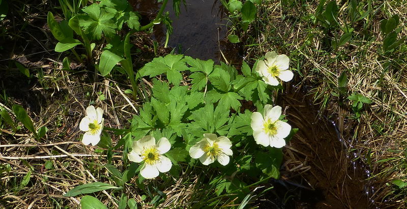 ┗▶ Richardson's Geranium at a wet ground near the stream  ┗▶ The wide alpine shelf below Mount Neva. This is a "wet" meadow in spring and early summer due to melting snow. Due to melting snow and higher altitude, this area stays wet like "tundra" in the arctic. The field is full of spring flowers, mainly with Richardson's Geranium and White Marsh Marigold 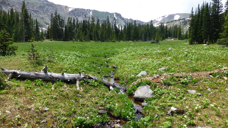 ┗▶ A small stream surrounded by the same wildflowers. 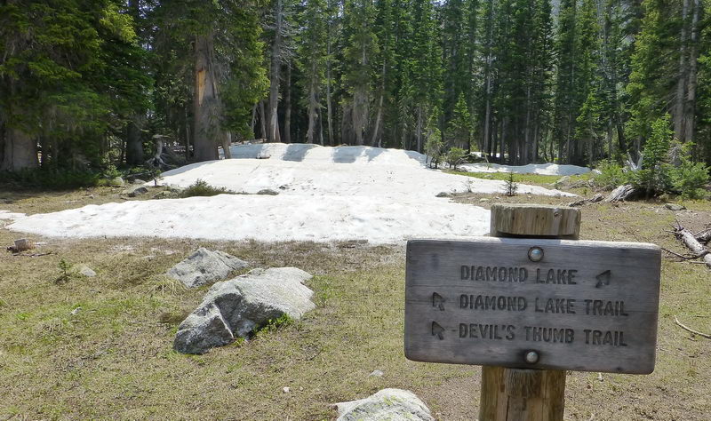 ┗▶ At 12,000 feet high and under the shade, there are still lingering snow accumulation of the last winter. 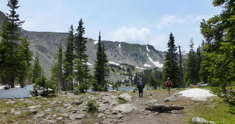 ┗▶ Approaching the Diamond Lake. The mountain range beyond the lake is the Continental Divide, splitting North American continent into Pacific and Atlantic watershed. 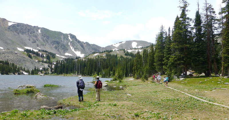 ┗▶ At the trail's end. We would be keep going and circle the entre lake all the way. 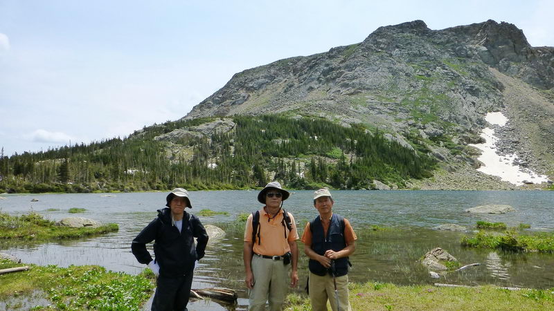 ┗▶ Local "Three stooges" at the Diamond Lake 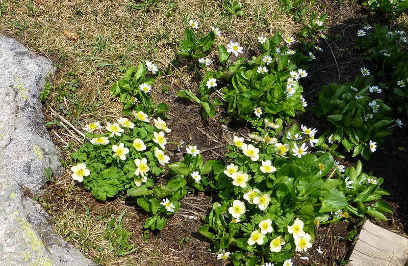 ┗▶ A small field of Richardson's Geranium (lower) and White Marsh Marigold (upper). They are always together. 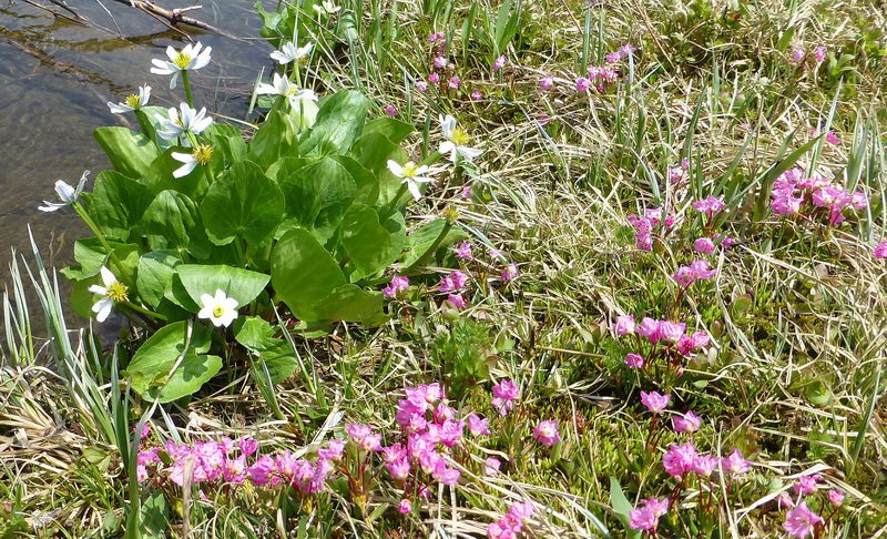 ┗▶ At the lakeside. Marsh Marigold (white) and Alpine Laurel (Bog Laurel, small pink) 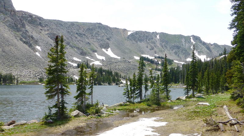 ┗▶ Western part of the lake. The lake and the Continental Divide ridge 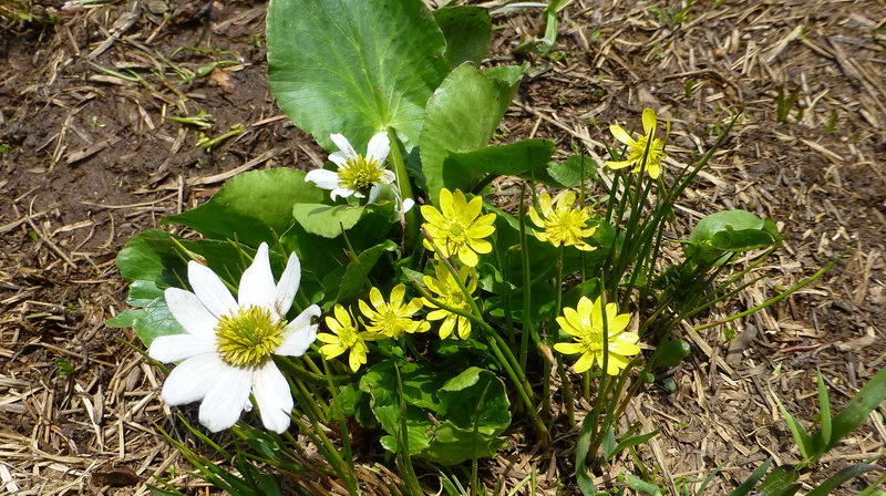 ┗▶ Marsh Marigold (white) and Yellow Marsh Marigold (Caltha palustris) 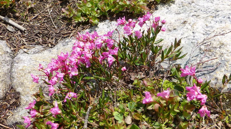 ┗▶ Close ups of Alpine Laurel. If you see carefully, these look like miniature version of azalea (진달래, flowers and leaves both) 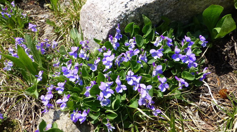 ┗▶ Hookedspur Violet (Early Blue Violet) 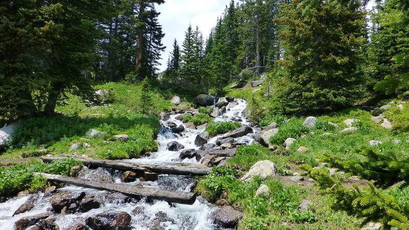 ┗▶ Another strean and falls coming from above into the lake 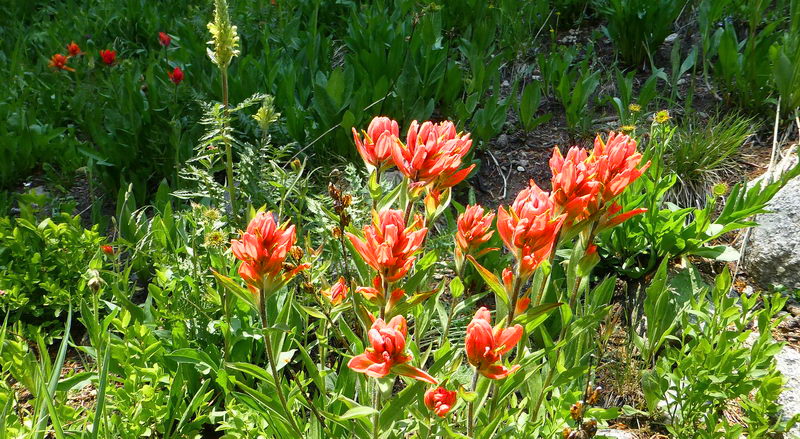 ┗▶ Indian Paintbrush 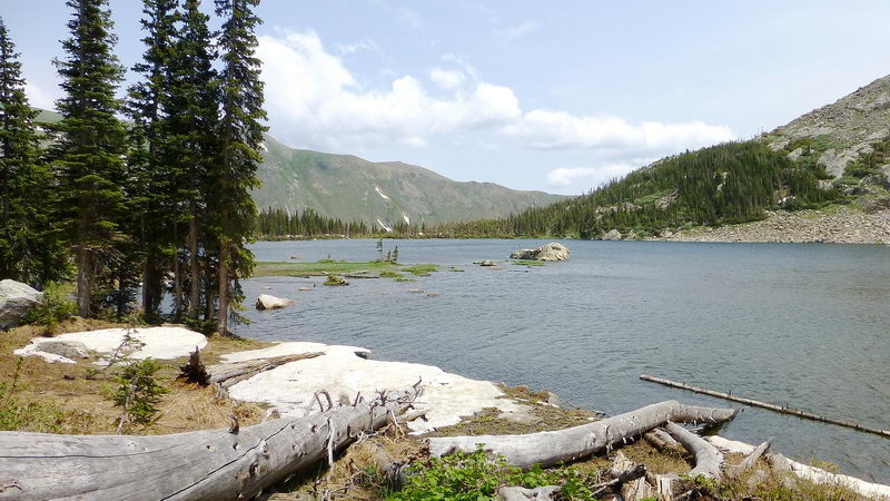 ┗▶ Looking toward east 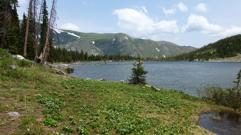 ┗▶ Another view of the lake across a white Marigold field  ┗▶ White Marigold field at the lakeside  ┗▶ The lake beyond a field of Marigolds and Geraniums 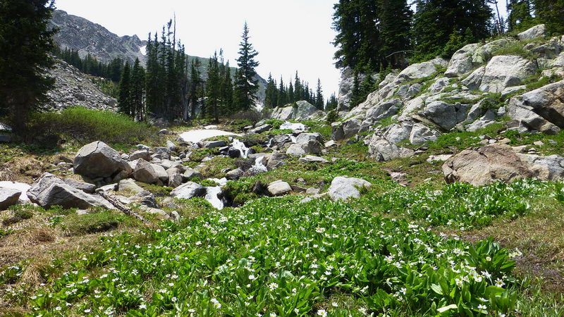 ┗▶ Looking further up at the western edge of the lake. 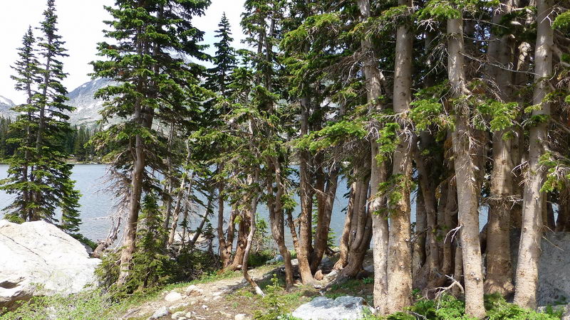 ┗▶ A group of unusually shaped fur (or pine) trees in this particular location  ┗▶ Crossing a rock field at the southern shore of the lake 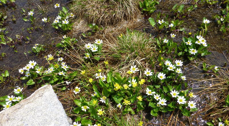 ┗▶ White Marigold and Yellow Marigold flowers at the lake shore 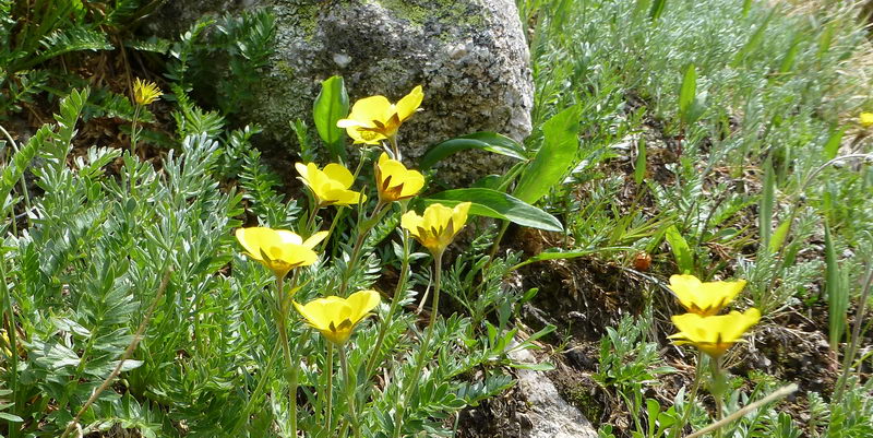 ┗▶ Varileaf Cinquefoil  ┗▶ Looking westwards 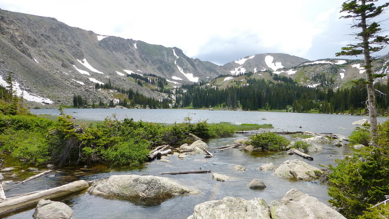 ┗▶ The outlet of the lake 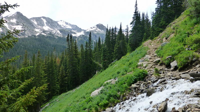 ┗▶ On the way back. In the backgounds are the peaks of Indian Peaks Wilderness. Most of them are near 13,000 feet high. The third one from left is Mount Jasper (12,923 ft.), and the peak in the right most is Mount Neva (12,814 ft).  ┗▶ At the trailhead parking area 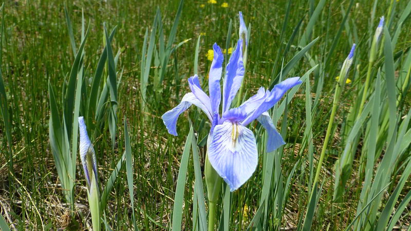 ┗▶ Rocky Mountain Iris. They are rare but occasionally seen near the trails.
Photo and Text by SNUMA WM |
 ......
Comment 5
-
홍초미#65
2013.07.24 14:01
-
계기식*72
2013.07.24 22:44
쉽지 않은 살길을 가야 하나 봅니다.
아름다운 경치와 신선한 공기.... 가슴이 후련해 집니다. -
조승자
2013.07.25 06:49
아, 11,000ft의 고산을 오르면
때묻지 않은 바위와 물과 꽃들이 기다리고 있군요!
적막이 안겨주는 평화로움이 있고
교태없는 맑은 꽃얼굴들이 별처럼 빛나는 들에
말없이 오르는 도시의 산사나이들 가슴에
보물을 찾은듯한 희열이 피어 오름을 봅니다.
즐거운 산행, vicariously 즐기고 갑니다.
몇시간이 걸렸는지 궁금합니다.
숨도 찾겠지요?
Beautiful webpage! -
운영자
2013.07.25 15:45
고산에서는 먼지가 아주 드믈지요. 바람이 다 불어내고 남은것은 작은 돌쪼각들뿐입니다.
우리는 5,000-6,000 feet 고도에 살기때문에 5,000 feet 더 올라온다해서 (11,000 feet로)
숨찬것을 별로 많이 느끼지 않습니다. 본인도 California (sea level)에서 돌아온지 이미 3개월이 되어 문제가 없지요.
승자님이 오신다면 (낮은 고도에서 갑자기 10,000 feet 이상에 올때) 숨이차고 "온몸이 나른"할것입니다.
고산 (high altitude)에서는 걸음을 일부러 천천히 걷지요. 보통 시내에서 걷는 속도의 반 정도로 천천히 갑니다.
이날 hiking은 약 5시간 걸렸는데 호수에서 한바퀴 돌면서 한시간 보냈지요.언제나 호숫가에서 물에 발 담그고 한없이 있고 싶은 생각 간절하지만,
오후의 천둥, 번개, 소나기의 가능성이 매일 있기때문에 오후 2시 이전에 Tree-line 아래로 하산하는것이 원측입니다.
비맞는것은 전혀 문제가 아니지만 (우비를 가져가니까), 제일 무서운것이 "번개- lightening"로서,
일단 12,000 feet (tree line) 이상 올라가면 나무가 없어서 피할데가 전혀 없지요. -
민경탁*65
2013.07.27 09:32
여름에 눈싸인 산에 오르는 기분은 표현하기가 어려운데,..
더운 지역에선 눈이 그립고, 더운데 오래 있으면, 또 따듯한 곳이 그립고..
사람없는 조용한데서 일주일만 있으면, 답답해 지고,..결론은 멀지 않은 곳 들이라면, 자꾸 움직여라?
북가주에도 -8월 까지 눈이 잇는 곳이 많은데, 좀 멀어서 문제지요.
제가 자주 가보든 eagle lake, 여기엔 trout 가 salmon 만큼 크고 고기도 분홍색 나고,.
유난히도 청초한 들꽃들, 잔잔한 호수, 은빛처럼 내려오는 stream 과 falls
한여름의 더위를 잊게 하여줍니다.
감사합니다.