Hiking to Mills Lake, Glacier Gorge
Rocky Mountain National Park
Estes Park, CO - July 13, 2013
I am way behind in recording my alpine journals this year. This one is more than a month too late. Anyway, I don't want to pass anyone of them. As so many hikings keep coming up, missing one would be loosing it forever from the memory.

I have been to Mills Lake many times. If someone asks me to list the best scenic lakes in Denver area, I will list Mills Lake in the Glacier Gorge of Rocky Mountain National Park and Diamond Lake in South Boulder Creek Valley. While Diamond Lake trail has a lot of wild flowers in early summer, Mills Lake trail has wonderful and awesome views along the way.
Following informations are from the Internet:
Trailhead: Glacier George shuttle station in Bear Lake Road
Round-Trip Length: 6.2 miles (includes Mills Lake and Jewel Lake)
Start-End Elevation: 9,240' - 9,955' (Mills Lake) : 9,967' (Jewel Lake)
Elevation Change: +727' net elevation gain to Jewel Lake (+938' total roundtrip elevation gain to Jewel Lake)
The Loch Vale Trail rises steadily through young aspen and mixed pine to Alberta Falls (.85 miles : 9,423'). A moderate climb continues to the North Longs Peak Trail split (1.6 miles : 9,768'), where it banks southwest and flattens through a narrow gorge between Thatchtop Mountain (12,668') and the Glacier Knobs.
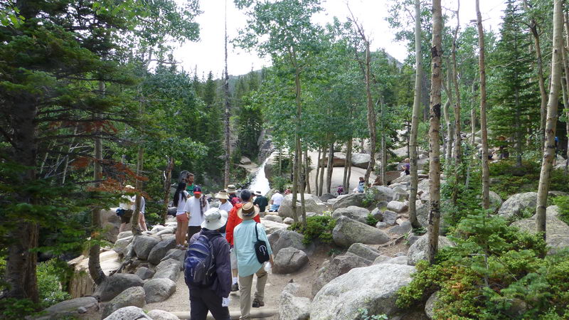
The trail drops to Glacier Junction and bears left to Mills Lake (2.1 miles : 9,804'). The trail turns south, crossing Glacier Creek twice and sections of cairn-marked rock slabs to Mills Lake (2.65 miles : 9,955'). Here you'll enjoy terrific views of Glacier Gorge: The Arrowhead (12,387'), Powell Peak (13,208) and McHenrys Peak (13,327') form the west wall, while Pagoda Mountain (13,497') and Keyboard of the Winds - a line of pinnacles near the summit of Longs Peak - rise to the east. Chiefs Head Peak (13,579') and The Spearhead (12,575') cap the upper valley. The trail - now intermittently rugged, undulating and heavily rooted - follows the lake's east shore to its marshy juxtaposition with Jewel Lake (3.1 miles : 9,967'). The trail continues past Jewel Lake on more rugged terrain to the Glacier Gorge Backcountry Campsite (3.35 miles : 10,068'), Ribbon Falls (4.7 miles : 10,540'), and Black Lake (4.8 miles : 10,630').  1: N40 18.621 W105 38.419 — Glacier Gorge Trailhead
2: N40 18.237 W105 38.289 — .85 miles : Alberta Falls
3: N40 17.982 W105 38.391 — 1.6 miles : North Longs Peak Trail junction
4: N40 17.842 W105 38.757 — 2.1 miles : Glacier Junction
5: N40 17.512 W105 38.597 — 2.65 miles : Mills Lake
6: N40 17.222 W105 38.387 — 3.1 miles : Jewel Lake
7: N40 16.911 W105 38.354 — 3.35 miles : Glacier Gorge Campground spur The lake is named after Enos Mills, the man commonly referred to as the "father of Rocky Mountain National Park".
Mills became the area's first naturalist, and made great contributions to the field that would eventually lead to the profession of interpretive park rangers. He also established a guide service that led tourists to the summit of Longs Peak. At the age of 15 he made his first ascent of Longs Peak, and over the course of his life would make the trip 40 times by himself, and nearly 300 times as a guide. His most significant contribution, however, was spending numerous years lecturing across the nation, lobbying Congress, and writing thousands of letters and articles that would eventually lead to the creation of Rocky Mountain National Park on January 26, 1915.
Quotes from the Internet)
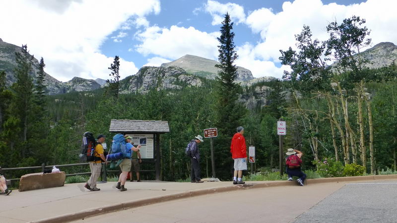
At the Glacier Gorge Station, entering the trailhead.
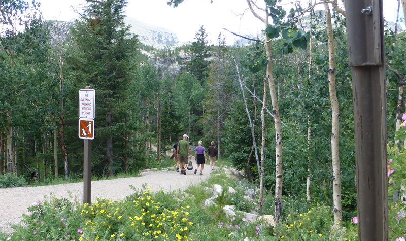
At the beginning of the trail
Approaching Alberta Falls

At the Alberta Falls. This is the lower part of the Glacier Creek.

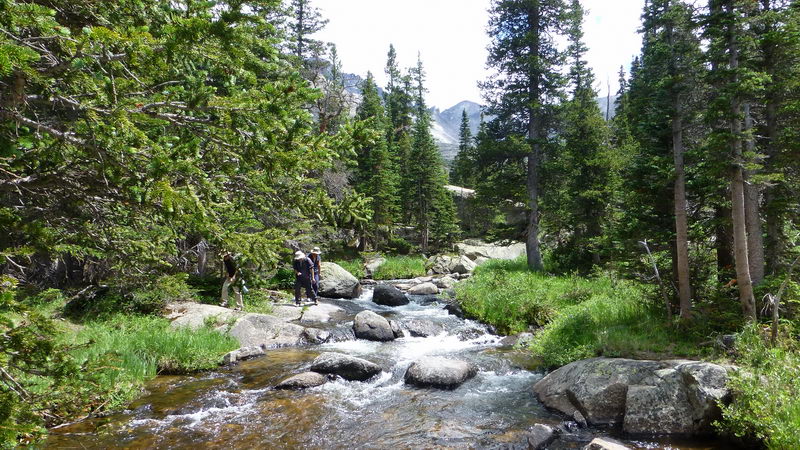
Crossing the Glacier Creek a creek
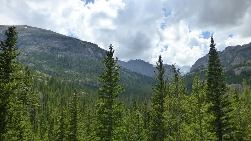
Almost there
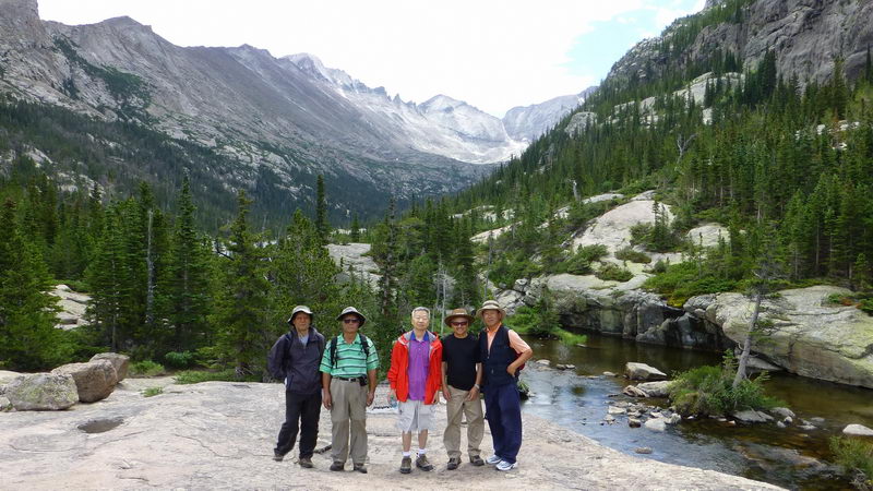
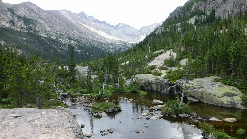
Just before Mills Lake, with the glacier carved valley in the background. Glacier Creek just below the lake.
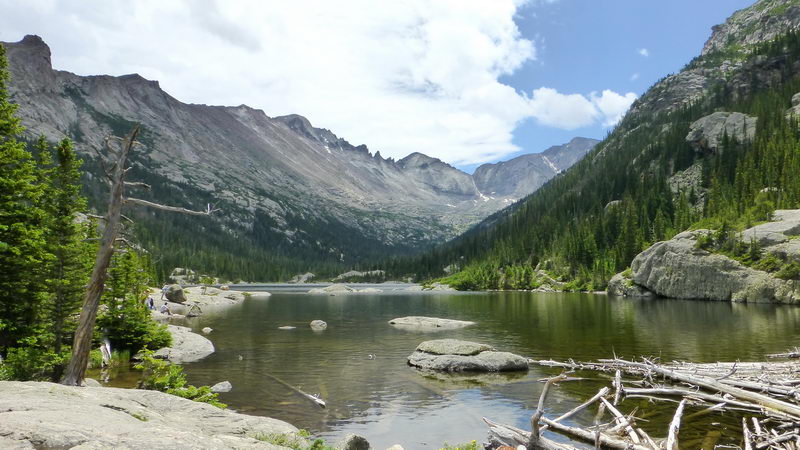
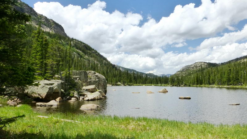
Mills Lake at the north end, looking toward south.
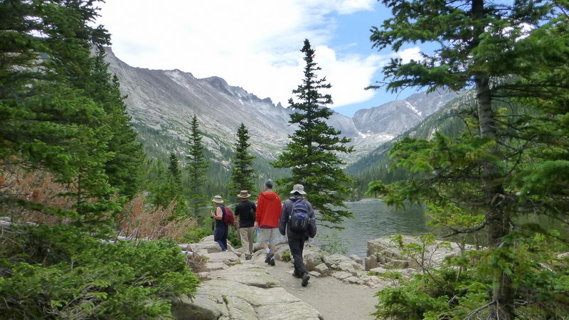
Walking along the eastern shore of Mills Lake
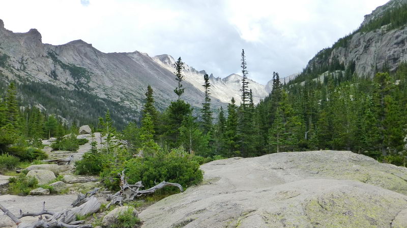
Surrounding mountains. Longs Peak (left most), Keyboard of the Winds (Sharp tooth-like pinnacles), Pagoda Mountain (pyramid shaped), and Chief's Head Peak (right) in the background.
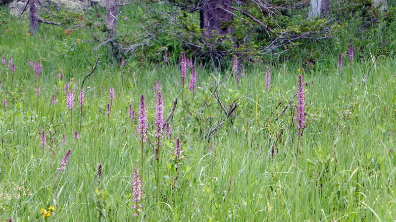
At the south end of the lake. Elephant head (pink) standing among grasses.
Looking toward north (valley)
Storm Peak range to the east

At the south end of the lake where the Glacier Creek enters the Mills Lake from Jewell Lake.
Glacier Creek coming down from Jewell Lake above.
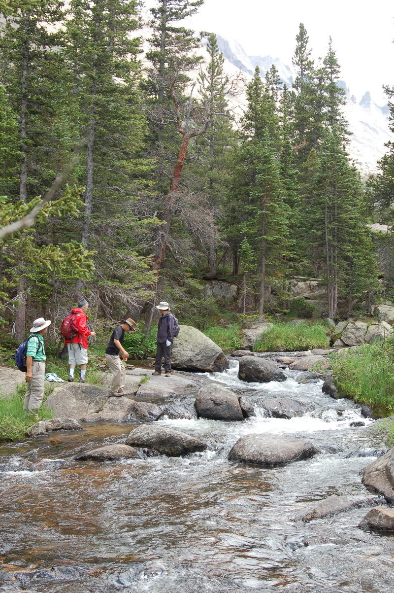
Wetting hands in the cold water of Glacier Creek
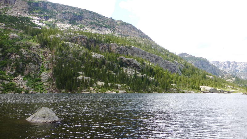
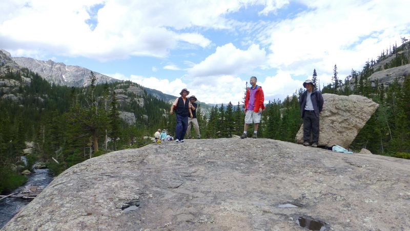
West wall of the lake
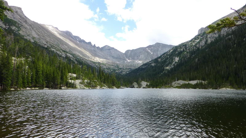
Looking toward south, Longs Peak, Pagoda, Chief's Head group in the background
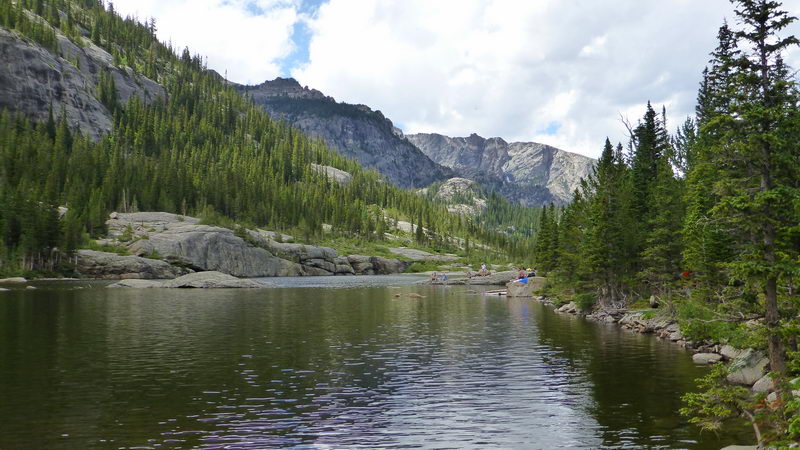
Looking toward north. People resting at the lake shore
Glacier Creek just below the lake
On the way down
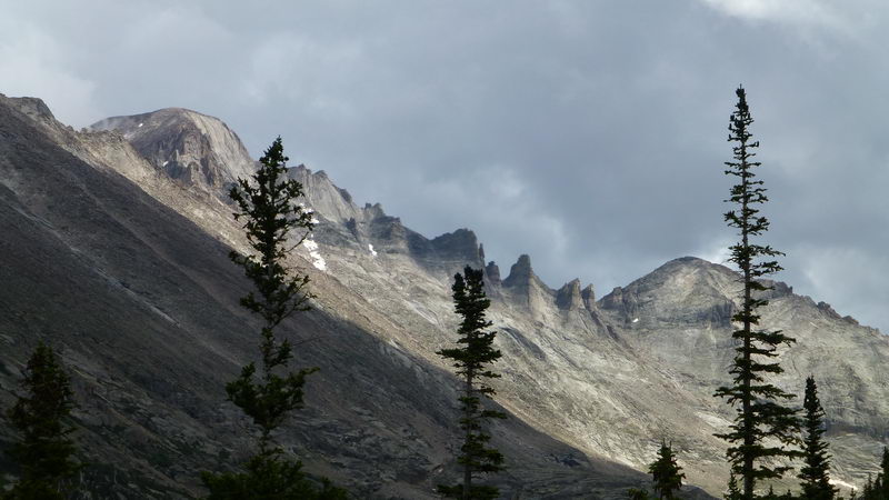
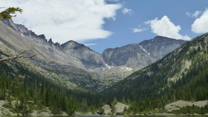
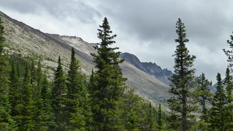
Sharp series of rocky pinnacles (center) are the "Keyboard of the Winds". The peak to the left is the summit of Longs Peak. Pagoda Mountain at right.
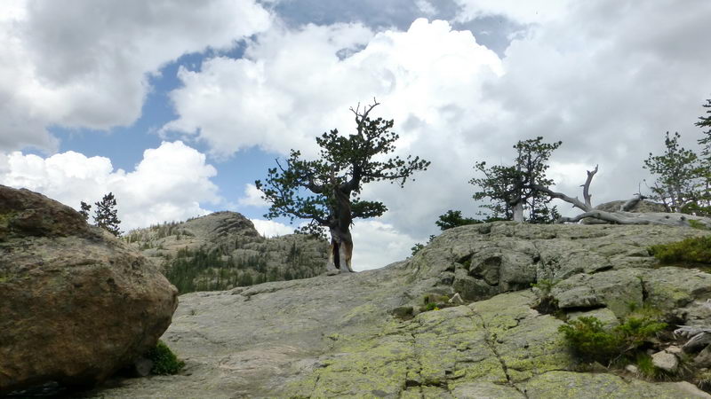
A Bristlecone Pine growing on a rock. Other bristlecone pines at right.
Distant scenes from the valley to the east.
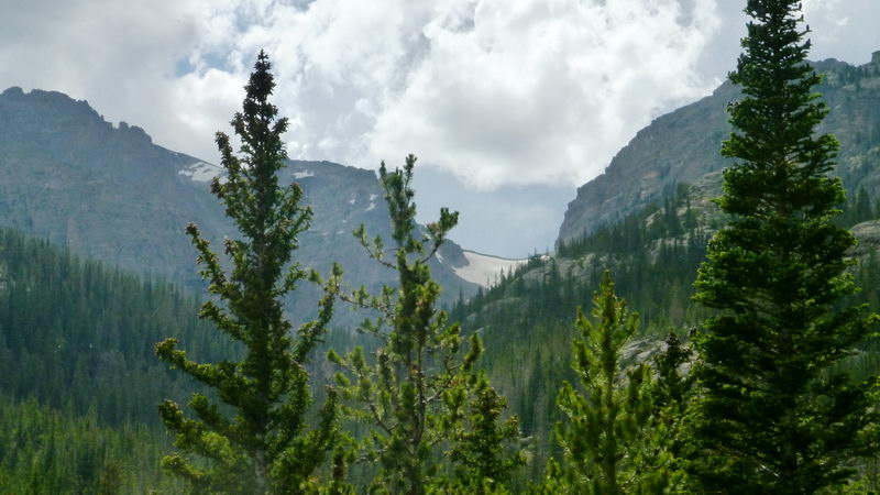
Distant range covered with snow
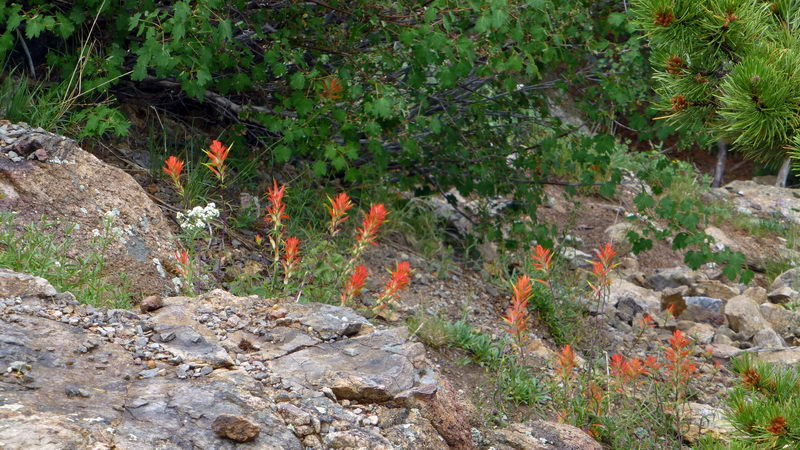
A group of Indian Paintbrush near the end of the trail
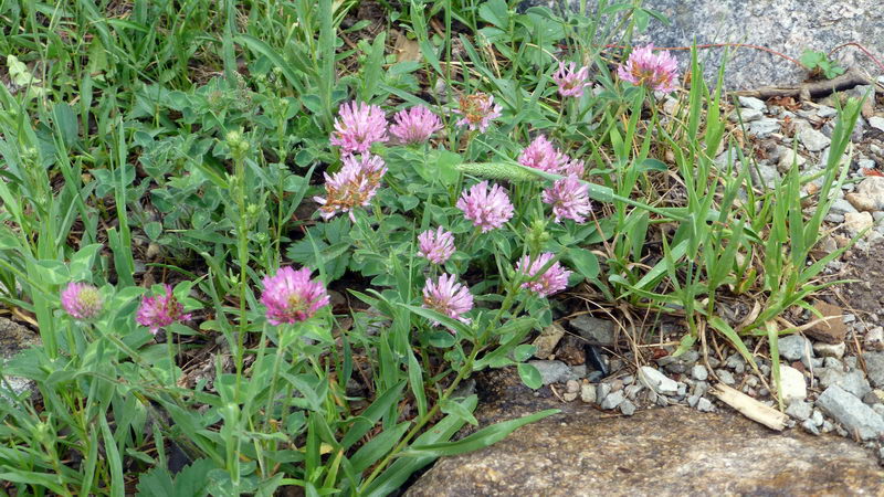
Pink Alpine Clover
Photo and Text by SNUMA WM - August 12, 2013 |


사진도 잘 나왔고요...
다리도 튼튼하고, 심장도 튼튼해야 할 것 같습니다.