Herman Lake
Arapahoe National Forest
Bakerville, CO July 21, 2012
Round-Trip Length: 6.5 miles
Start-End Elevation: 10,332' - 11,987' (12,018' max elevation)
Elevation Change: +1,655' net elevation gain (+1,815' total roundtrip elevation gain) Trail Description
Herman Lake is located north of Bakerville, CO in the Clear Creek Ranger District of the Arapaho National Forest. It lies in the open tundra of a capacious valley just below the Continental Divide. The Herman Gulch Trail, which is part of the greater Continental Divide Trail, traces Herman Gulch through luxuriant meadows to treeline, where it branches off on a well-defined path to Herman Lake. Visitors will enjoy good trail conditions, remarkable alpine landscapes, and an excellent chance to see bighorn sheep and mountain goat in their natural habitat. (From ProTrails.com)
Why do they bloom?
From the mid-June to the end of July is the best time to see wildflowers in the foothills of Colorado.
These alpine flowers have about 4-6 weeks of brief window of time in the summer to fulfill their destiny. Most of them germinate or regrow under the spring snow in early June and then grow, open their flowers, get pollinated, and then bear the seeds before the frost hits in the high altitude in August. Most of the flowering plants are perennials that established their root system many years before they can bloom. New seedlings grow a bit each year for many years before blooming.
Some of the flowers will wait to mature for 10-15 years before they can bloom only to die after pollination, leaving their seeds behind.
In the harsh alpine environment, their growth is stunted and they are physically much smaller than their cousins in the lower plains, however, their flowers tend to be larger and more brilliant in order to attract the pollinators like butterflies, bees, and other insects.
At times, beginners among us wonder why they would bloom and smile at us in a remote corner of the alpine meadows or woods.
One day, we realize that they don't bloom or smile for us. They only do that in order to be pollinated, to bear seeds, and to pass their genes to the next generation.
Knowing that, we should not touch or pick the flowers. Even a single flower is the results of many years' of hard work for them. They are there for a good reason and we should leave them alone. Perhaps, we may enjoy their beauty from a distance and just take pictures of them as we pass by.
This was one of the hiking trips we took in the summer season this year.
For an old dog, learning a new trick (remembering the names of the flowers) gets harder and harder. It's a brand new world for me.
I have to write it down under the pictures.
The pictures are here for my future reference in identifying the wildflowers.
SNUMA WM
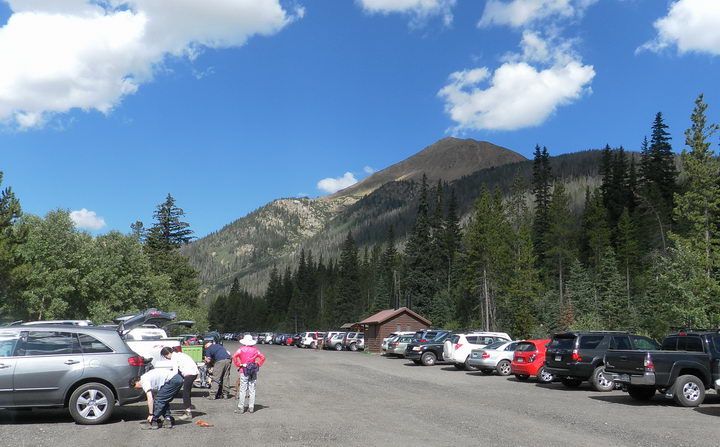
↑ Exit 218 from I-70-WB just before the Loveland Pass exit, then immediate right turn in the Herman Gulch Road, and right turn into the Herman Gulch Trailhead (10,332 feet). At the left center of the picture is the pyramidal-shaped summit of Mount Bethel (12,705 feet). This is the perfectly triangular landmark visible to the drivers from the I-70 west bound just before the Eisenhower-Johnson Tunnel. The trailhead parking lot was very generously wide for everybody. The Continental Divide Trail passes here and two major hiking trails start from here.
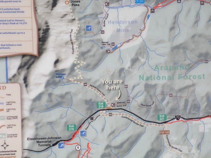
↑ This is the familiar playground for hikers and climbers in Denver. Two fourteeners of Grays and Torreys Peaks are here as well with numerous other hiking trails. The Loveland Ski Slope is here too. At the lower left, there's the famous Eisenhower-Johnson Memorial Tunnels that are west-east interstate passage through the Continental Divide of the Rocky Mountains Range.
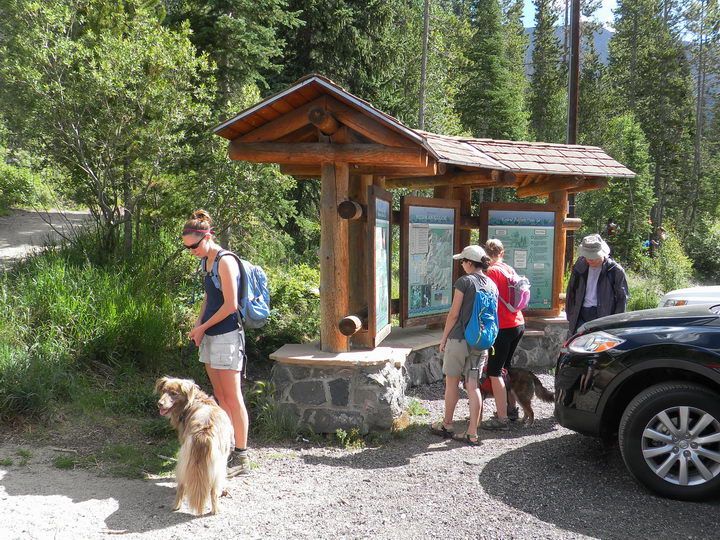
↑ At the bulletin boards of the Herman Gulch Trailhead.
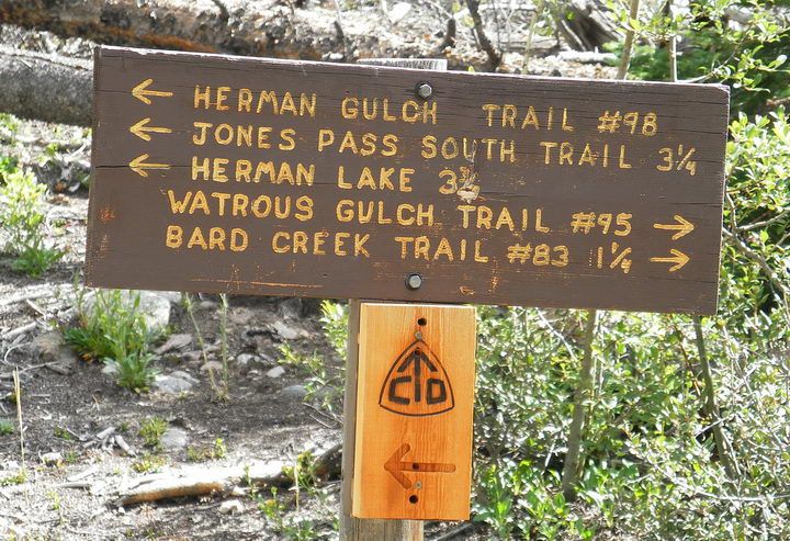
↑ Very soon, we came to a fork in the trail. Herman Lake to the left, 3.25 miles.
At this high altitude, 3 miles of uphill climbing means a long way.
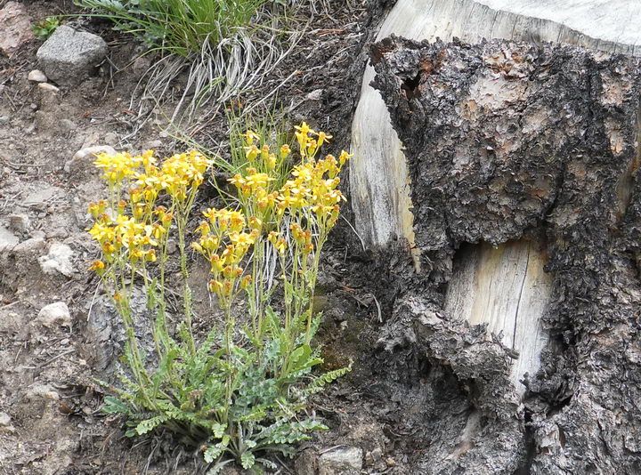
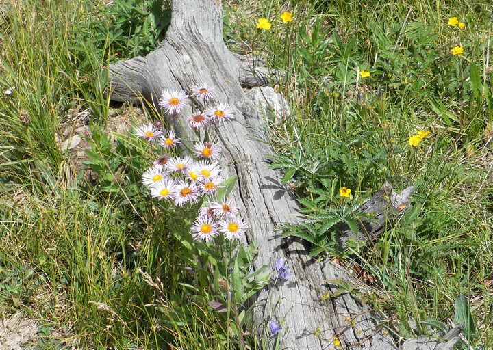
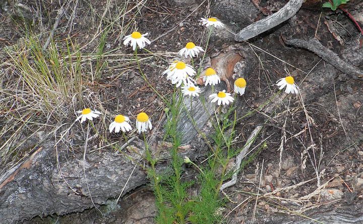
↑ Here comes the first group of wildflowers. First we passed a group of Fire Weeds and this group is Fendler's Senecio growing near a stump of a dead pine tree.
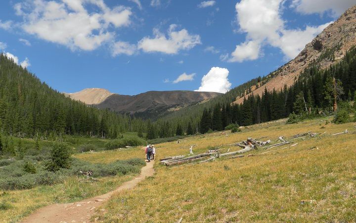
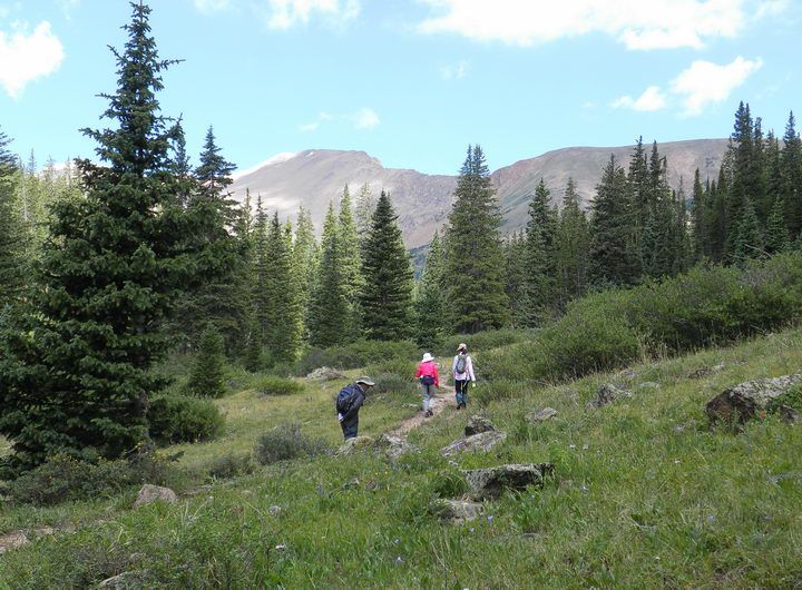
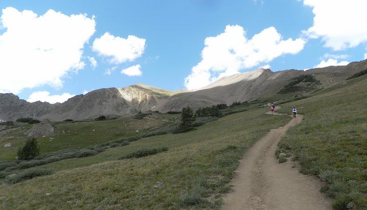
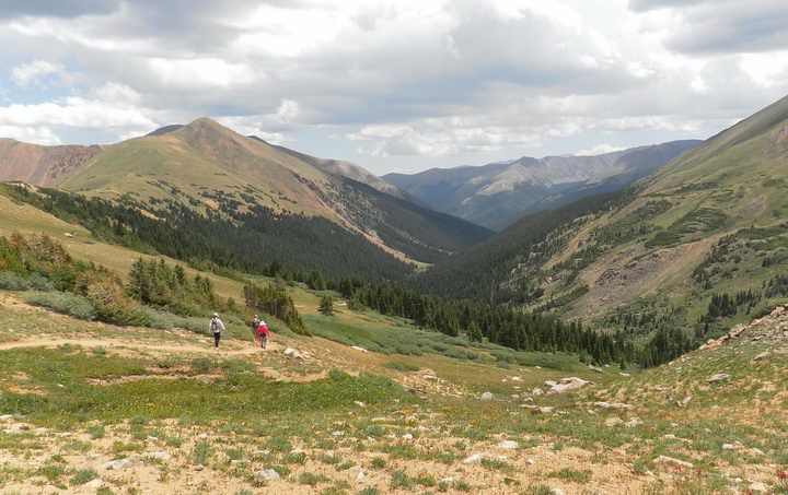
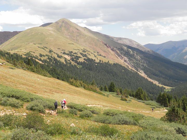
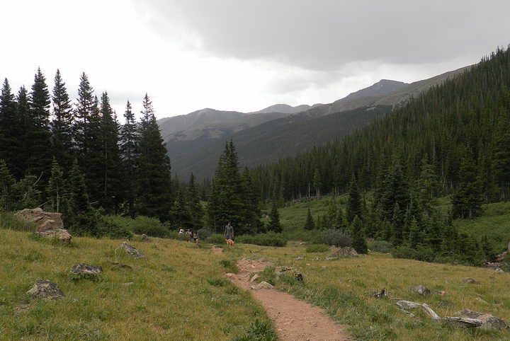
↑ After climbing through a dense forest of pines, firs, and spruces, we came out into a wide open alpine meadow. In front of us is the Pettingell Peak (13,553') far away under the sunlight. A beautiful day in the high mountains of Colorado.
Herman Lake is just below Pettingell Peak about another 1,000 feet higher.
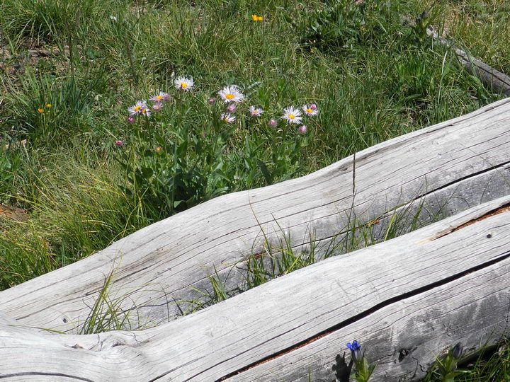
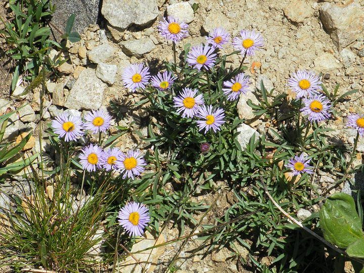
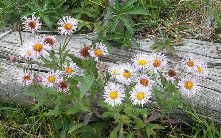
↑ A family of Blue Aspen Daisy, growing in the shadow of fallen trees. At right lower corner, there's a single Pleated Gentian.
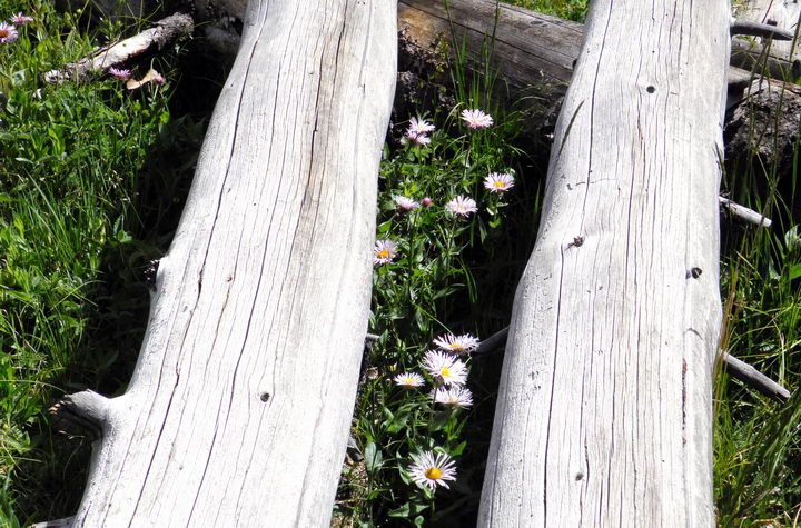
↑ Another group of Blue Aspen Daisies between dead and bleached tree trunks.
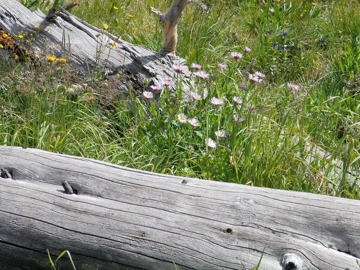
↑ Another group of Blue Aspen Daisies
↑ After the alpine meadow, we are entering into another alpine forest of spruce trees.
↑ Blue Aspen Daisy (pruple) and Beautiful Cinquefoil (yellow)
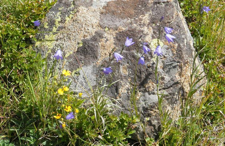
↑ Hare Bells (blue) and Beautiful Cinquefoil (yellow)
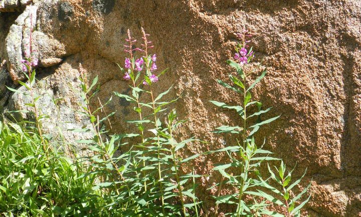
↑ Fireweed. Their name came from the fact that they grow well in the sunny space opened by wildfires in the forest.
American Indians eat the soft leaves and roots in spring time. Russians make tea from this plant.
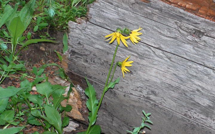
↑ Aspen Sunflower
↑ Alpine meadow above tree line. The lake is getting nearer as we can tell the the natural dam created by glacial moraine.
What looks like a green hill at center and left is the shelf that holds the glacial lake.
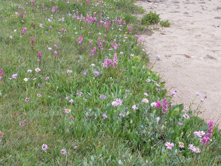
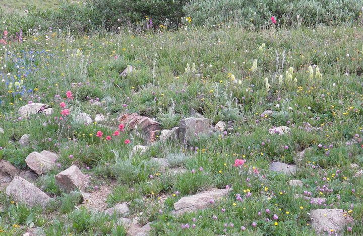
↑ A flower garden at the shore of a small dried pond. I think there was water here 2-3 weeks ago.
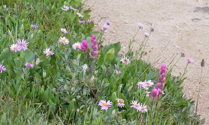
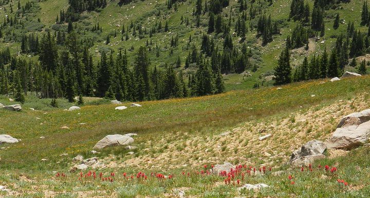
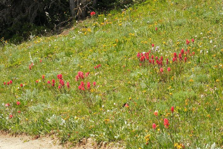
↑ Rosy Paintbrush (pink) and Blue Aspen Daisy (violet)
↑ Same flowers as above, plus Beautiful Cinquefoil (yellow)
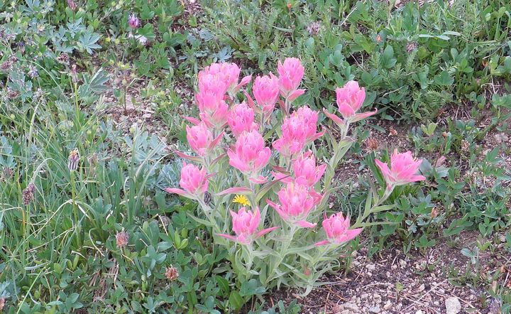
↑ Rosy Paintbrush in brilliant pink color.
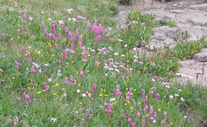
↑ Triangle-Leaved Ragwort (yellow, middle), Alpine Clover (purple), and Beautiful Cinquefoil (small round yellow)
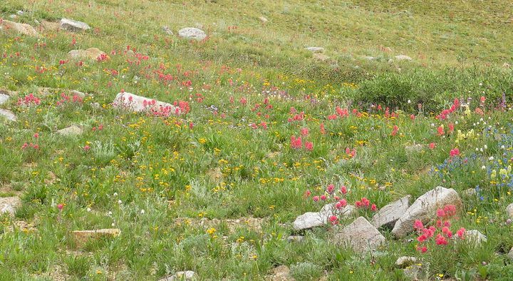
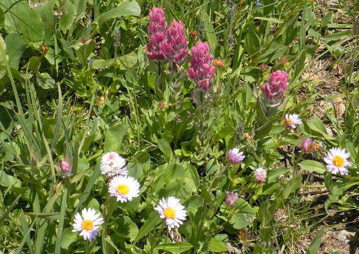
↑ Another flower garden in the alpine meadow. Ragwort (yellow) and Rosy Paintbrush (pink)
↑ Rosy Paintbrush (pink) and Western Yellow Paintbrush (cream). Alpine Clover (purple) at left lower corner.
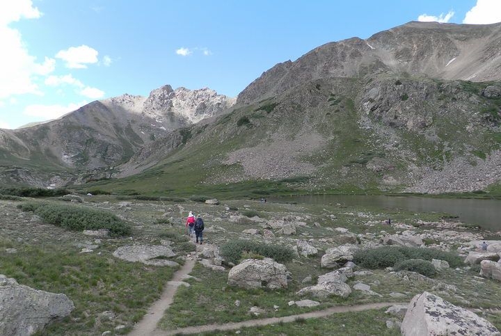
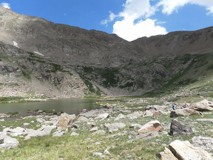
↑ Herman Lake. We are walking toward the south corner (left) where water drains out from the lake and forms an area of wetland. The wetland is where the flowers are.
Hagar Mountain (13,220') in the far left background, Mount Pettingell (13,553') at right upper corner.
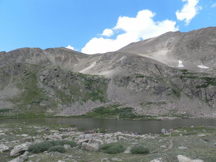
↑ Herman Lake (11,987') and Pettingell Peak (13,553') behind.
↑ North corner of the Herman Lake
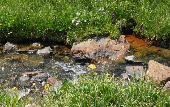
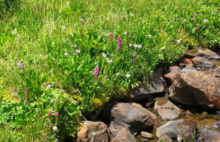
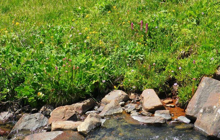
↑ A small creek, naturally draining the water of the Herman Lake, creating an alpine wetland.
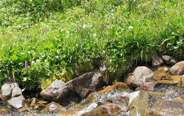
↑ A plenty of green plants and flowers along the water's edge.
↑ Snowball Saxifrage (white bulb), Rosy Paintbrush (pink)
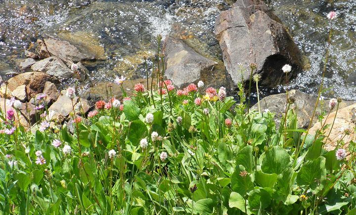
↑ Snowball Saxifrage (front, white) and Rosy Crown (or Queen's Crown, pink)
↑ A row of Rosy Paintbrush
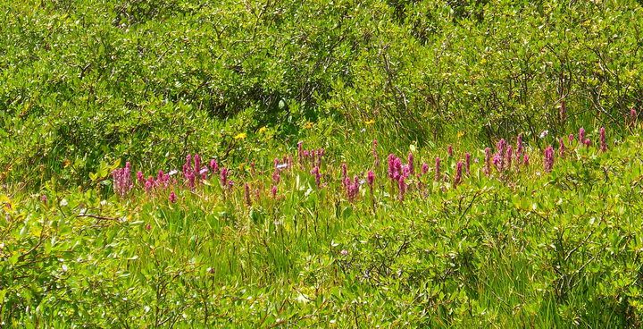
↑ Rosy Paintbrush (front) and Elephant Heads (tall ones just above the center rock)
↑ Elephant Heads (Elephantella)
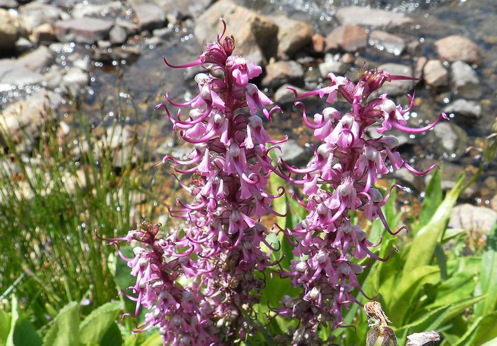
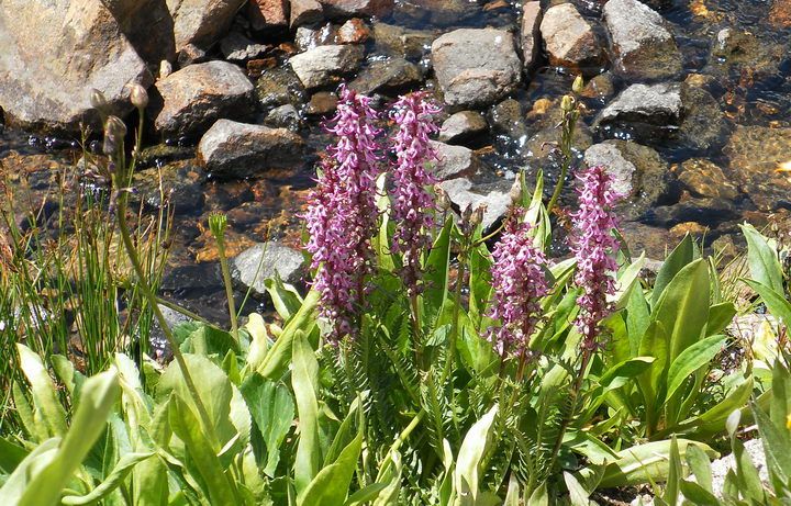
↑ Close up of Elephant Heads. You can see that each flower looks like an elephant's head and nose.
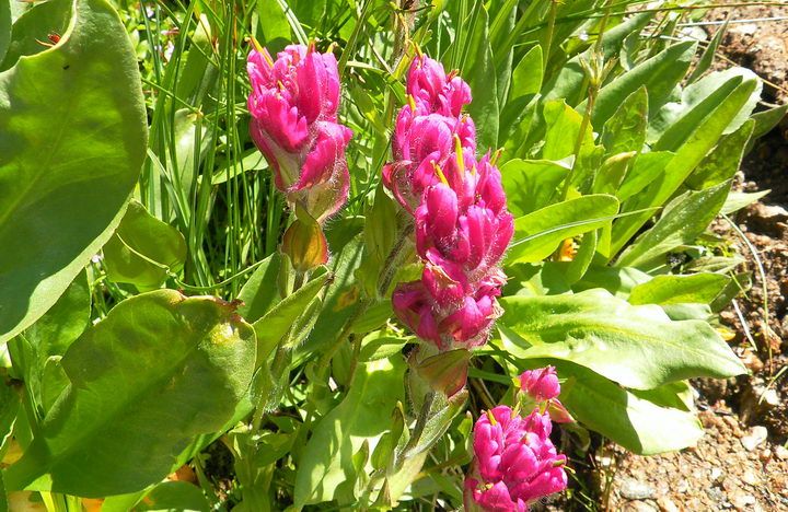
↑ Close up of Rosy Paintbrush. Actual flower is the yellow stick. Pink structures are supporting leaves (Sepal).
↑ Rosy Paintbrush (pink) and Blue Aspen Daisy (violet)
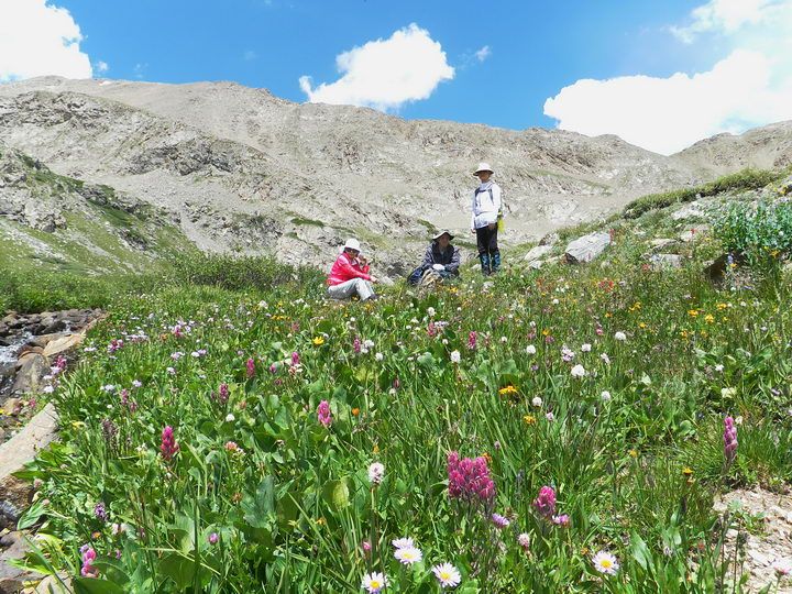
↑ A lunch time in an alpine flower garden
↑ Blue Aspen Daisy. At the higher altitude at the lake, they are smaller than the ones in the lower valley.
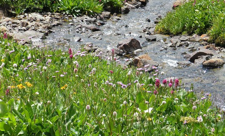
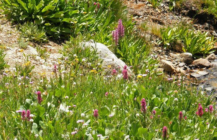
↑ Wetland flowers. Blue Aspen Daisies (violet) and Rosy Paintbrush (pink)
↑ Queen's Crown (pink at left), Elephant Heads (pink and tall at right)
↑ Mount Machebeuf at left. On the way home, we are walking down into the Herman Gulch at our right.
↑ A row of Rosy Paintbrush. Unidentified yellow flowers on the meadow horizon.
↑ Mount Machebeuf to the east as we were descending. Darker afternoon clouds in the sky.
↑ Flowers at the trailsides. Here they are mostly Rosy Paintbrushes (pink) and Fendler's Senecio (yellow).
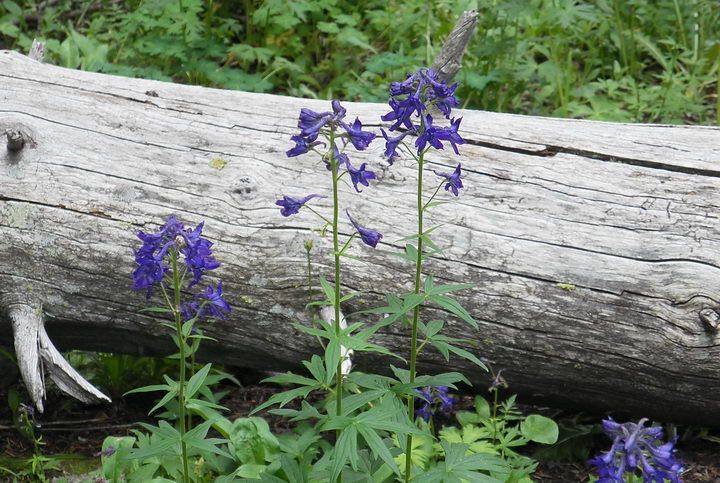
↑ Larkspur in a group against an old tree trunk
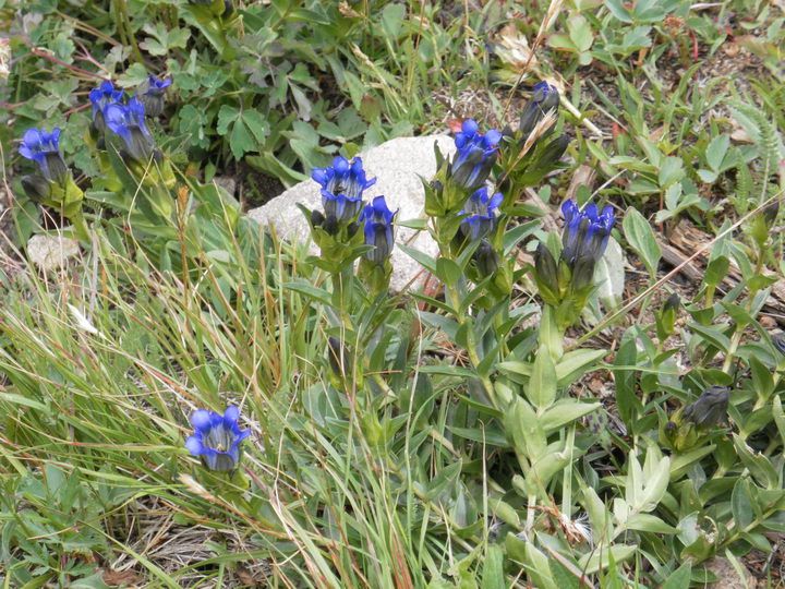
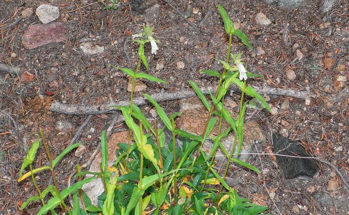
↑ Pleated Gentian
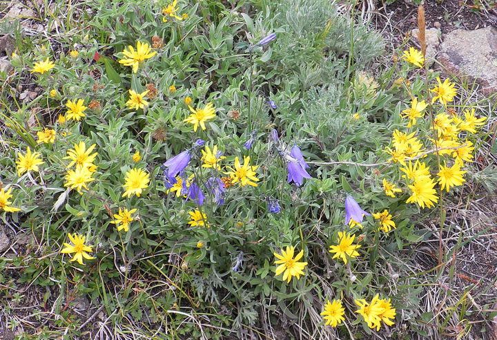
↑ Golden Aster (yellow) and Hare Bells (blue)
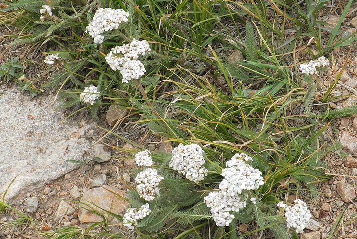
↑ Yarrow, decorating trail sides
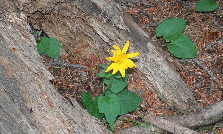
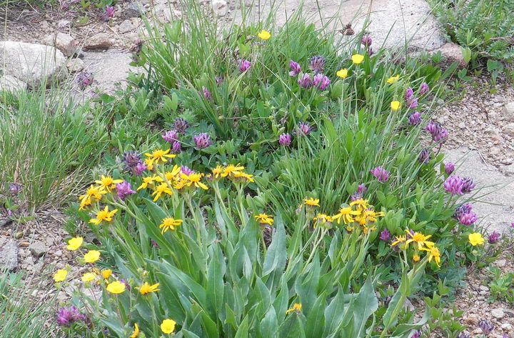
↑ Heart-Leaved Arnica with brilliant yellow petals, named from the shape of the leaves.
↑ Smooth Aster, growing under the shade of a dead tree.
↑ On the way down, dark clouds forms over the mountains, forecasting a typical afternoon thunder storm that happens almost every day in summer around 2:00 PM. Hikings and climbings need to be finished before then.
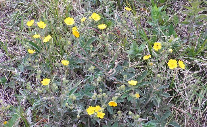
↑ Beautiful Cinquefoil, decorating both sides of the trail.
↑ Whipple's Penstemon. Some animal (probably deer) ate the tips of the flower stalks and flowers.
Usually, there are 6-8 cluster of flowers at the tip of the stalk. Here, there are only 1-2 left.
↑ Oxeye Daisy. They are not native but new invading species from Europe, taking over highway and trail sides.
Photo and Text by SNUMA WM - August 31, 2012 |


여기는 Treeline을 지나서 올라가며 거의 12,000 feet 고도 (3,650 meters)에 있는 빙하호수인데,
남쪽 끝으로 물이 넘쳐 흐르는곳에 고산 늪지대를 형성하고 여기에 물기를 좋아하는 야생화가 잔뜩 핍니다.
Colorado에는 이런곳이 많이 있지요.
물론 가는 길에도 때에 따라 야생화들이 봄부터 여름 내내 핍니다.
여기는 U.S. National Forest (연방정부 소유의 국유림) 로서, 꽃을 딴다거나 돌을 줏어가는것이 불법은 아니지만,
Hiking하는 사람중에서 꽃을 따는 사람은 한번도 본일이 없지요.
호수에서 Trout (송어, 松魚)낙시는 거의 아무데서나 할수있읍니다 (Colorado fishing license가 있다면)
대암산 용늪:
한국에도 이런 고산 늪지대가 한군데 있는데, 강원도 양구군과 인제군 사이에 있는 大岩山 (1,310 meters)의
정상에 있읍니다. 이것을 "대암산 용늪"이라하며, 큰용늪과 작은용늪 으로 있으며,
1997년 3월 28일에 국제보호습지로 지정 되었다 합니다.
물론 그전부터 한국정부에서 천연자원보호 구역으로 책정되어, 식물학자 외에는 일반인들의 등산이 완전금지되어 있었지요.
또 이곳이 DMZ에서 가까워서 민통선 북쪽이였고, 아직도 Punch Bowl Battle의 잔해로 지뢰가 남아있다합니다.
본인의 고향인 인제군 원통면 서화리부터 동남능선을 타고 2005년에 본인이 몰래 올라갔다 왔는데,
9월 말이여서 야생화는 못 봤읍니다.
정상에는 국군 통신부대가 있었는데 요새도 있는지 모릅니다.
아마 요새는 등산이 금지는 아니고 통제되어 있어서 등반이 가능할지 모릅니다.
지뢰는 주로 대암산의 북쪽 사면에 있기에 북쪽을 피하면 됩니다 (따라서 길을 잊으면 큰일날수있지요).
정식 등반은 양구쪽에서 서남능선을 타고 올라가는데, 사전 허가를 얻어서 가능할지 모릅니다.
만일 누군가가 여름철에 오른다면 특이한 야생화를 볼수있을지 모르지요.
대암산은 한번 더 가보고 싶은곳입니다. 본인이 그 그늘밑에서 자랐었지요.