Climb of Arapahoe Peak-South
Indian Peaks Wilderness
Eldorado, Colorado
September 19, 2015
The summit climb of the Arapahoe Peak was in my mind for the last couple of years. This was not an easy task because of the amount of vertical climb and the distance from the nearest trailhead. For a thirteener, it was much harder than some of the easy fourteeners (mountains over 14,000').
In the northwestern skyline of Denver, James Peak, Arapahoe Peak, and Longs Peak are always visible. As long as I am doing something in the Denver plains, they are always looking down at me. Having climbed James Peak already, hence, there has been an obssession in me about, "I got to climb the darn peak someday." The Arapahoe Peak is the monarch (highest) of the Indian Peaks Wilderness, just south of Rocky Mountain National Park.
In the morning of September 19th, together with my climbing partner, Johnny Rhee, we left home early. During the summer months, I prepared myself to get fit for the climb. I set the date just a few days past my 75th birthday, hoping to give myself a nice birthday gift, as I was getting "over-the-hill" in my 70s toward my 80s. South Summit Elevation: 13,397 (4,084m) feet
Fourth of July Trailhead Elevation: 10,145 feet
Elevation Gain: 3,250 feet
Round-trip Length: 9.2 miles
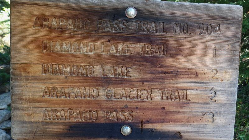
Starting from the Fourth of July trailhead (10,145'), follow the signs for the Arapaho Pass trail and Diamond Lake. The trail starts out with a gentle climb. The trail climbs about 500 vertical feet in easy westerly trails in the south-facing hillsides. In the first mile, it crosses over a few small and large streams that had much less water flow than in spring time. After easy westward climb of 1.1 miles at 10,750 feet, you reach the junction of the Diamond Lake trail. Here, take the Arapaho Pass trail to the right. The Arapahoe Pass or Arapahoe Glacier trails are the one that get you to the Arapahoe Peak. No where in the trail signs, Arapahoe Peak was mentioned. At 1.5 miles, around 11,100 feet, the trail reaches a top of a broad ridge (krummholz flat) that goes almost level for half a mile with beautiful sceneries. At 2.0 miles and 11,200 feet, you’ll reach the ruins of the Old Fourth of July Pit Mine and the junction of the Arapahoe Glacier trail, a much smaller trail than the Arapahoe Pass trail. Make a right hand turn onto Arapahoe Glacier trail and a long uphill climb toward the saddle starts from here. In the beginning, you’ll cross a substantial stream or marshy area, pass a large boulder. In these messes, you can lose your trail but it's no major problem. And then, you continue your ascent gradually gaining altitude. You’ll pass through 12,000 feet about 3 miles from the trailhead. South Arapahoe Peak’s summit comes into view to the northwest and you realize how awesome and scary the Arapahoe Peak is. The Old Baldy’s summit (13,038') comes into view to the northeast. After a long gradual climb through many switchbacks, you reach the Saddle (12,600') between Arapahoe and Old Baldy Peaks. At the saddle, there is a small shallow rocky shelter under a big boulder surrounded a stone fence. This is a good place to avoid winds, take some needed rest, and for lunch for the last push to the summit.
From the saddle, Arapahoe Glacier comes into view together with awesome and scary north wall of the Arapahoe Peaks. Due to surrounding high cliff walls, the glacier seems to be in the shade most of the time. It's a good thing that no one is legally allowed to go down there as it looks lke a bottomless dark pit from which you may nver get out.
Below the glacier, a long "forbidden" valley extends to the east that contains many lakes and streams that make up the Watershed of City of Boulder. The summit cone is one big steep pile of large rock boulders and is about 700' in vertical height from the saddle.
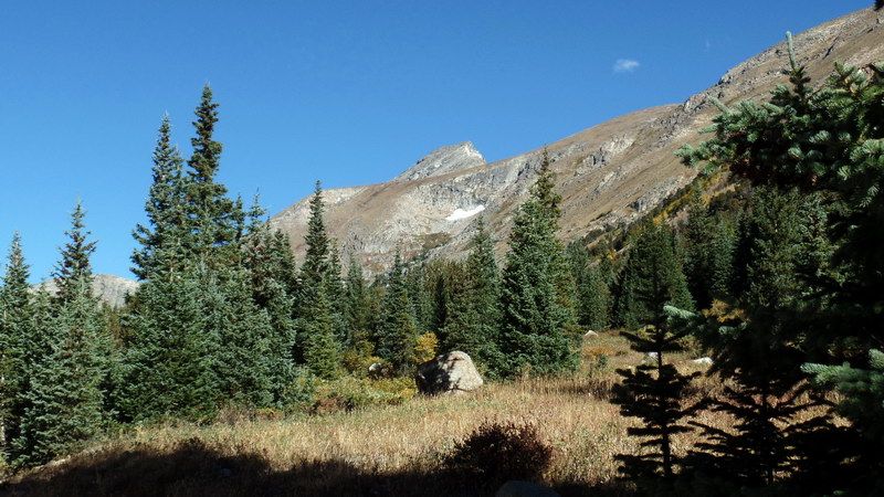
From the town of Nederland, we drove west to a small town of Eldorado and continue on dirt road to the "Fourth of July" trailhead. We are about there when we saw the sharp triangular summit of Arapahoe Peak (in the upper middle of the picture). Now, we are over 10,000 feet elevation and some of the fall colors were fading already.
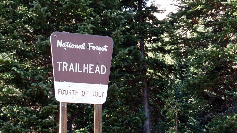
Arriving at the "Fourth of July" trailhead. This is a busy trailhead leading to many climbimg trails from here.

Fourth of July trailhead and Buckingham camground.

Northwest ridge with a few patches of aspens in fall color.
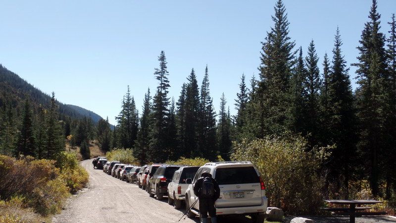
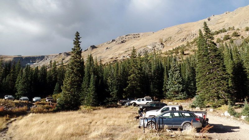
The parking lot is full by 9:50AM. We parked at roadside.
We started on Arapahoe Glacier trail from which we can approach Arapahoe Peak.
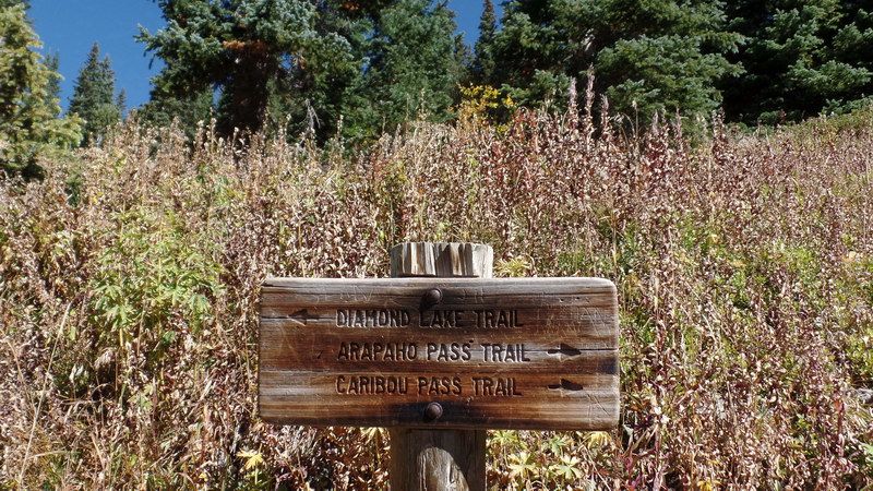
Having traveled a mile toward west, we came upon the junction of Diamond Lake trail and Arapahoe Pass trail.
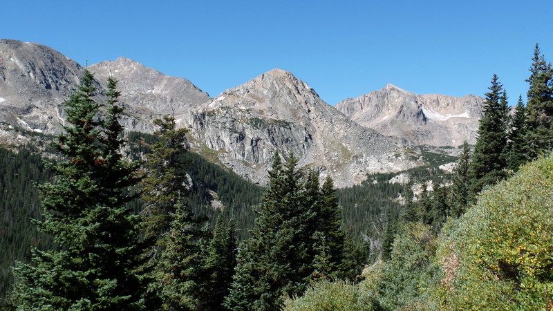
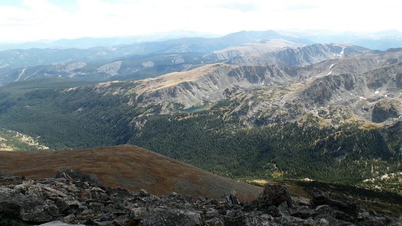
On the way up, across the valley to the south:
Mount Jasper (12,923' 3,939m, far left background), Mount Neva (12814' 3906m, far right background)
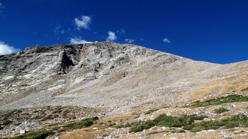
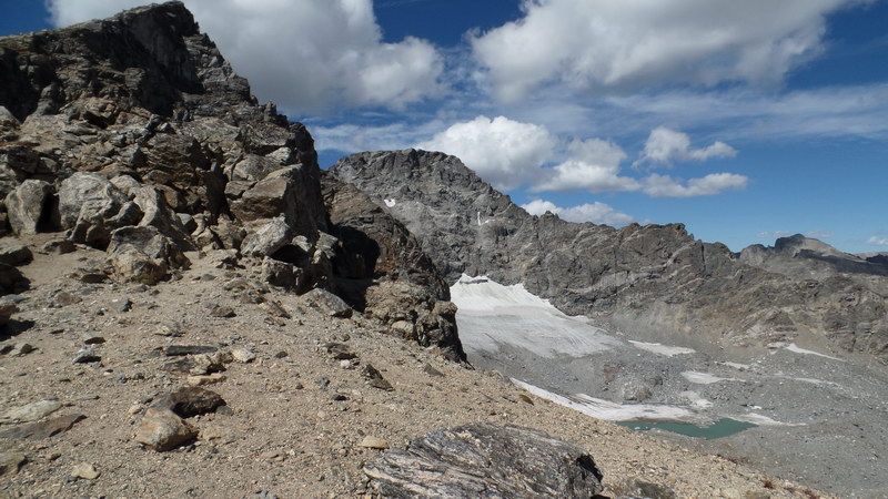
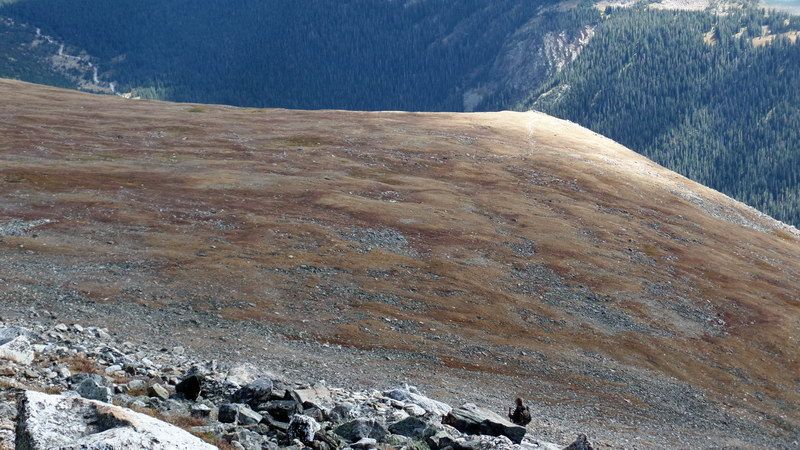
The south face of the south summit of Arapahoe Peak. From here, it looks deceivingly very gentle and easy to climb but the reality is not so. We found out as soon as we saw the side profile and the north face of the mountain later.
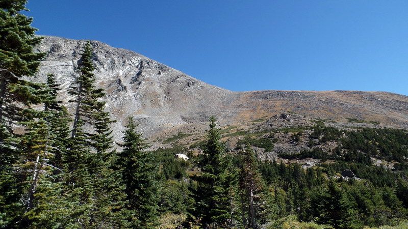
Arapahoe Peak is at the left half of the picture. The flat ridge at the right half of the picture is the southern face of Old Baldy mountain (13,038') with both summits not visible from here. In the center of the picture is the "saddle" between two mountains. We have to reach there before climbing Arapahoe Peak.
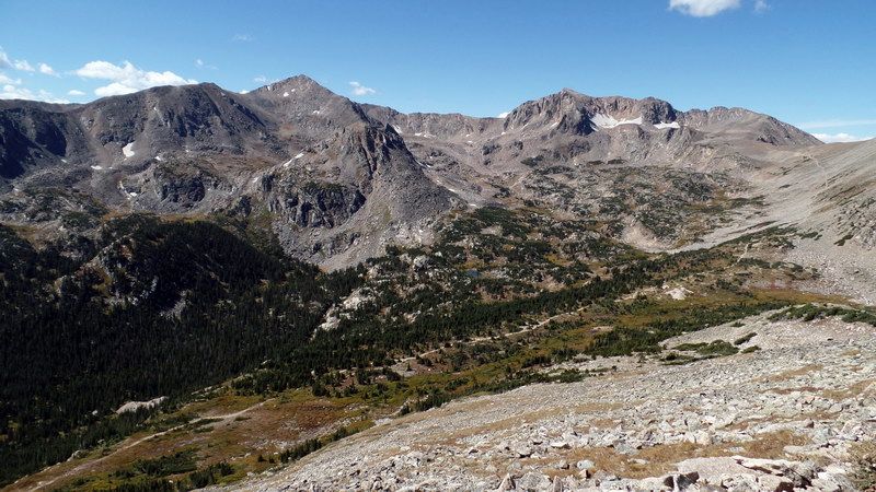
Mount Jasper: 12,923' 3,939m (top left 1/3, pyramidal peak at far background)
Mount Neva: 12814' 3906m (top right 1/3, broad summit ridge with sharp summit with two glaciers underneath)
Arapahoe Pass Trail: White line, running oblique from the left lower corner to right upper ridge top. This trail runs through a krummholz flat (forest of stunted trees at the tree line) mixed with wetlands.
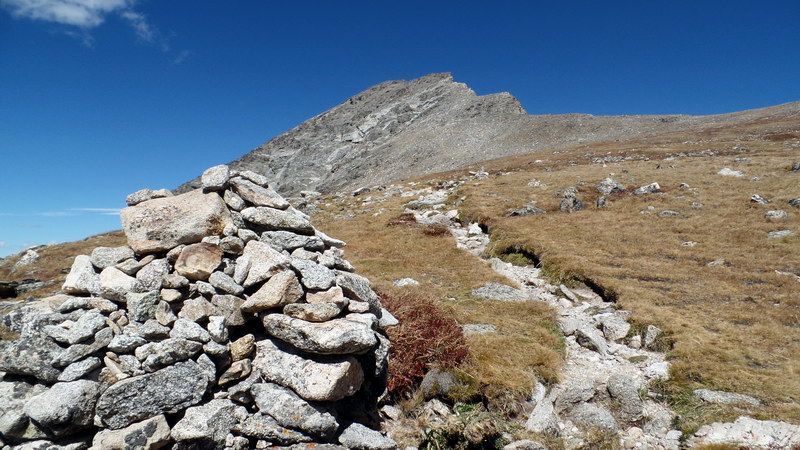
On the way to the saddle. A large cairne located at the junction of one of many switchbacks. Rough trail with large rocks. In the backgound is the jagged edge of the summit ridge of South Arapahoe Peak.
We got into heavy westerly wind at 30-40 MPH. I thought about giving up climbing if wind continued at this strength.
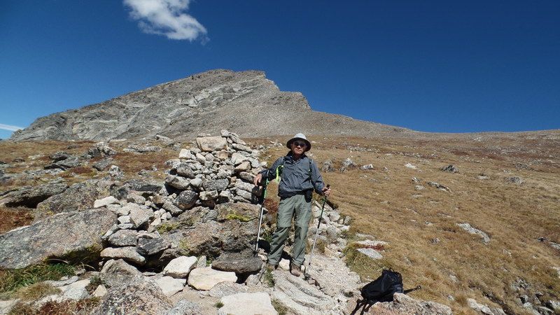
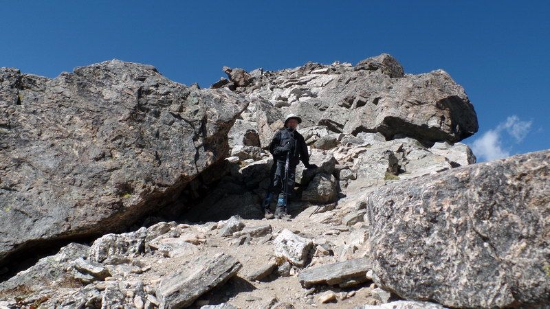
An old man passing by a cairne. From where, why, and how did he end up coming here?
What is he tryng to find in the wind-swept empty alpine tundra and a rocky peak?
Of all those questions, probably no one knows the answer and even he himself knows nothing.
Very far away, a small wispy cloud seems to be pointing the summit of Arapahoe Peak with her finger.
Only thing he may know is that's where he's trying to reach at the moment.
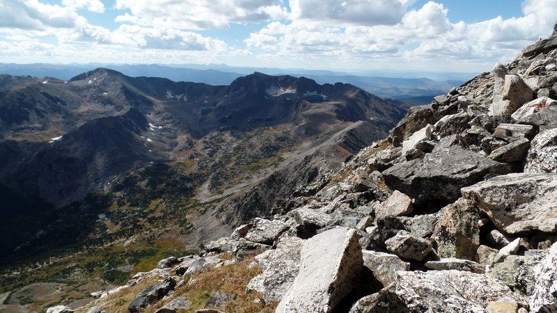
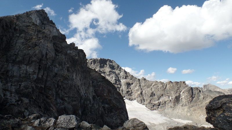
Arapahoe Glacier Overlook: After a long climb, against severe 30-40 MPH westerly wind, we reached at the saddle between "Old Baldy" and Arapahoe Peak. This is the eastern base of the summit cone of the Arapahoe Peak.
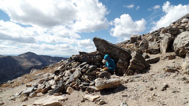
A small rock wind-shelter under a large boulder. A marathoner, Ashley of Boulder, climbed from Rainbow Campground, was having her lunch break. We just finished our lunch there.
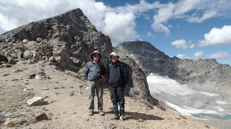
Me and Johnny Rhee, with Arapahoe glacier in the background, the largest glacier in the US Rockies.
The flat peak above the glacier is the North Arapahoe Peak (13,502'), the highest point in the Indian Peaks Wilderness.
We were about to climb the summit just behind us, about 0.5 mile and 700' vertical from here.
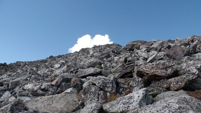
We got on the talus slope, the last push, heading for the summit where a white cottony cloud rises.
Looking down and back where we came from. You can see a thin line of our trail at the sun-lit triangular corner of the wide alpine tundra. A climber is going down at left lower area of the picture.
The summit cone is covered with big rocks in 45 degree slope.
On the way up toward the summit, looking down to the south.... Here, the ridge you see is the Continental Divide.
Water left of the ridge drains to Atlantic Ocean while right of the ridge drains to Pacific Ocean.
Mount Neva with her glaciers (just right of the summit) and Lake Dorothy in the deep cirque under Neva, fed by the Neva's glaciers.
The terminus of the Arapahoe Pass just in front of the Lake Dorothy. A thin thread of the trail leading toward the lake.
At the right edge of the rocks is the north face of Arapahoe that drops down more than a thousand feet straight down.
Totally empty right side made me feel dizzy and gave me acrophobia. The summit is above but not visible here.
Somewhere midway in this talus slope, en route to the summit, we cleared through 13,000' altitude.
Looking back again where we came from. "Old Baldy" mountain below in the center.
A thin thread of our trail to the saddle, barely visible at the right lower center edge of this picture.
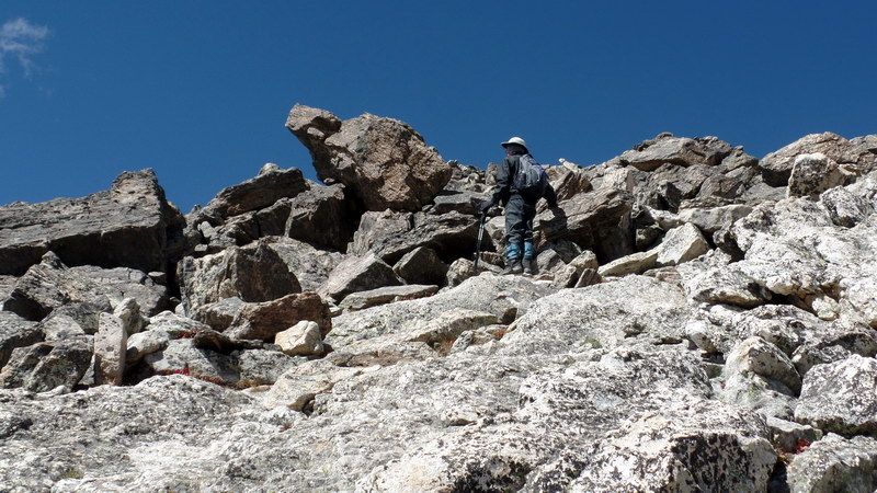
Going got tougher at above 13,000 feet altitude on a more than 45 degree heavy talus slope.
On the way up, the summit was never visible. Then suddenly, Johnny in front of me couldn't go any further up.
On a summit like this, one realizes that he's on the summit only until after he steps on it.
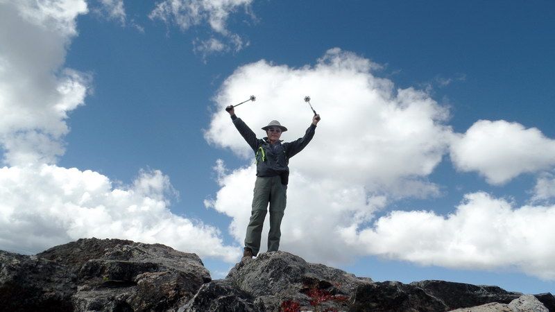
There, finally, we reached the summit of Arapahoe Peak (13,397' 4,083m).
My arms and hands were up for the successful summit climb and also for the Celebration of my 75th Birthday
and My Appreciation for the Curses and Blessings of being punished and glorified to be there, another one of the most precious gifts in my life time !! I knew that it was me who gave myself a curse to have undertaken the job of climbing, but I do not know who gave me the blessings to reach the summit, but, somehow, it all happened.
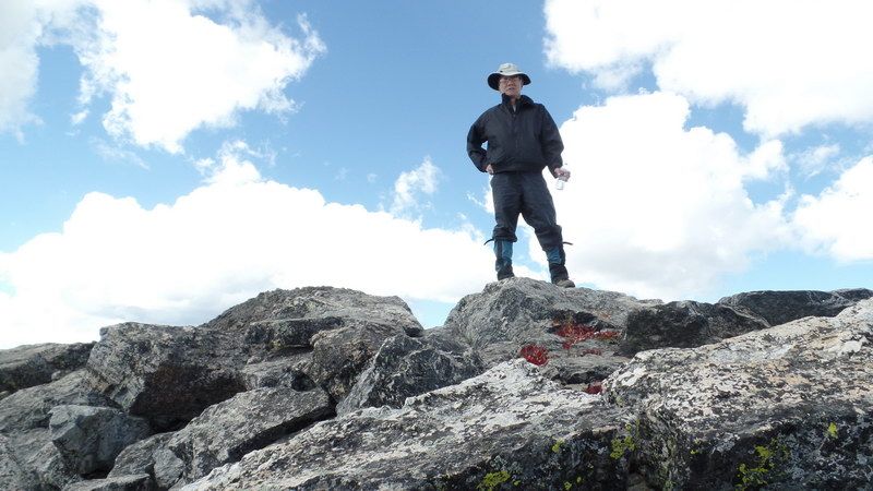
Johnny Rhee at the summit. Without him, I would not have ventured the climb.
Incidentally, the reddish plants under his feet are "Spring Beauty", an alpine flowering plant, that had transformed from dark green color of summer into red pigmented plants for the winter. The red color comes from "Anthocyanin" which works as a sunscreen, photosynthesizer at lower temperature, and possibly as an antifreezer for the plant to survive the coming harsh winter at any moment.
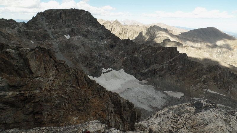
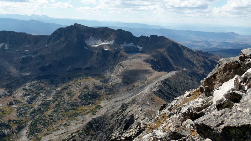
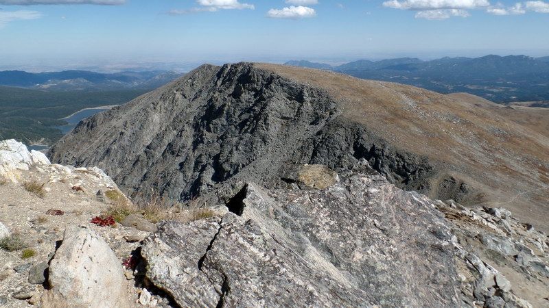
View toward north from the summit: The flat-topped peak is the north summit of Arapahoe Peak (13,502' 4,115m). This is the highest mountain in the Continental Divide in north of Denver.
There is a half mile severly exposed ridge between the south and north summits that could have been traversed.
The round trip to the flat-topped north summit on this knife-like gendarmed ridge (grade 3-4), with a lot of exposures on both sides of the ridge, would take 2-3 hours. We had neither energies, time, knowlege, nor equipments to attempt the trip to the north peak.
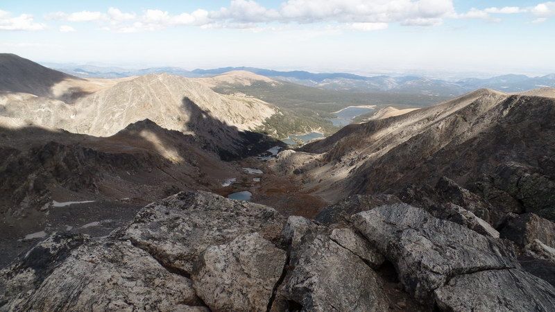
View from the summit toward east: This valley under the Aapahoe Glacier is the watershed of City of Boulder.
A few lakes and reservoirs in the valley floor. The entire valley is owned by the city and is forbidden for hikers to enter.
Here, the ridge on the right is where we came up from the Fourth of July trailhead.
The ridge on the left of the valley is the border line to the Brainard Recreation Area where Lake Isabelle is.
Way below south, the Diamond Lake is visible as a small patch of blue water.
On the way down looking up, the awesome ghostly north face of Arapahoe Peak under afernoon shade.
After a 7-hour, 3,250' vertical, and almost 10 miles of round trip, we left the trailhead for our homes, safe and sound, under the evening sun, leaving behind dark clouds in the northern sky.
Photo and text by SNUMA WM, Some data from the Internet, September 20, 2015 |


Glad to have you back intact.