


- Total
- General
- Arts
- Book
- Culture
- Economy
- Essay
- Fun/Joke
- History
- Hobbies
- Info
- Life
- Medical
- Movie
- Music
- Nature
- News
- Notice
- Opinion
- Philosophy
- Photo
- Poem
- Politics
- Science
- Sports
- Travel
Travel Climb of Mt. Whitney, 2016 #3
2017.04.25 08:00
|
Climb of Mount Whitney No.3, Sierra Nevada Range
Lone Pine, California
August 14-16, 2016
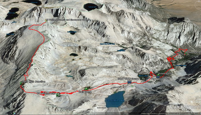
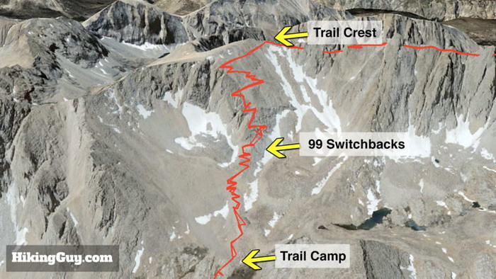
August 16, 2017 - The Summit Day We left Trail Camp (12,000' 6.0 miles) at 2:00AM, climbed the dreadful 99 Switchbacks in total darness, and we reached Trail Crest (13,700' 8.2 miles) at 5:40AM. After a short downhill trip to Muir Trail Junction (13,480' 8.7 miles), we started on the last 2.3 miles push toward the summit (14,508 11.0 miles). We reached the summit at 7:51 AM and spent a short time at the summit and came down to the Trail Camp at 12:00PM. After a short rest, we packed our tents and at about 1:30 PM, descended the mountain through the same trail to Whitney Portal at 6:00PM. After a dinner at Lone Pine, we left for home, arriving at about 1:00AM next morning.
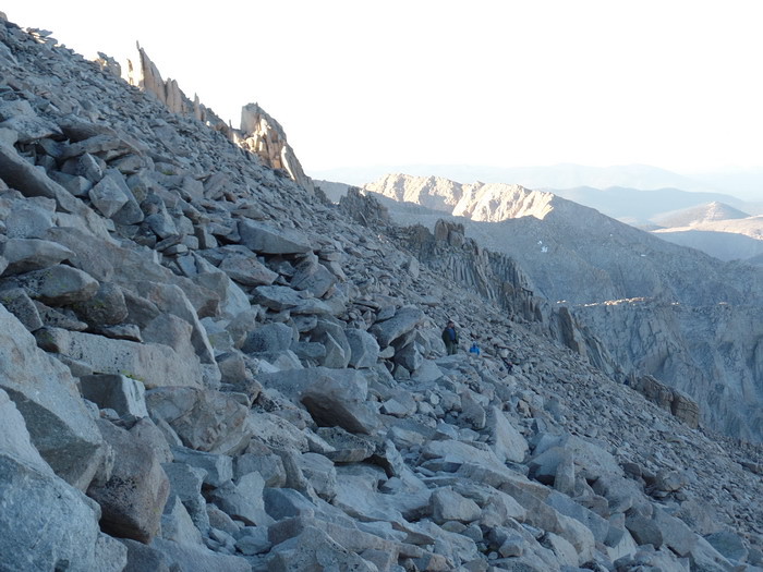
We left the Trail Camp at 2:00AM. There was bright moonlight till about 1:30AM and then it disappeared to the west beyond the mountain ridge. Through the total darkness, we started to climb with our headlamps. Already there were two climbing groups ahead of us with series of light dots from the headlamps on the slope. We were also one of those few light dots moving slowly up the slope. A few groups of light dots were following us. Nothing else was visible in the total darkness except four or five groups of light dots slowly moving up on the slope.
We took slow paces going up the "99 Switchbacks" under the constant chilly easterly winds. Fotunately, the wind was not strong but enough to make us cold whenever we took a rest on the way. One of us got really cold and I gave him my thermal jacket. After that, I was getting colder as well. The Trail Crest came soon at 5:40AM when there was very faint brightness in the eastern sky. Once we passed the Trail Crest and got over the ridge top, the wind was no more but near 14,000 feet high, it was even colder.
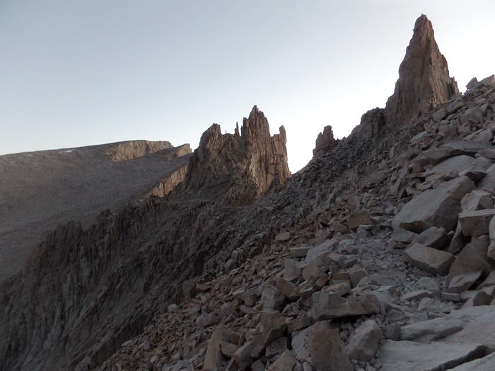
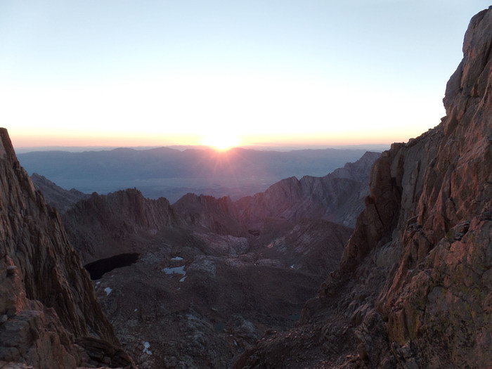
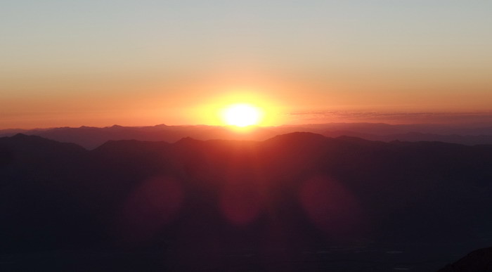
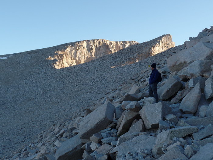
After a brief stop at the Muir and Whitney Trail junction, we started to climb the last 2.3 miles of gentle rocky trails toward the summit. On the way to the summit, at 6:16AM, the sun came up the Inyo Mountain Range across the Owens Valley. There, we had the glory of looking at the sunrise from the Whitney summit ridge. 6:06 AM, 8-16-2016: This was the early morning of 8-16-2017 after we passed the Trail Crest into the backside of the summit ridge. The world had become quieter and less cold in this wind-protected backside of the ridge. The sun was about to rise. The light here came from brightening sky. It is actually very dark now. The camera was seeing the scenes much brighter than my eyes. Here, the lightness of the scene comes from the camera exposure and photo-editing software. Actually, it was much darker than the picture. We still had to depend on headlamps to take our steps on the narrow rocky trails. With faint brightness from the eastern sky, we were able to see the outlines of nearby rocky pinnacles as if a few giant ghosts were standing there and looking down at us.
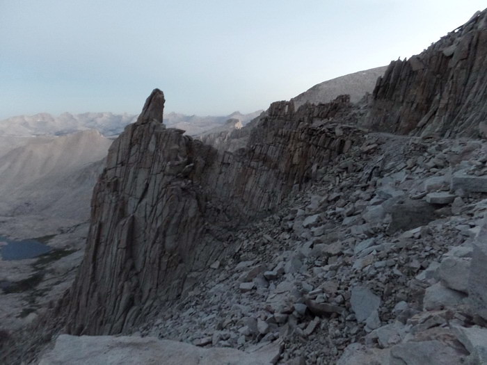
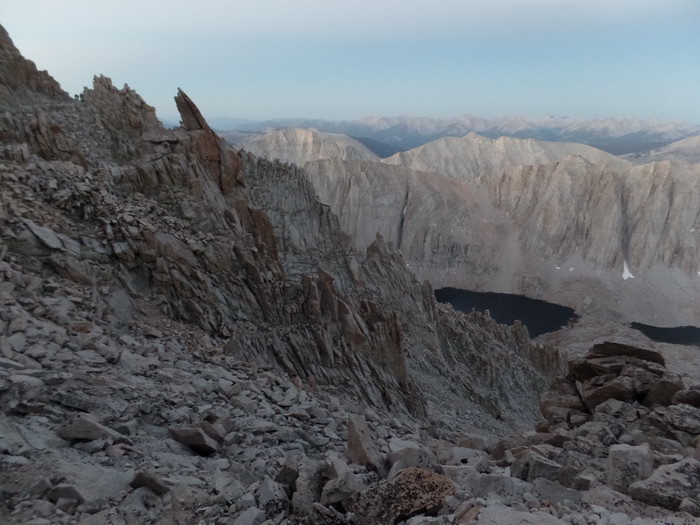
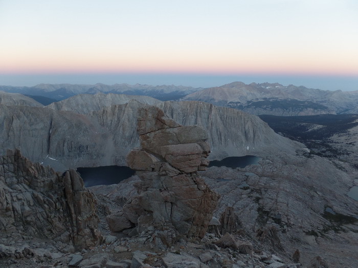
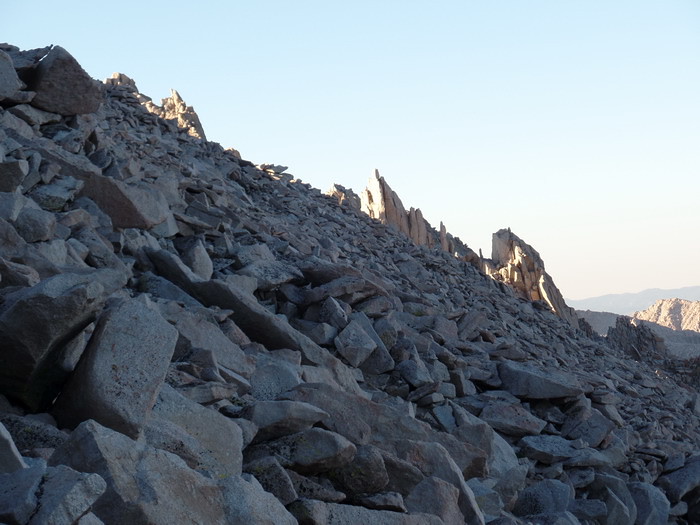
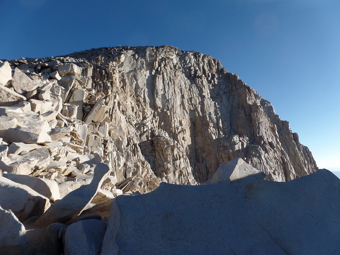
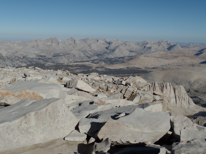
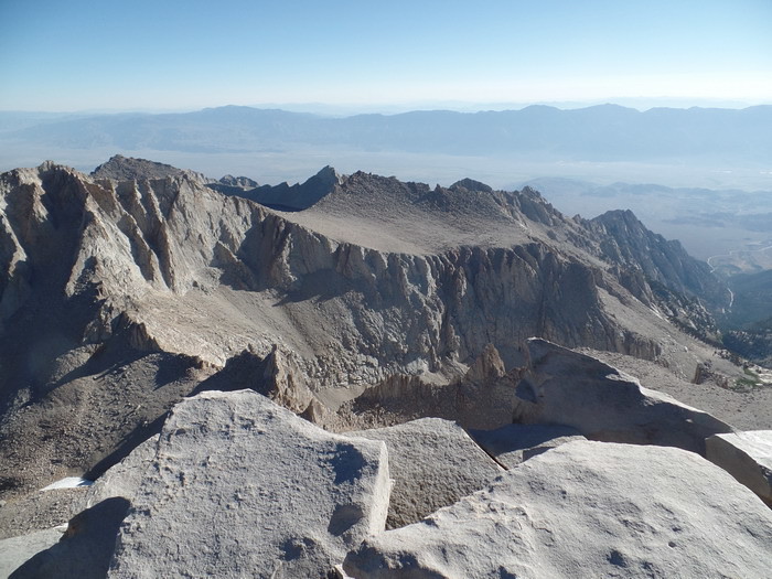
6:07 AM: Even the far slopes faintly showed up. We were still using headlamps to see our steps. A view toward north and the summit. The high pinnacle in the front is Mt. Muir (14,012', 4271m). Then there are three "Needles" before the summit at the end of this picture. The last gently sloped flat-top peak is the Whitney summit, our final destination more than 2 miles away. As you see, the west side of the awesome "Needles" are nothing much here. They are an easy traverse walk on the Trail, but the view from down below from the east is a different story. They are near vertical pillars of sharp needle-like fracturing granite rocks and appears to pierce the sky, as you saw in the previous pictures of the east wall.
6:16 AM: The morning sun started to break through over the Inyo Range beyond the Owens Valley. We were still going up under the headlight illumination.
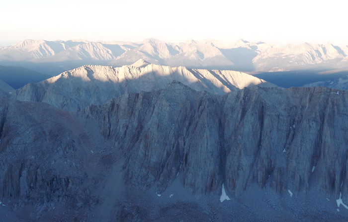
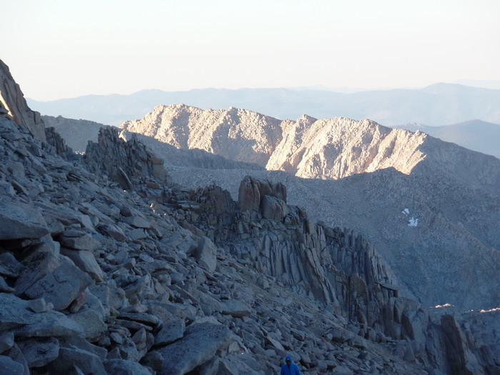
Looking behind me where we climbed so far. The southern ridge were also lighted up. The westernside of the Whitney Ridge is one giant endless loose-talus slope.
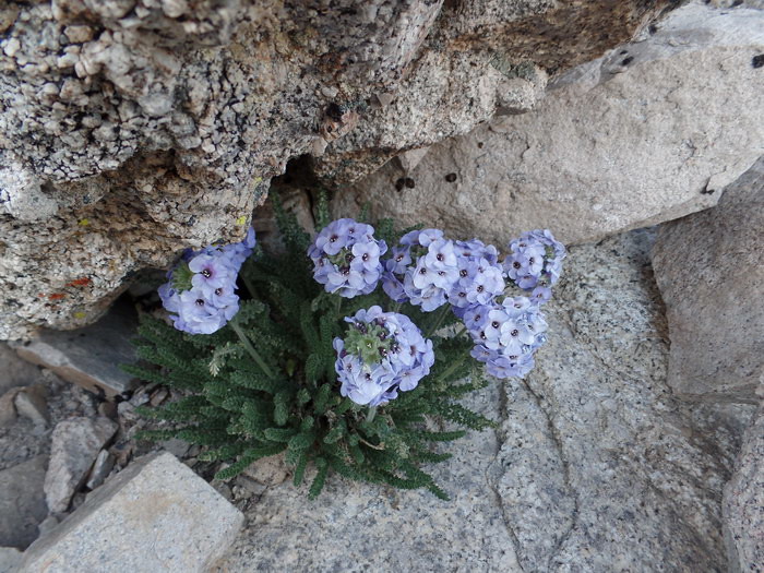
In the dark corner between rocks, I found this beautiful flowers, by the name of Sky Pilot. I have never seen them before. They don't look like a high altitude plant at all. They are just like flowers in our garden. I searched Internet and finally found about it. Here's the quote: The brightly colored sky pilot (Polemonium eximium), considered to be among the most beautiful of the Sierra Nevada wildflowers, grows in very harsh conditions to elevations of 13,000 feet (4,000 m), which is near the upper limit of plant growth in California.
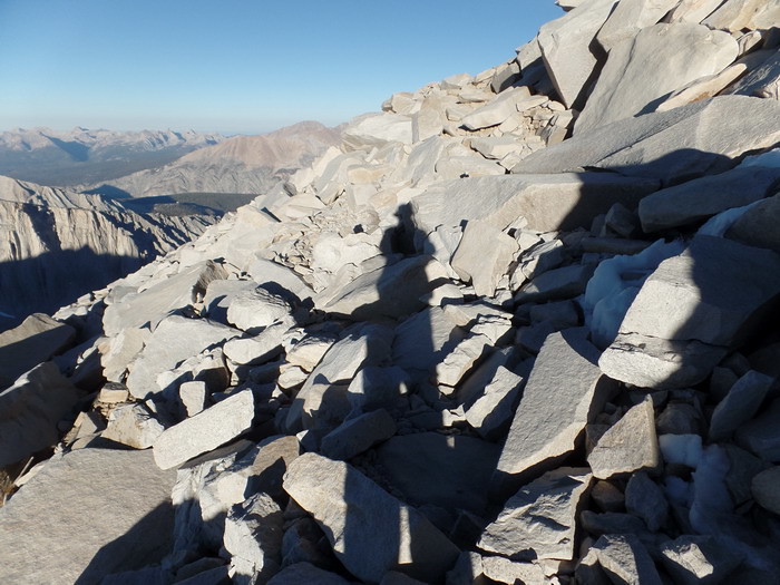
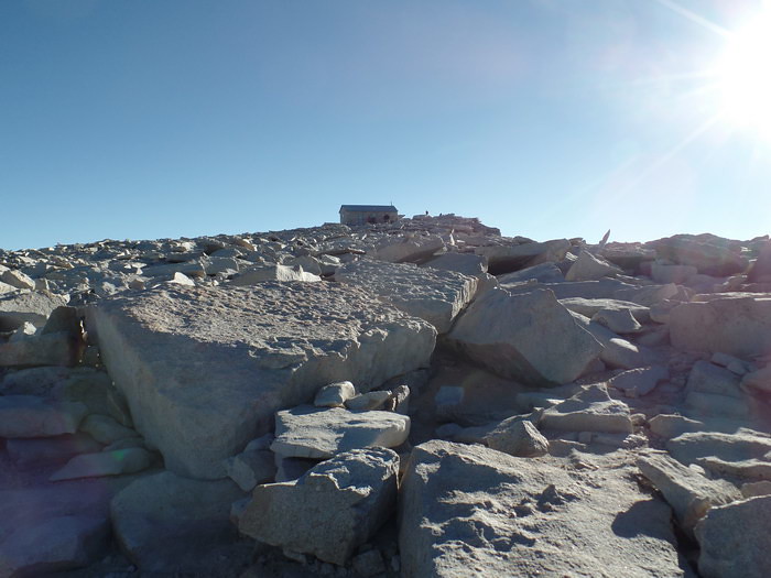
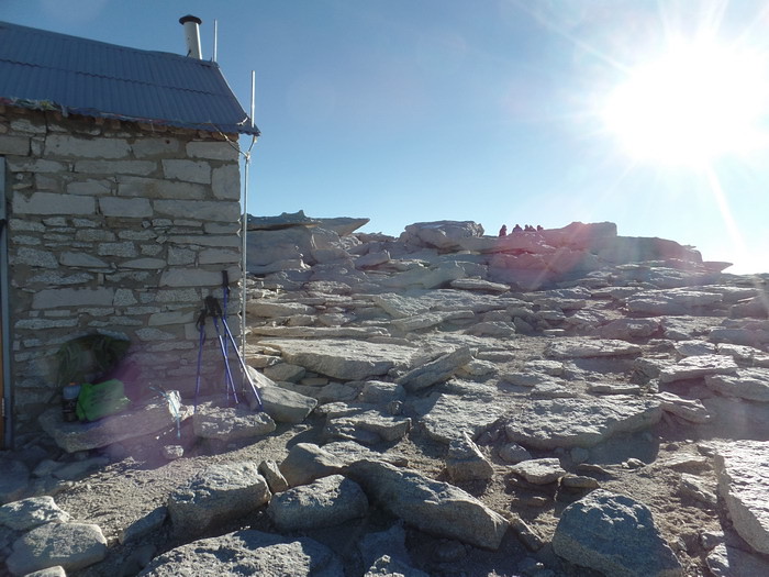
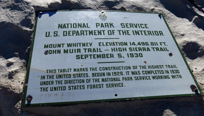
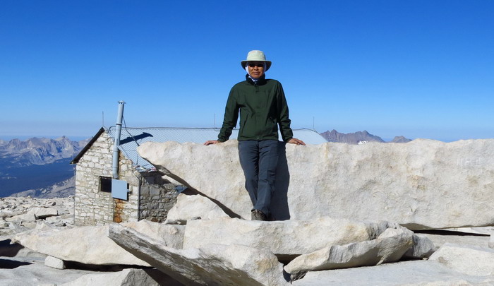
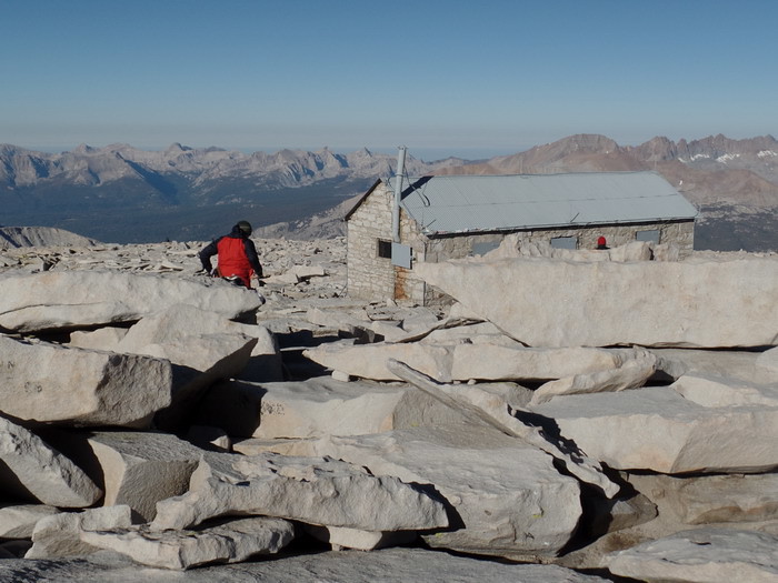
Still far but we were almost there. In the rarified air of 14, 500 feet, we walked slow and steady. The two thin short poles at the roof may be lightning rods (?). I am not sure but hope they are.
8:55 AM by Ben: Yes, you said it loud and well... "The highest (man-made) Trail in the U.S."
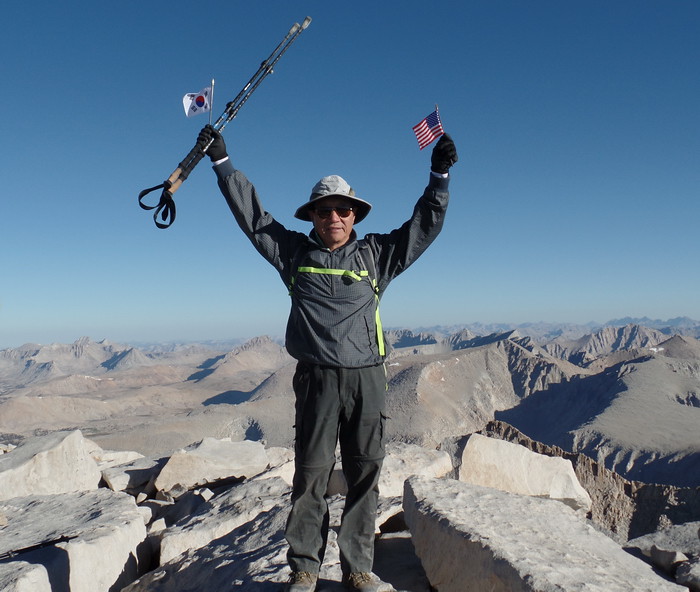
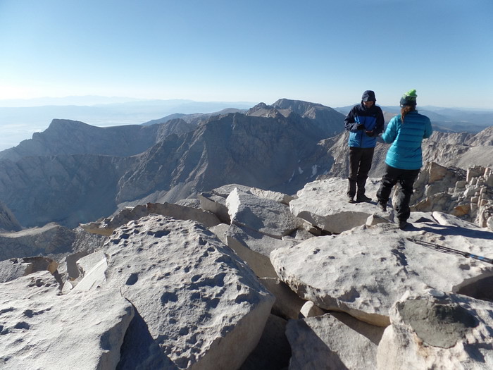
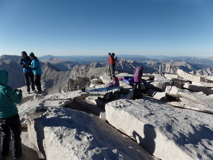
8:04 AM: At the summit. The twosome of Ben and Jungchul were behind us and summited a little later.
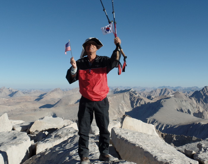
At 9:13 AM, 8-16-2016 by Ben: Ben Byungkoo Choi from Las Vegas at the summit.
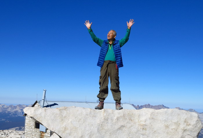
The ectasy of Jung-Churl Kim from Las Vegas at the summit. The historical moment for him was 9:12 AM, 8-16-2016 picture by Ben.
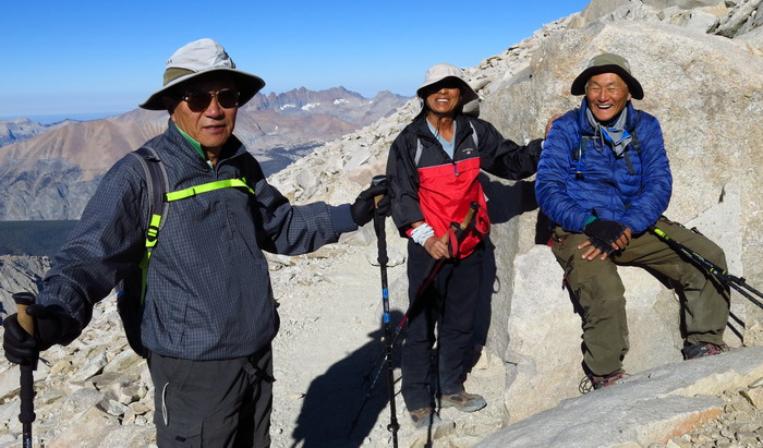
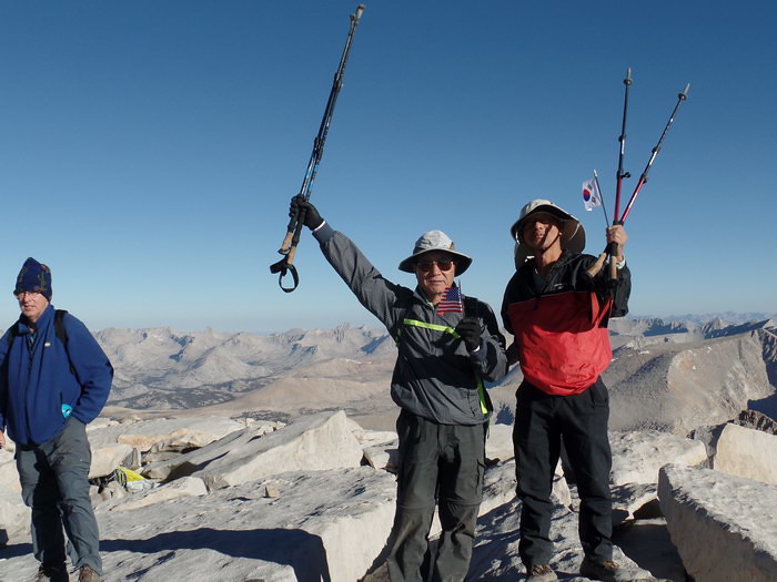
8:19 AM by Ben: Near the summit, on the way down, we met Ben and Jung-Churl coming up. I don't remember what was so funny there. But we were cheerful knowing that all four of us reached the summit.
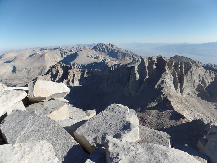
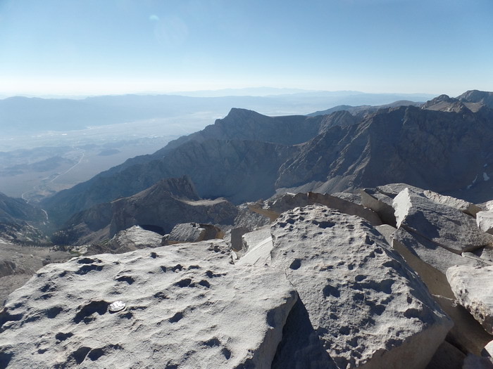
as the state of California is being pushed up.
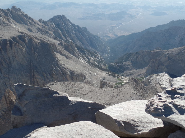
To the east, Mount Russell at left. In the middle, Mount Carillon just above the flat dish-like slope. Mount Thor to the right.
Background music: Omar Akram - Dancing with the Wind |


Comment 0
| No. | Subject | Date | Author | Last Update | Views |
|---|---|---|---|---|---|
| Notice | How to write your comments onto a webpage [2] | 2016.07.06 | 운영자 | 2016.11.20 | 18089 |
| Notice | How to Upload Pictures in webpages | 2016.07.06 | 운영자 | 2018.10.19 | 32218 |
| Notice | How to use Rich Text Editor [3] | 2016.06.28 | 운영자 | 2018.10.19 | 5806 |
| Notice | How to Write a Webpage | 2016.06.28 | 운영자 | 2020.12.23 | 43733 |
| 492 | 어느날 서울 관광; 탑골공원, 익선동, 낙원상가, 교동초등학교, 운현궁 [1] | 2023.11.03 | 온기철*71 | 2023.11.03 | 86 |
| 491 | 파타고니아 기행 [10] | 2023.03.03 | 노영일*68 | 2023.04.25 | 271 |
| 490 | 시카고 동창회 소식 [2] | 2022.12.17 | 노영일*68 | 2023.03.16 | 386 |
| 489 | Greenland 기행 [3] | 2022.08.06 | 노영일*68 | 2022.09.07 | 112 |
| 488 | Iceland 기행 (2/2) [1] | 2022.08.06 | 노영일*68 | 2022.09.11 | 124 |
| 487 | Iceland 기행 (1/2) [1] | 2022.08.06 | 노영일*68 | 2022.09.07 | 119 |
| 486 | Seoul; the smartest city in the world [2] | 2022.08.01 | 온기철*71 | 2022.08.04 | 95 |
| 485 | The Best Passport to Carry with You [3] | 2021.10.05 | 운영자 | 2021.10.06 | 12589 |
| 484 | Too many Chinese? | 2020.08.03 | 이병붕*63 | 2020.08.05 | 72 |
| 483 | Small tips for the trip to India to the alumni | 2020.01.06 | 이병붕*63 | 2021.11.01 | 1014 |
| 482 | 강화도 [1] | 2019.11.02 | 온기철*71 | 2019.11.03 | 79 |
| 481 | 하늘공원과 남이섬 [5] | 2019.10.30 | 온기철*71 | 2019.11.04 | 119 |
| 480 | 서울고: 서울역사박물관과 경희궁, 독립공원과 서대문형무소 [3] | 2019.10.29 | 온기철*71 | 2019.11.03 | 75 |
| 479 | 신안군, 거문도, 백도 [5] | 2019.10.20 | 온기철*71 | 2019.10.22 | 203 |
| 478 | 발칸여행 동영상들 | 2019.05.19 | 온기철*71 | 2019.05.19 | 78 |
| 477 | Croatia; Dubrovnik [5] | 2019.05.17 | 온기철*71 | 2019.05.19 | 129 |
| 476 | 남미 기행 (5) 아르헨티나 | 2019.04.06 | 노영일*68 | 2019.04.06 | 188 |
| 475 | 남미 기행 (4) 브라질 [2] | 2019.04.03 | 노영일*68 | 2019.04.07 | 113 |
| 474 | 남미 기행 (3) 페루 | 2019.04.01 | 노영일*68 | 2019.04.01 | 116 |
| 473 | 남미 기행 (2) 페루 [2] | 2019.03.30 | 노영일*68 | 2019.04.07 | 123 |