Summit Climbs of Mount Evans
Idaho Springs, Colorado
August 7, 2015
Mount Evans is the highest summit of the Chicago Peaks in the Front Range of the Rocky Mountains of North America. The prominent 14,271-foot (4,350 m) fourteener is located in the Mount Evans Wilderness, southwest by south of the City of Idaho Springs in Clear Creek County, Colorado.
The peak is one of the characteristic Front Range peaks, dominating the western skyline of the Great Plains along with Pikes Peak, Longs Peak, and nearby Mount Bierstadt. Mount Evans can be seen from over 100 miles away to the east, and many miles in other directions. Mount Evans dominates the Denver Metropolitan Area skyline, rising over 9,000 feet above the area. Mount Evans is the highest peak in a massif known historically as the Chicago Peaks. The peak is 35 miles (56 km) west of Denver, "as the crow flies", and approximately 51 miles (82 km) by road, via Idaho Springs. The other peaks in the massif are:
Mount Spalding (13,842 feet), 1.1 mile northwest
Gray Wolf Mountain (13,602 feet), 2.2 miles north-northwest
The Sawtooth (13,780 feet), 1.2 miles west
Mount Bierstadt (14,060 feet), 1.5 miles west-southwest
Mount Warren (13,307 feet), 1.2 miles north-northeast
Rogers Peak (13,391 feet), 2.33 miles northeast. At least 7 deep glacial cirques cut into the Chicago Range. The cirques around Mount Evans are the deepest cirques in the Colorado Rockies. The bottoms of many of these contain tarns, the most notable being:
Summit Lake at the head of Bear Creek, 0.5 miles north
the Chicago Lakes at the head of Chicago Creek, 2 miles north
Abyss Lake at the head of Lake Fork, 1 mile west-southwest The Mount Evans Scenic Byway consists of State Highway 103 from Idaho Springs, Colorado on I-70 about 13 miles (21 km) to Echo Lake, and Colorado 5 from Echo Lake 15 miles (24 km), ending at a parking area and turnaround just below the summit. The latter has long been the highest paved road in North America and is only open in the summer. Most of the Mount Evans massif is now part of the Mount Evans Wilderness area in Arapaho National Forest and Pike National Forest. The exception is a narrow corridor along the highway from Echo Lake that is excluded from the wilderness. Summit Lake Park and Echo Lake Park, are part of the historic Denver Mountain Parks system.

Spalding정상에서 Saddle로 향해서 내려가기 시작. 왼쪽 낭떠러지 오른쪽 안으로 희미한 가느다란 Trail 선들이 보인다. 이 trail을 따라서 사진 왼쪽의 능선 (north summit ridge of Mount Evans)으로 올라간다.
오른쪽 능선 건너에 보이는 Mount Bierstadt (another fourteener, 14,060 feet, 4,285 m). 왼쪽은 Evans의 동면 낭떠러지.
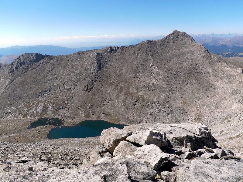
왼쪽 정상이 Mount Bierstadt (14,060 feet, 4,285 m), 그 밑에는 Abyss Lake (12,650 feet, 3,856 m).
여기서 보이는 부분은 Bierstadt의 동면, Mount Bierstadt 등반은 반대쪽 서면으로부터 올라온다.
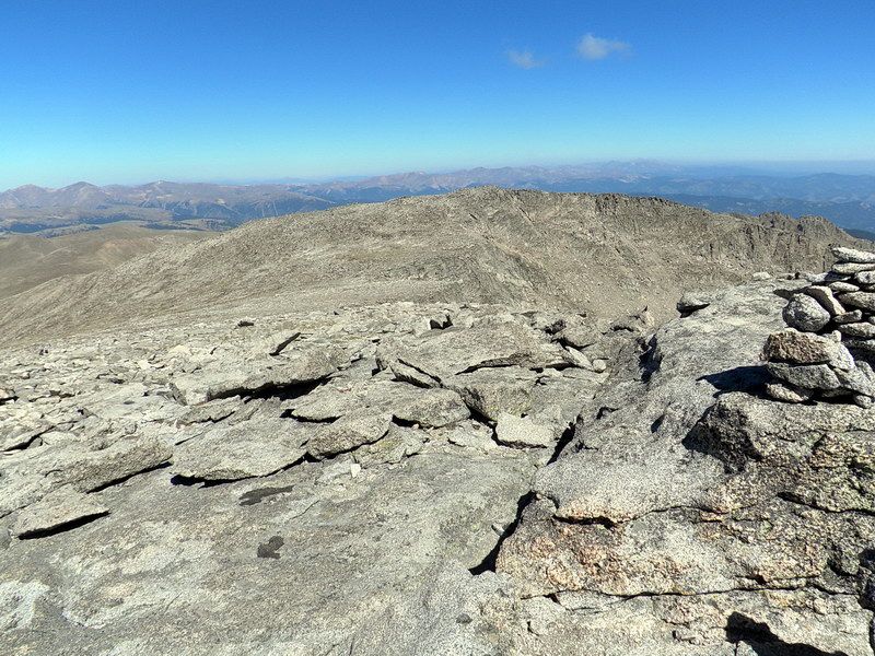
Mount Evans의 북쪽 능선을 올라가며, 뒤 돌아 본 (To the north), 방금 떠난 Mount Spalding (왼쪽 중간의 편편한 정상).
We climbed along the ridge in the right side (east ridge of Mount Spalding) of the summit.
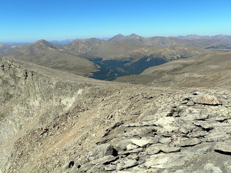
Evans의 북쪽 능선에서 서쪽으로 내려다 본 Guanella Pass의 Georgetown으로 내려 가는 길 (나무가 있는 골짜기).
더 멀리 뒷 배경 skyline에 Grays and Torreys Peaks가 뾰족한 두개의 pyramids (side by side)로 보인다.
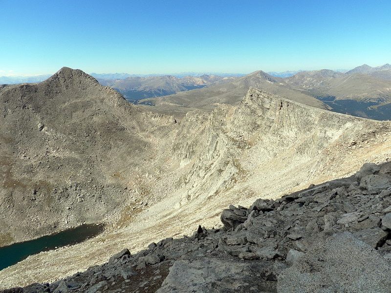
Mount Bierstadt (left) and Saw Tooth Peak (right), 그 사이, 중간의 톱날같이 보이는 산 능선이 Saw Tooth Ridge로서,
Mount Bierstadt (왼쪽의 정상)에서 Mount Evans로 올때 건너야하는 길이다.
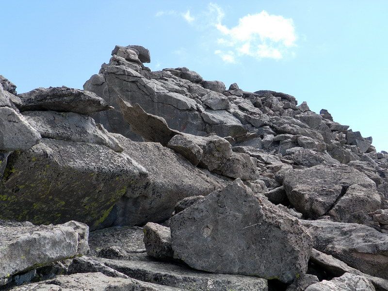
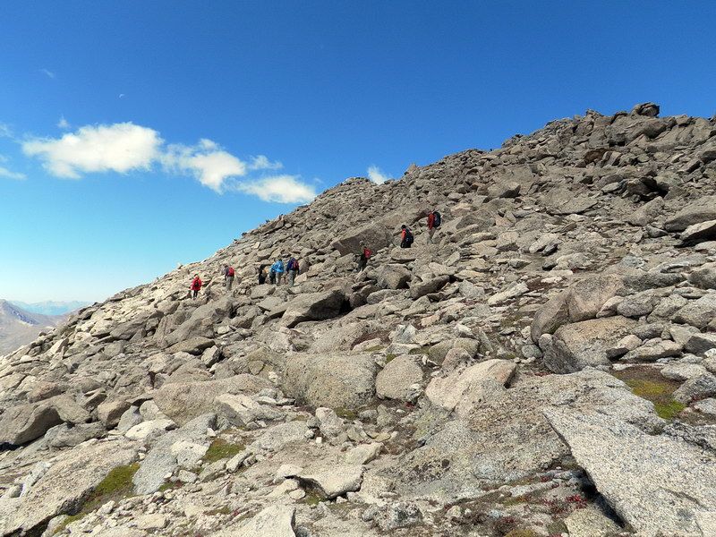
정상으로 가는 바윗 길 (Talus slope). 정상에 가까이 있기에 정상이 보이지 않는다. 하늘을 향해서, 구름을 바라보며 가는길...
우리가 걷고 싶어서 여기까니 온 그 길이다.
이 바위 건너편에는 Evans의 동면, 1,500 feet 낭떠러지. 여기는 이미 14,000 feet 고도를 넘은곳으로 정상은 200 feet 이내에 있을것이 틀림없지만 보이지는 않는다. 이 고도 대기의 산소량은 해발고도 산소량의 39% 밖에 되지 않는다. 따라서 우리는 Hyperventilation으로 blood 산소량을 보충하려 하며, 그것으로 인해서 생기는 Alkalosis 때문에 많은 사람들이 dizziness를 느끼게 된다. 고도 적응이 않된 사람들은 Hypoxia때문에 전신적인 Lassitude (노근하게 느껴지는 감)와 약간의 headache를 느낀다. 제일 큰 문제는 다리의 근육이 아픈것이다.
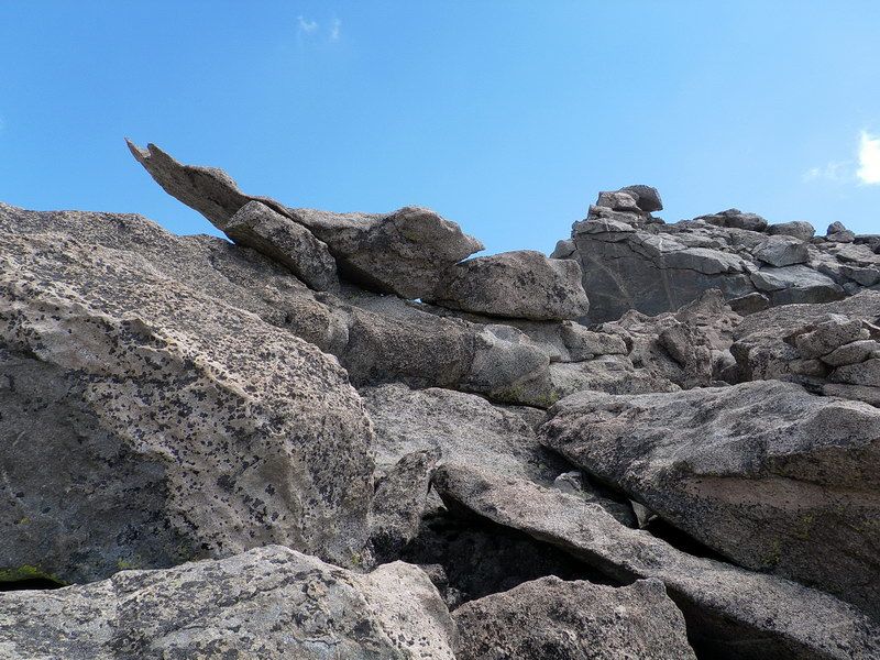
중간 약간 왼쪽에 멀리 보이는 cairn을 향해 바위사이로 올라간다.

Western face of the summit ridge. Taking a brief rest.
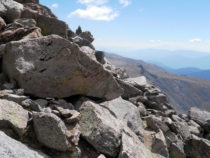
여기에서도 두개의 cairns가 보인다 (사진 중간 위). 앞이 멀리 보이지 않고 Trail이 없기에 이것들만 따라 올라간다.
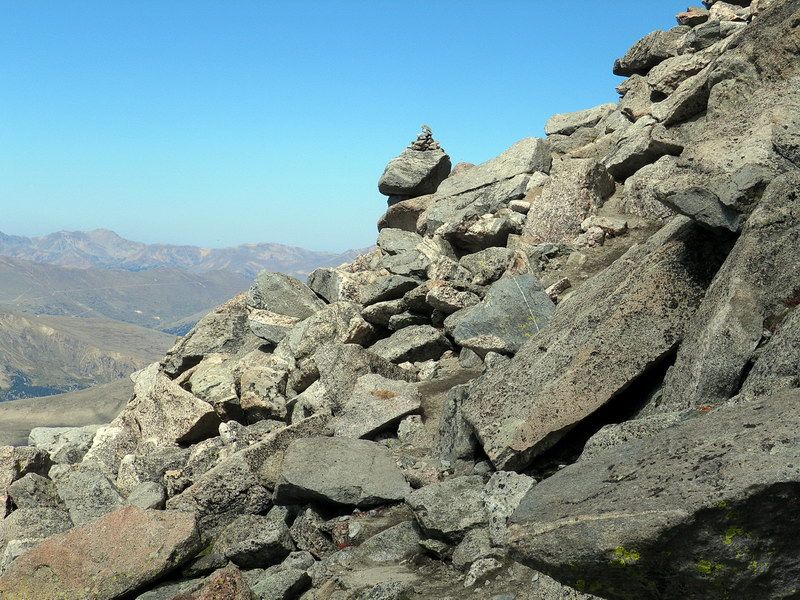
뒤 돌아 보면서, 북쪽의 골짜기와 산, 막 지나 온 cairn 하나.
북쪽 능선으로 하산하는 등산객들. 이들은 Guanella Pass (northwest)에서 등반한 사람들로 그쪽 (northwest)으로 내려간다.

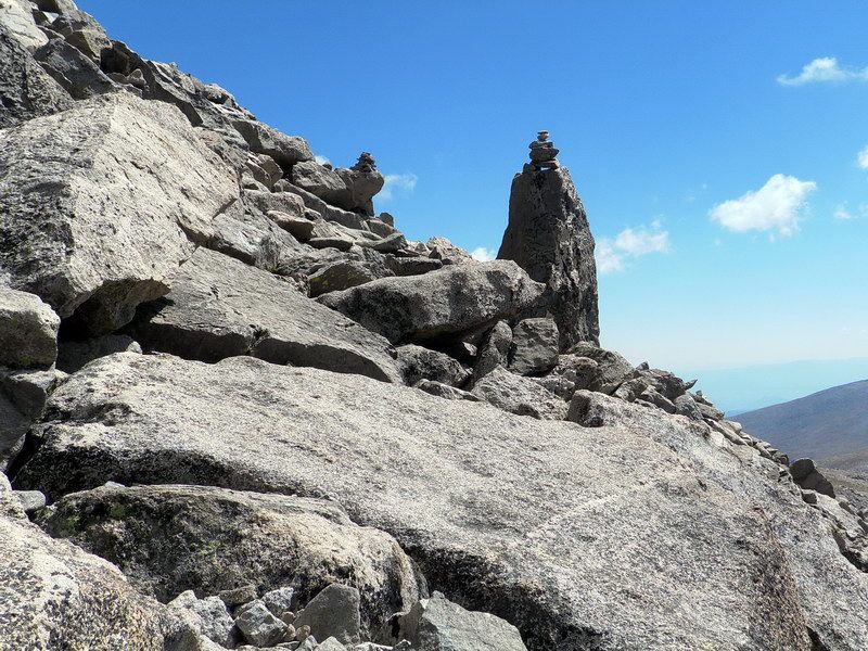
또 하나의 cairn (왼쪽 아래)을 지나자 멀리 (중간) Evans 정상이 보인다. 그위에 사람들이 보인다. 아직도 한참 가야할것 같다.

다른 cairn을 지나며...

왼쪽 위에 정상, 오른쪽 멀리 University of Colorado의 천문대가 보인다.
드디어 오늘의 목표인 정상에 오른다.

We are at the summit of Mount Evans, 14,271-foot (4,350 m) !! "All of us" arrived here safely !!

A picture, celebration and a chorus of a Korean song (Arirang). In retrospect, I wish we could have sung "America The Beautiful" as well. Next time, if it ever happens again, somewhere and some time, we should do it.
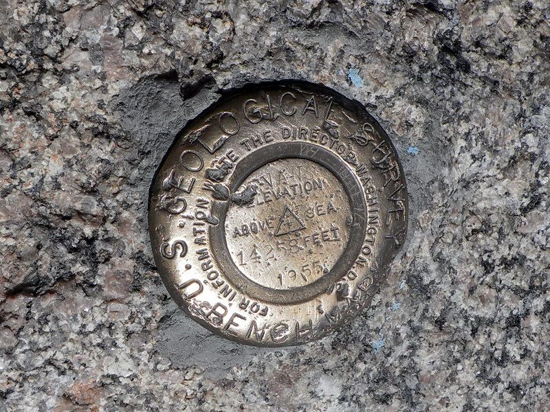
┗▶U.S. Geological Survey에서 밖아놓은 Summit Marker... 14, 258 feet (4,346 meter)라고 새겨있다.
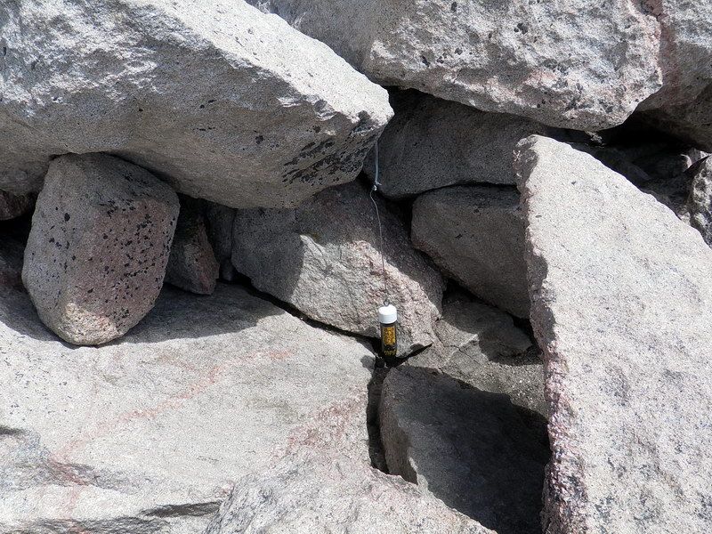
┗▶바위 사이에 매달어 놓은 기록 보존함. 여기에 Climber 들이 자기 이름을 적어 놓고 간다.

At the summit with other climbers.
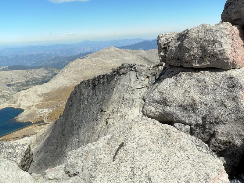
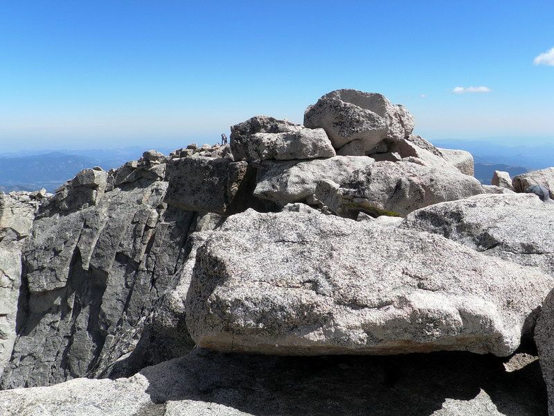
┗▶건너편 봉우리 (the last peak in the summit ridge)의 북면. 어마어마한 낭떠러지. 본인 바로 왼쪽도 마찬가지.
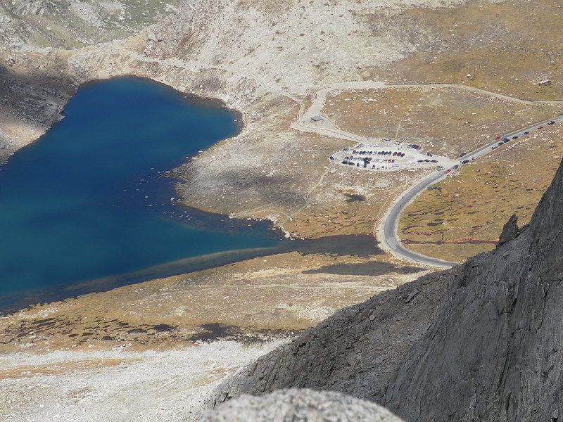
┗▶밑으로 내려다 보이는 Summit Lake와 주차장. 우리가 아침에 떠난곳.

Looking down at the summit parking lot, the terminal for the Mount Evans Highway.
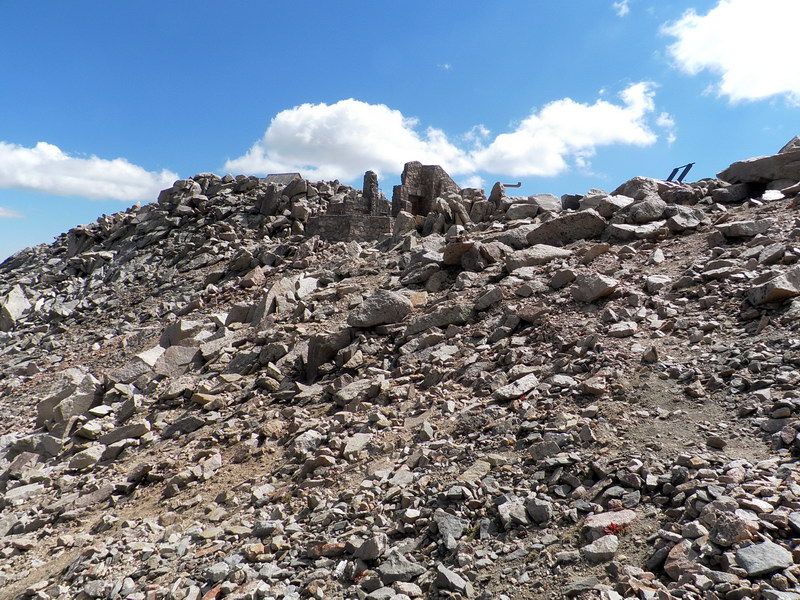
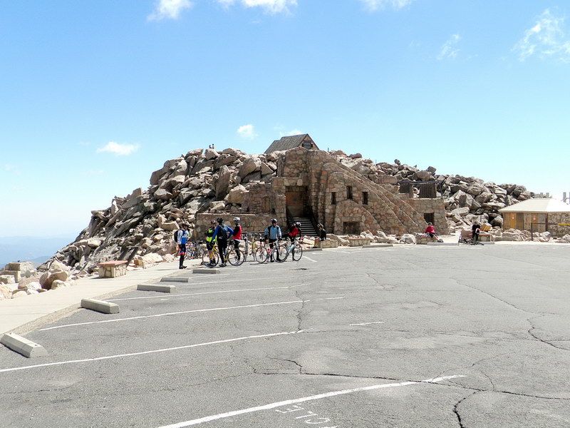 정상 주차장. 자전거 (또는 자동차)로 올라 온 사람들. 정상의 후계소. 이들에게는 여기에서 200 feet 만 걸어 올라가면 정상이다.
Bikers 위로 보이는 stone building: The ruins of the Crest House (1941–1942). Once containing both a restaurant and a gift shop, it burned down on September 1, 1979 and was not rebuilt, but remains as a place of contemplation today. The rock foundation and walls remain as a windbreak for mountain travelers, and the viewing platform is one of Colorado's premier scenic overlooks.

정상 주차장에서 올려다 본 Mount Evans 정상. 한줌의 돌 무덤같이 보이지만, 보통 바위 하나가 자동차 크기만하다.

We got together at the "Crest House" ruins and had a lunch. It was getting windy and cold.
There are no roofs to keep us covered in case of rain. Here, we divded our group into two.
One group walked down the eastern slope on foot and the other took a car brought up by our captain.

Beginning of the down slope. Two people at the overlook deck. You can see how small they are and how big the rocks are.
Mount Evans의 southeast face를 내려가기 시작, 방금 떠난 정상 주차장을 한번 뒤 돌아보고...
오른쪽에 희미하게 Mount Evans Highway가 꾸불꾸불 올라온다. 그 왼쪽에 Rogers Peak 과 Mount Warren이 보인다.
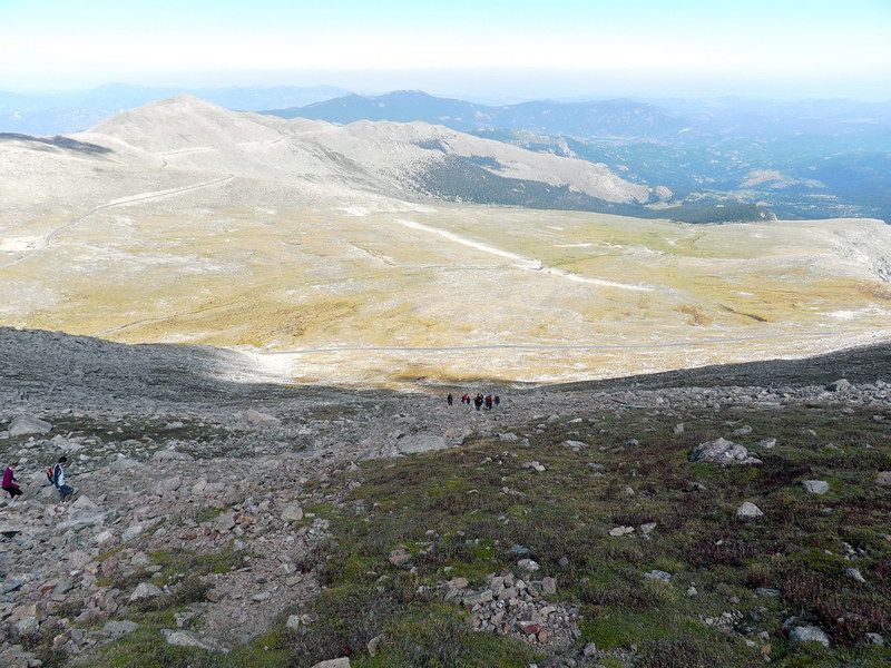
On the slippery rocky slope, 앞에 내려가는 group들이 보인다. The great Plains in the hazy horizon.
Summit Lake이 feeding 하는 wide flat area of "arctic tundra" under the bright sun.

After a long descent, we reached grass area at the lower slope.

On the way down, we are resting on patches of yellow flower (Unidentified) and American Bistort (white).

From the rocky upper slope, we reached plant zone. We were not far away from the highway.

Queen's Crown (pink) and Varileaf Cinquefoil (yellow) at the road side.

The small yellow ones are (possibly) Whiplash Saxifrage (Spider plant, yellow). If it is, it is one of the rare wildflowers.
I only realized later that they were there on picture. Naturally, I failed to take a close up picture. This is the run-off area of the summit Lake. This forms the only one "Arctic Tundra" in Colorado, being at very high altitude.

Elephanthead (Elephant's Head) Lousewort at the alpine wetland just below Summit Lake.
These wildflowers are all gone in the lower altitude areas. They are still here in this high altitufe.

Queen's Crown (Rose Crown) at foreground. American bistort (western bistort) at water's edge, white).
This is at the lake shore of Summit Lake.

On the way down, some of us stopped at the Mount Goliath Nature Center, run by Denver Botanical Garden.
In summer months, Denver Botanical Garden gives free tour of the high altitude life on the Mount Goliath Trail (about 1.5 miles), located behind and left of the nature center.

Rocky Mountain Goldenrod
Data from the Internet. Pictures by SNUMA WM |


