


- Total
- General
- Arts
- Book
- Culture
- Economy
- Essay
- Fun/Joke
- History
- Hobbies
- Info
- Life
- Medical
- Movie
- Music
- Nature
- News
- Notice
- Opinion
- Philosophy
- Photo
- Poem
- Politics
- Science
- Sports
- Travel
Sports [Hiking] The Crags Trail at Divide, Colorado
2013.06.25 16:54
The Crags Trail and Mueller State Park, CO
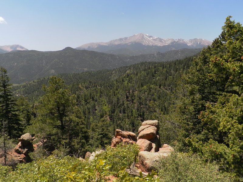
It was a sunny Saturday. We planned to hike the "Waldo Canyon in Colorado Springs" to see the effect of massive wildfire last year. When we arrived at the trailhead of Waldo Canyon, the road was blocked with "No Entry" sign. From below, we saw heavy damages in the old trail. Most damage came to pine trees but there were a lot of bush coming back alive. By now, there should be a plenty of wildflowers on the trail but we couldn't go. Sometimes granite erodes horizontally into monumental slabs resembling stacks of gigantic red pancakes (see my guide for Horsethief Falls & Pancake Rocks). Not too far away the same kind or rock erodes vertically into colossal collections of cusps, ready to take a bite out of any clouds that venture too close to the earth. A few miles south of Divide CO, this kind of rock formation is called “The Crags.” The Crags Trail: This one is an easy short trail. The scenic trail is for almost anyone. About 5 total miles of "Out and Back" round trip. Elevation Gain: 800 feet Directions: Exit I-25 at Cimarron Ave (exit 141) in Colorado Springs onto US Hwy 24-West. Drive west through Woodland Park to the town of Divide. Turn south (left) on CO Hwy 67 and drive about 4.3 miles. Just past the entrance to Mueller State Park, turn left at a sign, "Crags Campground 3.5 miles" (Forest Service Rd. #383). On this gravel road, after about 1.5 miles you pass the Mennonite Rocky Mt. Campground. Continue on for another 2 miles through the Crags Campground and then make a left turn (do not keep going) into the trailhead lot where a pit toilets are. Here, you are following the Fourmile Creek at left side. The new trailhead parking is on the right before the final left turn. You can park and start here or go all the way into the fianal trailhead. The Crags Campground is at a cul de sac at the end of the road. Parking is free at the lower parking lot but in the upper parking lot at the cul de sac, about a quarter mile closer to the trail, there's a parking fee of $6. The small picture above shows the Pikes Peak taken by me during a hiking at Waldo Canyon on May 26, 2012. 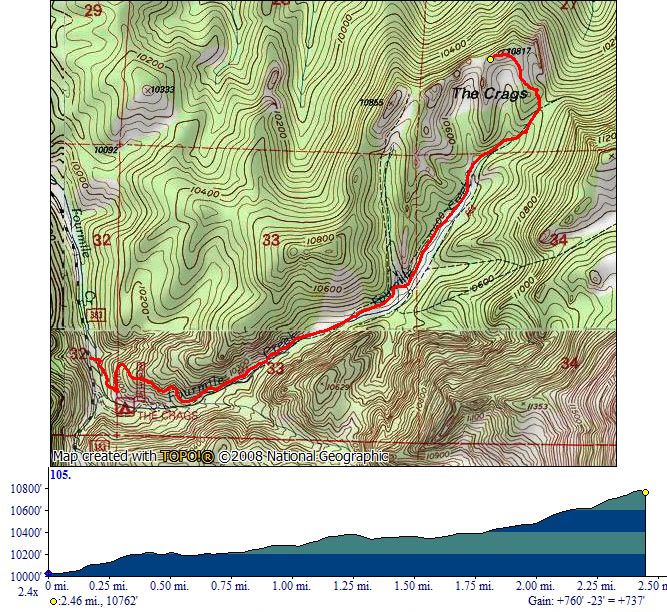 ┗▶ The trail and elevation map of The Crags Trail 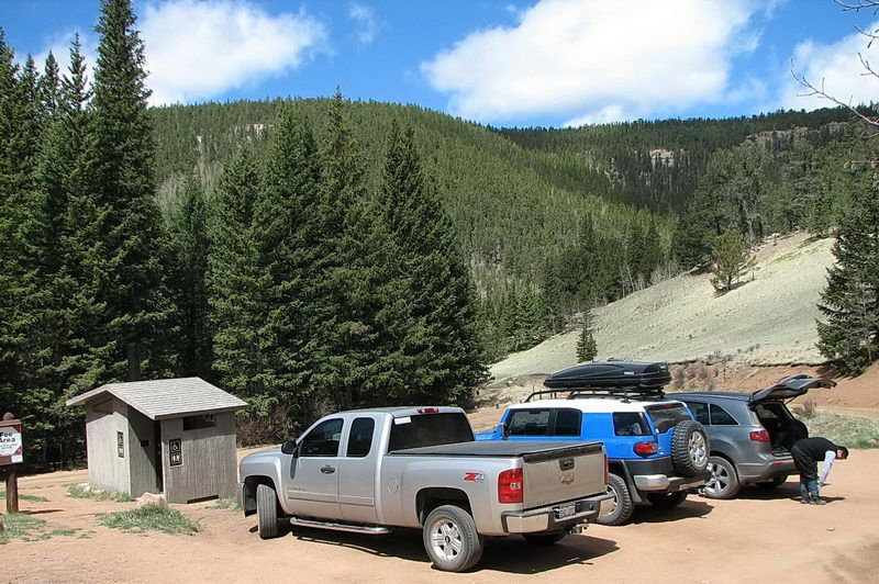 ┗▶ Parking at the trailhead. This is the upper parking lot with parking fee of $6. Lower parking is free. 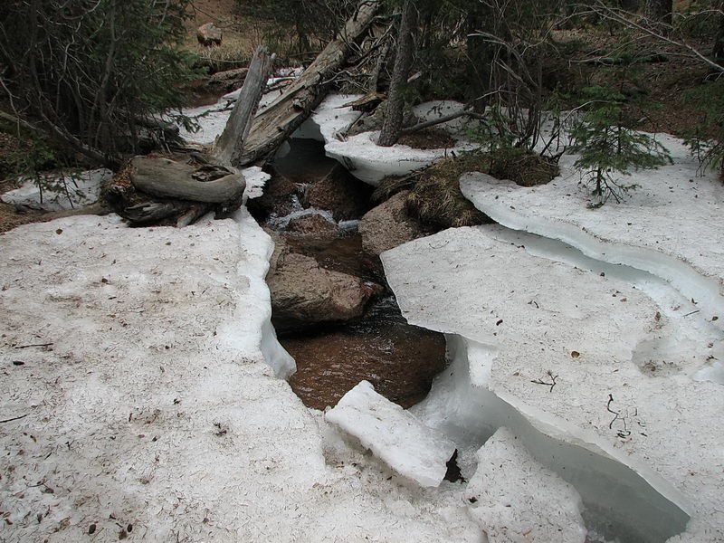 ┗▶ The upper stream of Four Mile Creek running under the snow 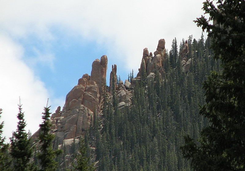 ┗▶ Rocks with vertical erosion, showing vertical slits with pinnacle shaped boulders. As you see, there's pinkish tinge in rocks, hence they are called "pink granite", appearing in the Pikes Peak area.  ┗▶ You walk through a forest of Engelmann spruce (green) and quaking aspen (bare, no leaves yet) with open alpine meadows. Here and there, you see large smooth rock formations and boulders of Pikes Peak pink granite. They came here 60 million years ago from the depth of the earth's mantle. 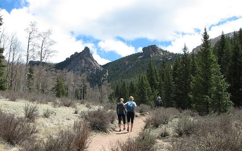 ┗▶ Through the alpine meadows. Rocky pinnacles of granite in front of us. Busy trail with a lot of hikers. 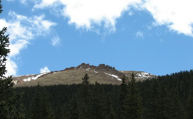 ┗▶ View to the southeast on my right on the way up. The slope above the tree line leads to base of the Devil's Playground and the summit of Pikes Peak massif. It looked very far and high. I like to try the summit someday, 6 miles and 4,200 feet higher from where I was. 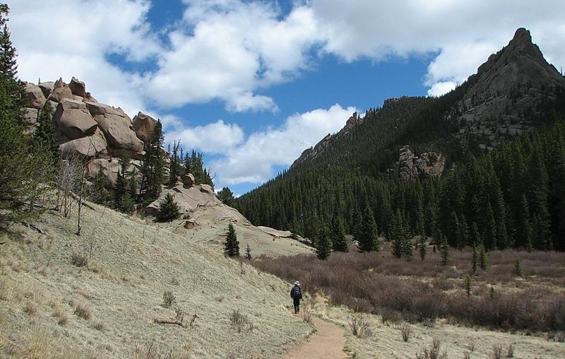 ┗▶ This rock formation at left shows both vertical and horizontal erosion, creating a multiple square blocks. 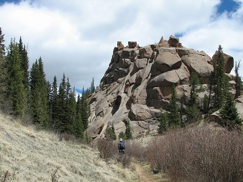 ┗▶ The same rock formation 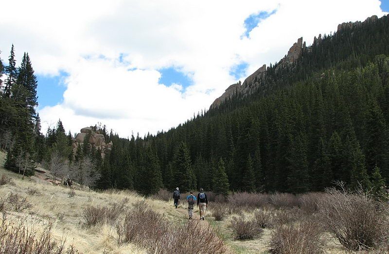 ┗▶ A father and son on a Saturday hiking. 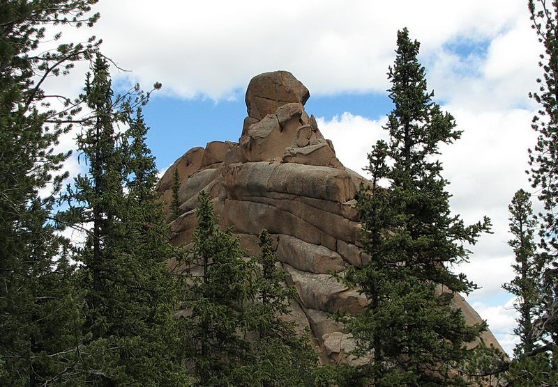 ┗▶ Somewhere around here, there supposedly is a trail to the tall pinnacles of The Crags. We may attempt it some time in the future. I think it can be easily done. This rock pinnacle shows mainly horizontal erosions in the shape of stacked pancakes. 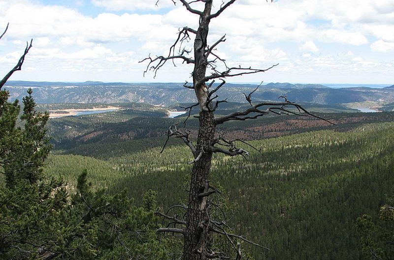 ┗▶ At the final ridge on the trail, the view opens to the northwest and north with the Catamount Reservoirs (followed by reservoirs crop). 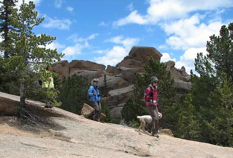 ┗▶ Three grandmothers are coming down. My sincere respect on them who took the hiking on their own. 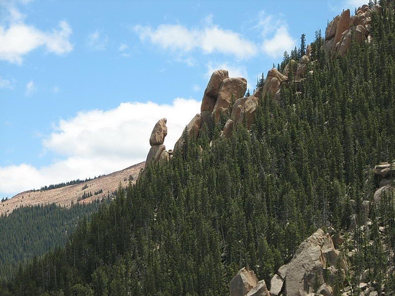 ┗▶ Vertical erosion of the granite created this rocky pinnacles. That's why this area is known as "The Crags." 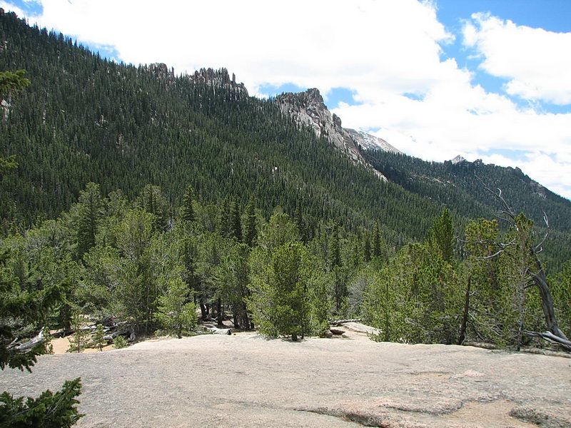 ┗▶ Distant rocky peaks with crags formation to the east. Beyond is the snow-covered base of the Pikes Peak. 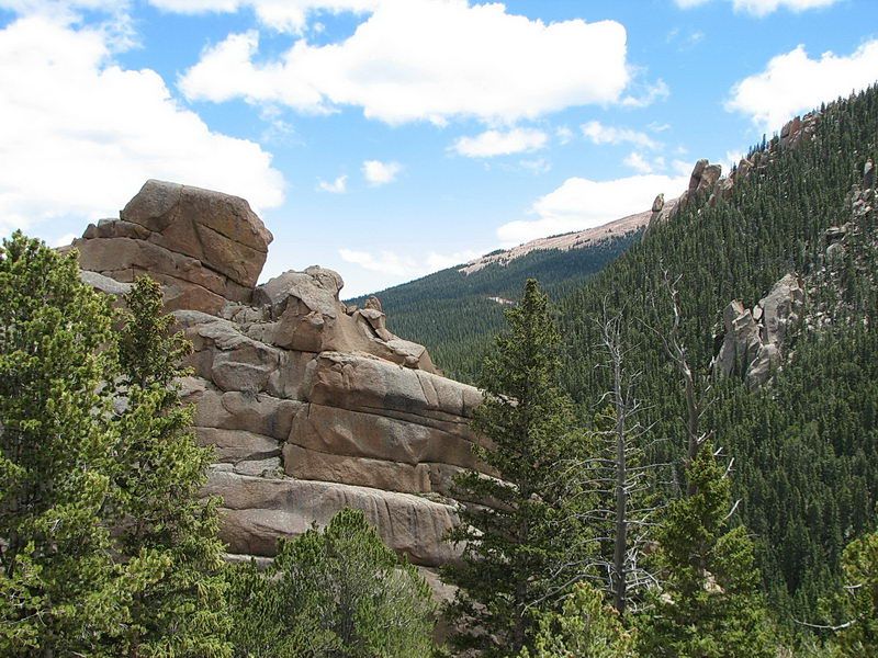 ┗▶ This particular granite mass shows horizontal cracks (stacked pancakes) instead of vertical split. 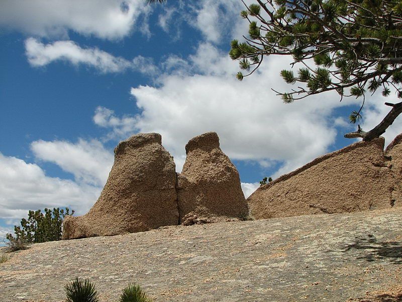 ┗▶ Heavily eroded granite. The surface is so rough that it was painful to touch. 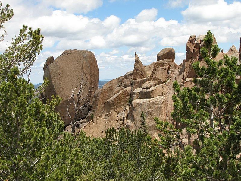 ┗▶ Vertical and horizontal cracks in the rock 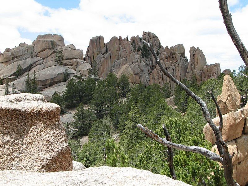 ┗▶ How could vertical and horizontal erosions happen in the same area side by side? 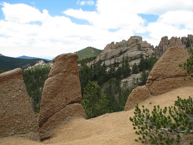 ┗▶ You can see how rough the surface of the rocks are. This may not be granite. 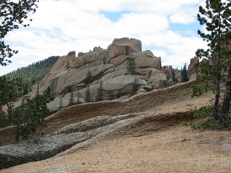 ┗▶ A long and wide rock (마당바위) as a part of the trail. 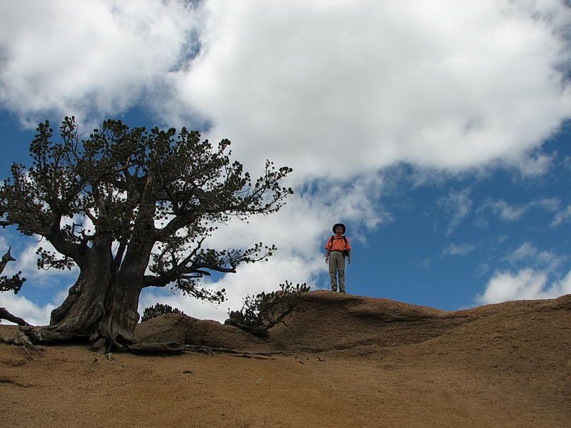 ┗▶ I don't see any soil around here but an old Bristlecone Pine grows on and between the rocks. I am sure this tree is at least more than 1,000-2000 years old. I am just over 70. Then, what am I ?  My hiking partner, Yun-Jae Lee with two Bristlecone pines at the summit of the promontory 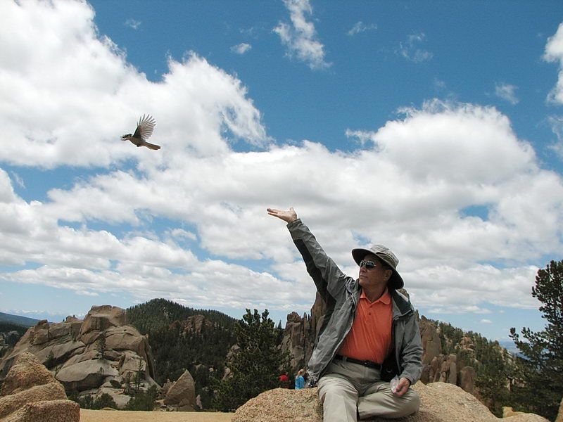 ┗▶ A gray jay landed on my hand for a split second to pick up a piece of roasted pecan. The usual delay by the "shutter lag" cause the picture to have been taken a little too late. They are very tame, not afraid of us. The bird stayed around us for a while for more. It is illegal to feed wildlife in Colorado. I may get fined if a wildlife ranger sees this picture. 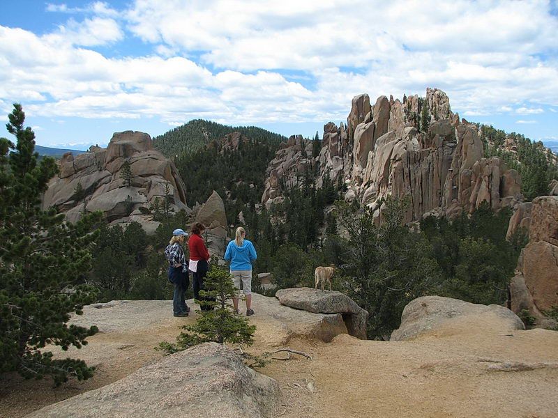 ┗▶ We are at a promontory overlooking The Crags across a valley. 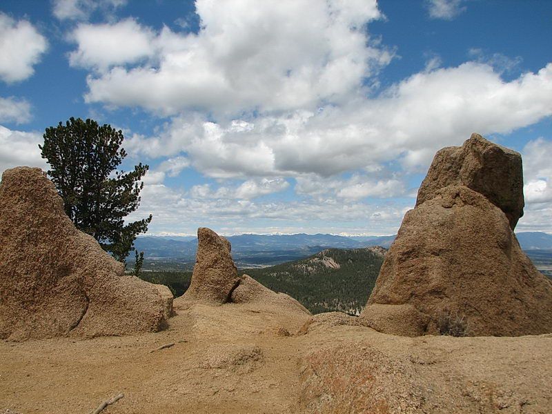 ┗▶ Far to the west, are the snow capped mountain ranges, such as Shavano, The Collegiate Peaks, Democrat, Sherman and Quandry are the fourteeners to the west. They appear too far for me to identify. 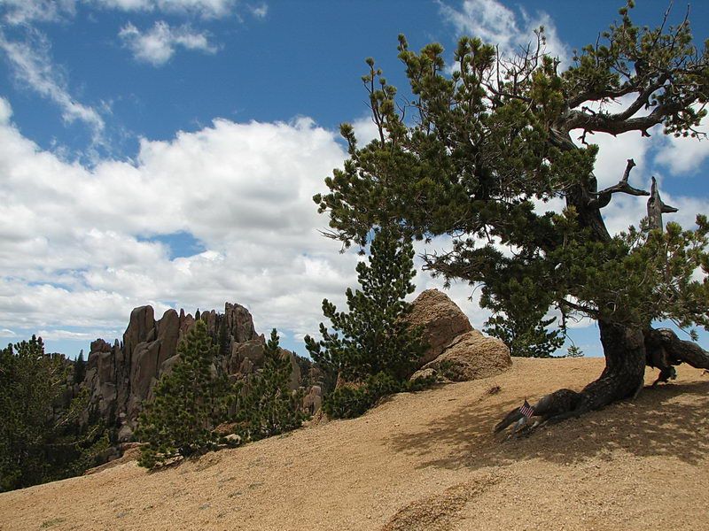 ┗▶ There is a small grove of Bristlecone pines at the promontory at the end of the trail. Someone left an American flag under the tree fo some reason. A memorial or to remember a loved one ?? 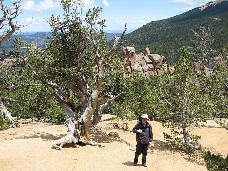 ┗▶ My hiking partner with another ancient Bristlecone pine, with the background of Colorado Springs area. 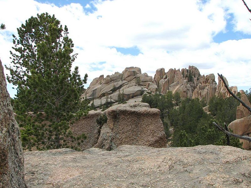 ┗▶ 마당바위 위에 군데 군데 서있는 square rock boulders. 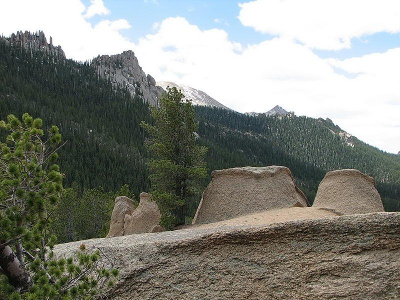 ┗▶ Another group of rock boulders, looking like a loaf of sliced bread (?). 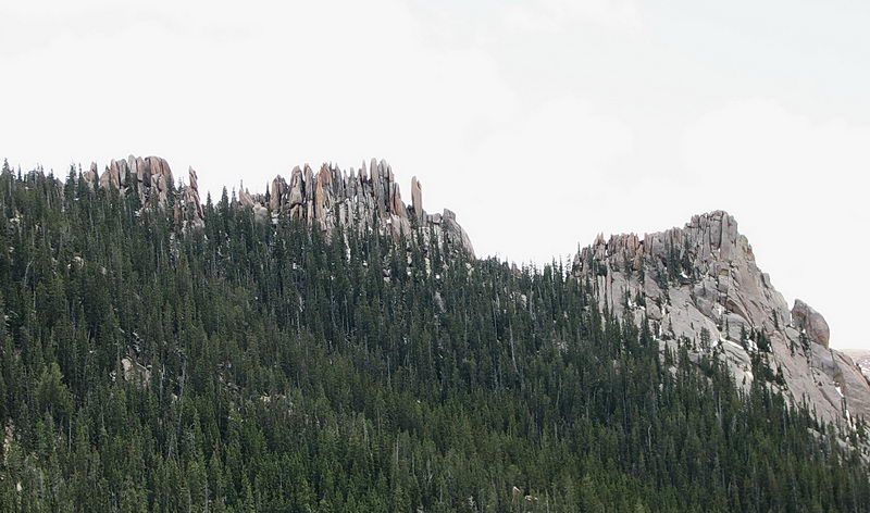 ┗▶ To the east, another groups of Vertically eroded granite peaks, the crags, showing sharp rocky columns. 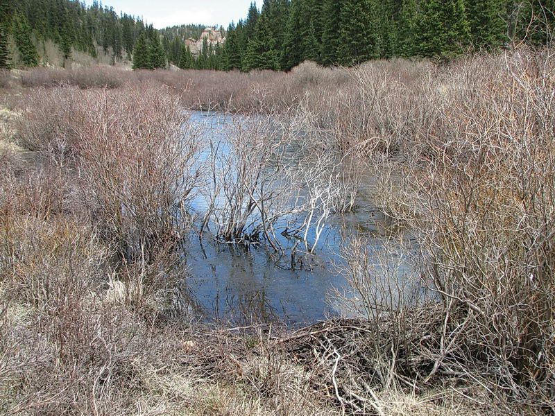 ┗▶ For the city folks, here's a picture of a beaver dam on the Fourmile Creek, creating a small pond. The pond is surrounded with pussy willow bushes. 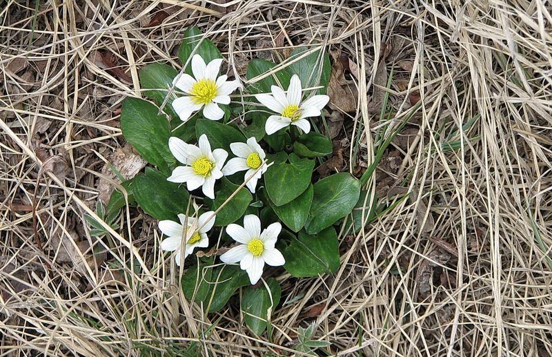 ┗▶ White Marsh Marigold, growing near the creek where the ground is wet. In the early summer in the very high altitude, there weren't a lot of wildflowers today. I found a few. 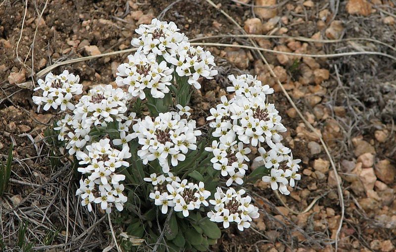 ┗▶ Alpine Smelowskia, growing in high altitude. Here, the altitude is over 10,000 feet high. 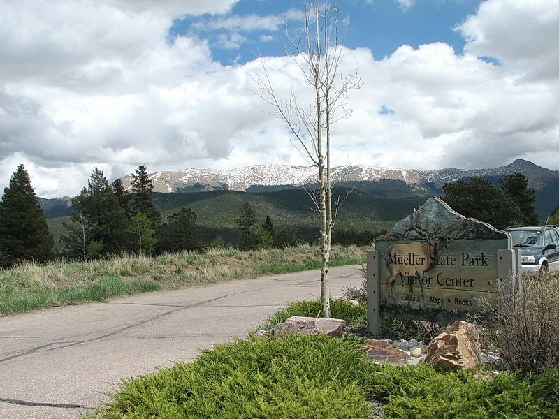 ┗▶ We stopped at thr Mueller State Park on the way home. At the entrance of the park with Pikes Peak in the background. 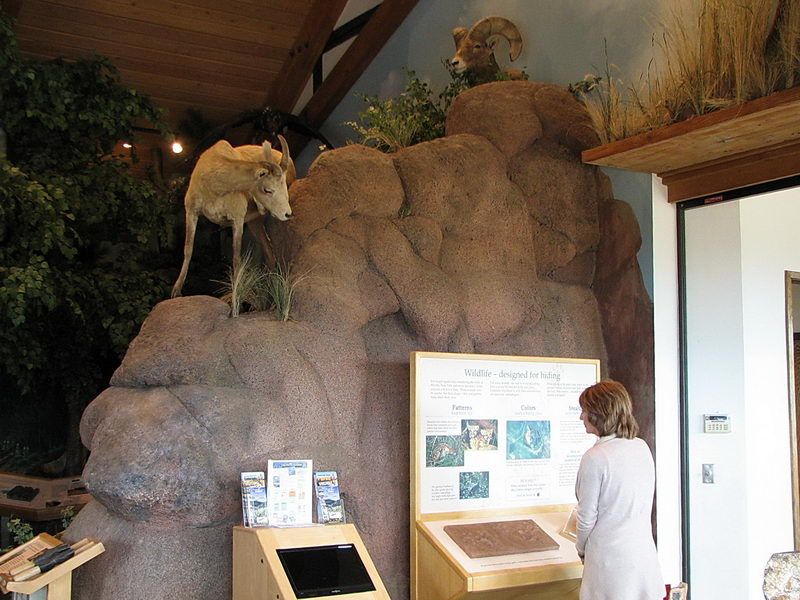 ┗▶ Inside exhibitions in the visitor center. 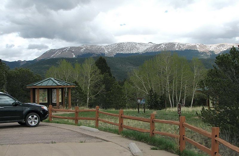 ┗▶ The western side of the Pikes Peak above tree line. The summit is not visible. The small triangular peak behind the ridge may be the Devil's Playground. It's a long way. 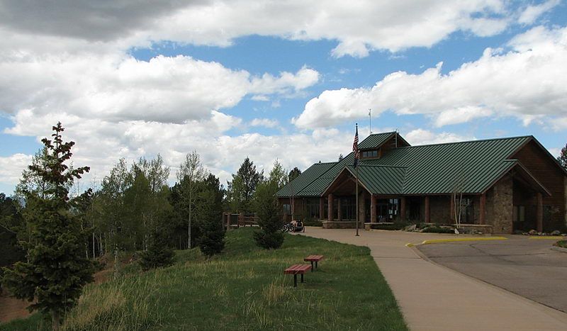 ┗▶ The Mueller State Park visitor center, located on the top of a hill with great view all around. 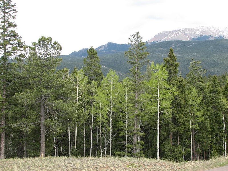 ┗▶ Light green leaves of aspen, waking up from the winter's sleep. It's because this spot is warmer at about 9,000 feet high, while at the Crags Trail over 10,000 feet, they are not waken up for the spring yet. Of course, they will soon. We are going to return this area for other hiking trails. It will be wonderful in autumn when aspen trees turn yellow. |
 Trail to the summit of Pikes Peak: From the final trailhead parking, after a tenth of a mile you will see a sign on the right labeling trail #664 and 664A. Stay at the left fork in trail 664 to The Crags. If you take trail #664A, by going over a wood plank bridge to cross the Fourmile Creek, you are heading for the Pikes Peak summit through The Devil's Playground. This trail 664A will lead you to the summit by 11.5 miles roundtrip and 4,200' elevation gain). This is one of the easier trails to the summit of Pikes Peak but, today, we are not prepared for the climb of "a fourteener". At 14,115 feet (4,302 m), Pikes Peak is one of Colorado's 54 fourteeners, mountains that rise more than 14,000 feet (4,300 m) above mean sea level. Pikes Peak rises 8,400 feet (2,600 m) above the city of Colorado Springs. It is a designated U.S. National Historical Landmark.
 Comment 8
-
운영자
2013.06.25 17:29
-
방준재*70
2013.06.25 19:44
This is WONDERFUL PHOTOTREKKER
- and I enjoyed a cool mountain breeze
- and I forwarded this to someone in Oakland, CA.PS;
Today - my golf day - they're reporting
93 F - I am already thirsty under the
burning Sun. -
황규정*65
2013.06.26 02:23
Thanks for the beautiful photography in Colorado.
The landscape of Colorado is not rich and juicy?
as some part of the country, but it sure is beautiful
in dryness like sense of humor, clearness, and pureness!
I love songs of 장사익 anytime at anyplace. KJ
Picture with great,great----------greatson!
누가 찍으셨는지는 모르지만 순발력이 대단하십니다.
-
운영자
2013.06.26 03:51
I took the picture of my hiking partner from below, and the composition looked good.
Then he took mine. Once in a while, a good picture comes along.
The secret is not to wait or looking for a good picture but just take a lot of pictures.
What we see with our eyes is not exactly the same as the camera sees it.
It's not easy to predict the result by the visual feeling unless one is an extremely talented expert.
In this picture of mine, I tried to stress the bristlecone pine in the center,
but in my partner's picture of me, he tried to put me in the center,
and I was against the blue sky. Anyway, that turned out to be nice. One never knows.
Philosophically, the bristlecone pine is an almost immortal figure while he and I are just transient mortals.
Which one should be in the center? No one knows. -
조승자
2013.06.26 14:42
A solitary wanderer in solitude I see,
Beautiful images and beautiful web page!
I like your frame and size of photos too.
-
계기식*72
2013.06.26 14:49
아름다운 경치 구경 잘 했습니다. 그 곳도 꽤 덥네요...
사진에 대해서 제가 들은 바로는....
인물을 쎈터에 두지 말고, 주변 사물과 배치시켜야 좋은 사진이라는 것이었습니다.
그런 관점에서 보면, 운영자 선배님께서 찍으신 사진이 그 이론에 맞는 것 갈습니다. -
운영자
2013.06.26 15:20
승자 님;
아셨는지 모르지만 우리 website (Freeboard only)의 넓이를 1,000 pixels 로 바꾼지 오래입니다.
따라서 사진의 size는 maximum 1,000 pixels 까지 됩니다 (Table frame을 넣지 않는다면).
Table을 쓰는 경우에는 Table (border, cellspacing, cellpadding)이 차지하는 넓이 만큼 빼어야겠지요.본인 사진은 800 pixels 로서 table이 차지하는 space까지 포함해서 전체가 884 Pixels 로
아직도 116 pixels 의 여분이 남어있지요.
Table을 어떻게 쓰냐에 좌우되지만, 대개 Maximum usable 사진의 넓이는 920 쯤 됩니다.단지 주의할것은 Focus가 잘 맞은선명한 사진인 경우에는 크게 올려도 좋지만,
사진이 선명치 않을때는 크게 올린 사진은 오히려 더 보기 싫게됩니다.
또 큰 사진은 file size가 크기 때문에 뜨는데 오래걸리지요.
이점 주의 하시기 바랍니다. -
홍초미#65
2013.06.27 11:31
이곳도 주말에는 온도가 100도 이상이 될거라합니다.
오늘부터 벌써 온도가 올라 가는군요
시원한 fresh air 를 마시는 기분으로 구경 잘 했습니다.
'마당바위' 어감이 참 좋습니다.
Thank you.
I am sure that the rest of US are in similar situation.
So, here is a cool mountain breeze and sceneries for you, "The Crags Trail."
The Crags Trail was somewhat accidental because of the unknown unexpected closure of the Waldo Canyon Trail.
We don't know when Waldo Canyon will open. Once it's open wildflower will be plentiful especially after wildfire.
Anyway, it was very fortunate to have run into "The Crags" trail. It was a blessing.
We will be hiking around the area of Divide, Colorado this summer and autumn.
June is the month for wildflowers in Colorado.